
– Lat/Long: 39.00° N 106.84° W
 Green-Wilson Hut
Weather Forecast, United StatesIssued: 11 am Sat 13 Sep Local TimeUpdates in: hr min sUpdate imminent
Issued: 11 am Sat 13 Sep Local Time
Updates in:
Update imminent hr min s

Issued: 11 am Sat 13 Sep Local Time
Updates in:
Update imminent hr min s
Days 1–3 Weather SummaryLight rain (total 4mm) at first, then becoming colder with a dusting of snow on Sat afternoon. Freeze-thaw conditions (max 11°C on Mon afternoon, min -1°C on Sat night). Wind will be generally light. | Days 4–6 Weather SummaryMostly dry. Very mild (max 12°C on Wed afternoon, min 3°C on Tue night). Wind will be generally light. | |||||||||||||||||
Saturday 13 | Sunday 14 | Monday 15 | Tuesday 16 | Wednesday 17 | Thursday 18 | |||||||||||||
AM | PM | night | AM | PM | night | AM | PM | night | AM | PM | night | AM | PM | night | AM | PM | night | |
rain shwrs | snow shwrs | some clouds | clear | some clouds | clear | clear | clear | clear | clear | rain shwrs | clear | clear | clear | clear | clear | clear | clear | |
km/h | ||||||||||||||||||
 |  |  |  |  |  | |||||||||||||
— | 2 | — | — | — | — | — | — | — | — | — | — | — | — | — | — | — | — | |
1.4 | 3 | — | — | — | — | — | — | — | — | 0.2 | — | — | — | — | — | — | — | |
max°C | 6 | 4 | 1 | 6 | 9 | 4 | 10 | 11 | 6 | 10 | 11 | 6 | 10 | 12 | 6 | 11 | 12 | 7 |
min°C | 5 | 2 | -1 | 2 | 8 | 3 | 7 | 10 | 3 | 7 | 6 | 3 | 7 | 11 | 4 | 7 | 12 | 5 |
2 | -1 | -4 | 0 | 5 | 1 | 5 | 7 | 2 | 6 | 6 | 3 | 7 | 9 | 2 | 6 | 10 | 5 | |
4150 | 4000 | 3500 | 3850 | 4650 | 3950 | 4350 | 4750 | 4150 | 4350 | 4700 | 4050 | 4400 | 4850 | 4300 | 4500 | 4950 | 4450 | |
Cloud base (m) | 5450 | 3350 | 3450 | 4000 | 4950 | 5500 | 8700 | 5700 | 5450 | 5650 | ||||||||
6:47 | — | — | 6:48 | — | — | 6:48 | — | — | 6:48 | — | — | 6:50 | — | — | 6:50 | — | — | |
— | 7:17 | — | — | 7:15 | — | — | 7:14 | — | — | 7:13 | — | — | 7:10 | — | — | 7:09 | — | |
Loading...
Green-Wilson Hut Weather (Days 0-3):
The weather forecast for Green-Wilson Hut is: Light rain (total 4mm) at first, then becoming colder with a dusting of snow on Sat afternoon. Freeze-thaw conditions (max 11°C on Mon afternoon, min -1°C on Sat night). Wind will be generally light.
Green-Wilson Hut Weather (Days 3-6):
Mostly dry. Very mild (max 12°C on Wed afternoon, min 3°C on Tue night). Wind will be generally light.
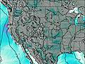
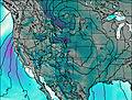
This table gives the weather forecast for Green-Wilson Hut at the specific elevation of 3482 m. Our advanced weather models allow us to provide distinct weather forecasts for several elevations of Green-Wilson Hut. To see the weather forecasts for the other elevations, use the tab navigation above the table. For a wider overview of the weather, consult the Weather Map of Colorado.
| Weather Station | Temp. | Weather | Wind | Gusts | Cloud / Visibility |
|---|---|---|---|---|---|
thunderstorm affecting Snowmass Village | |||||
lightning 21km WNW of Crested Butte | |||||
lightning 24km NNE of Aspen | |||||
lightning 23km ENE of Paonia | |||||
lightning 18km NE of Basalt | |||||
Leadville Airport | |||||
lightning 19km S of Eagle |
* NOTE: not all weather observatories update at the same frequency which is the reason why some locations may show data from stations that are further away than known closer ones.