– Lat/Long: 48.69° N 113.64° W
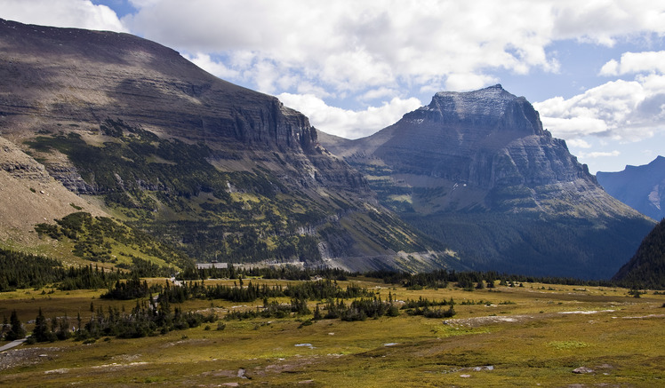
 Going-to-the-Sun Mountain
Weather Forecast, United StatesIssued: 5 am Mon 03 Aug Local TimeUpdates in: hr min sUpdate imminent
Issued: 5 am Mon 03 Aug Local Time
Updates in:
Update imminent hr min s

Issued: 5 am Mon 03 Aug Local Time
Updates in:
Update imminent hr min s
Days 1–3 Weather SummaryMostly dry. Warm (max 20°C on Wed afternoon, min 4°C on Mon morning). Wind will be generally light. | Days 4–6 Weather SummaryMostly dry. Warm (max 22°C on Thu afternoon, min 9°C on Sat night). Winds decreasing (fresh winds from the WSW on Fri afternoon, calm by Sat night). | |||||||||||||||||
Monday 3 | Tuesday 4 | Wednesday 5 | Thursday 6 | Friday 7 | Saturday 8 | |||||||||||||
AM | PM | night | AM | PM | night | AM | PM | night | AM | PM | night | AM | PM | night | AM | PM | night | |
light rain | rain shwrs | clear | clear | clear | clear | clear | clear | clear | clear | clear | clear | clear | clear | clear | clear | clear | some clouds | |
Cloud base (m) | 1950 | 2800 | 3500 | 4650 | 4650 | 9050 | 9550 | 4700 | ||||||||||
km/h | ||||||||||||||||||
 |  |  |  |  |  | |||||||||||||
— | — | — | — | — | — | — | — | — | — | — | — | — | — | — | — | — | — | |
mm | 0.2 | 0.1 | — | — | — | — | — | — | — | — | — | — | — | — | — | — | — | — |
max °C | 7 | 11 | 10 | 13 | 16 | 13 | 16 | 20 | 16 | 18 | 22 | 19 | 20 | 22 | 17 | 17 | 20 | 17 |
min °C | 4 | 9 | 7 | 11 | 15 | 11 | 13 | 18 | 13 | 15 | 21 | 12 | 17 | 21 | 11 | 14 | 19 | 9 |
chill °C | 3 | 9 | 7 | 11 | 14 | 10 | 13 | 18 | 12 | 15 | 21 | 11 | 16 | 21 | 11 | 14 | 19 | 9 |
Freezing level m | 2550 | 2950 | 3300 | 3350 | 3700 | 4000 | 4000 | 4250 | 4450 | 4400 | 4550 | 4800 | 4600 | 4650 | 4400 | 4300 | 4350 | 4300 |
6:09 | — | — | 6:11 | — | — | 6:13 | — | — | 6:13 | — | — | 6:16 | — | — | 6:16 | — | — | |
— | — | 9:08 | — | — | 9:07 | — | — | 9:06 | — | — | 9:05 | — | — | 9:02 | — | — | 9:01 | |
Loading...
Going-to-the-Sun Mountain Weather (Days 0-3):
The weather forecast for Going-to-the-Sun Mountain is: Mostly dry. Warm (max 20°C on Wed afternoon, min 4°C on Mon morning). Wind will be generally light.
Going-to-the-Sun Mountain Weather (Days 3-6):
Mostly dry. Warm (max 22°C on Thu afternoon, min 9°C on Sat night). Winds decreasing (fresh winds from the WSW on Fri afternoon, calm by Sat night).
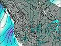
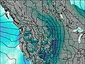
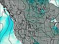
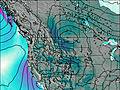
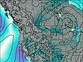
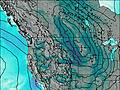
This table gives the weather forecast for Going-to-the-Sun Mountain at the specific elevation of 2000 m. Our advanced weather models allow us to provide distinct weather forecasts for several elevations of Going-to-the-Sun Mountain. To see the weather forecasts for the other elevations, use the tab navigation above the table. For a wider overview of the weather, consult the Weather Map of Montana.
| Weather Station | Temp. | Weather | Wind | Gusts | Cloud / Visibility |
|---|---|---|---|---|---|
Carway- Alta | |||||
Waterton Park Gate- Alta | |||||
Bullhorn Headwaters- Alta | |||||
Cardston- Alta |
* NOTE: not all weather observatories update at the same frequency which is the reason why some locations may show data from stations that are further away than known closer ones.
Going-to-the-Sun Mountain Photos
View all
Central Montana Rockies photos (3) |
Rocky Mountains (USA) photos (298) |
photos from mountains in United States (3056) |
all photos
 Upload new photo
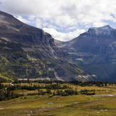
Going-to-the-Sun Mountain