– Lat/Long: 49.25° N 19.93° E
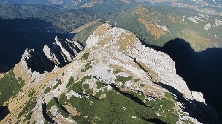
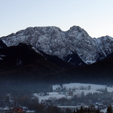
 Giewont
Weather Forecast, PolandIssued: 1 pm Mon 03 Aug Local TimeUpdates in: hr min sUpdate imminent
Issued: 1 pm Mon 03 Aug Local Time
Updates in:
Update imminent hr min s

Issued: 1 pm Mon 03 Aug Local Time
Updates in:
Update imminent hr min s
Days 1–4 Weather SummaryMostly dry. Warm (max 23°C on Wed afternoon, min 18°C on Mon night). Wind will be generally light. | Days 5–7 Weather SummaryModerate rain (total 19mm), heaviest on Fri night. Warm (max 23°C on Thu afternoon, min 8°C on Fri night). Wind will be generally light. | ||||||||||||||||
Mon 3 | Tuesday 4 | Wednesday 5 | Thursday 6 | Friday 7 | Saturday 8 | ||||||||||||
PM | night | AM | PM | night | AM | PM | night | AM | PM | night | AM | PM | night | AM | PM | night | |
rain shwrs | some clouds | some clouds | some clouds | clear | clear | clear | clear | clear | some clouds | rain shwrs | some clouds | mod. rain | heavy rain | some clouds | clear | clear | |
Cloud base (m) | 2900 | 4200 | 4350 | 4300 | 4600 | 4700 | 4300 | 4250 | 900 | 850 | 2450 | 2250 | |||||
km/h | |||||||||||||||||
 |  |  |  |  |  | ||||||||||||
— | — | — | — | — | — | — | — | — | — | — | — | — | — | — | — | — | |
mm | 0.1 | — | — | — | — | — | — | — | — | — | 0.5 | — | 6 | 12 | — | — | — |
max °C | 19 | 20 | 20 | 21 | 21 | 21 | 23 | 22 | 22 | 23 | 22 | 15 | 13 | 12 | 9 | 11 | 11 |
min °C | 19 | 18 | 19 | 21 | 21 | 20 | 22 | 22 | 21 | 22 | 15 | 14 | 13 | 8 | 8 | 10 | 9 |
chill °C | 19 | 18 | 19 | 21 | 21 | 20 | 22 | 22 | 21 | 22 | 15 | 14 | 13 | 7 | 7 | 9 | 7 |
Freezing level m | 4300 | 4400 | 4450 | 4500 | 4650 | 4500 | 4650 | 4600 | 4600 | 4650 | 4550 | 4450 | 4250 | 4000 | 3750 | 3800 | 3900 |
— | — | 5:15 | — | — | 5:16 | — | — | 5:18 | — | — | 5:18 | — | — | 5:20 | — | — | |
— | 8:17 | — | — | 8:15 | — | — | 8:14 | — | — | 8:13 | — | — | 8:10 | — | — | 8:09 | |
Loading...
Giewont Weather (Days 0-3):
The weather forecast for Giewont is: Mostly dry. Warm (max 23°C on Wed afternoon, min 18°C on Mon night). Wind will be generally light.
Giewont Weather (Days 3-6):
Moderate rain (total 19mm), heaviest on Fri night. Warm (max 23°C on Thu afternoon, min 8°C on Fri night). Wind will be generally light.
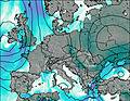
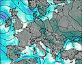
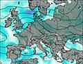
This table gives the weather forecast for Giewont at the specific elevation of 1909 m. Our advanced weather models allow us to provide distinct weather forecasts for several elevations of Giewont. To see the weather forecasts for the other elevations, use the tab navigation above the table. For a wider overview of the weather, consult the Weather Map of Poland.
| Weather Station | Temp. | Weather | Wind | Gusts | Cloud / Visibility |
|---|---|---|---|---|---|
lightning 4km ESE of Zakopane | |||||
lightning 9km E of Poronin | |||||
lightning 4km SSW of Zdiar | |||||
lightning 4km NE of Strba | |||||
thunderstorm affecting Vysoke Tatry |
* NOTE: not all weather observatories update at the same frequency which is the reason why some locations may show data from stations that are further away than known closer ones.
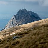
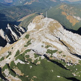
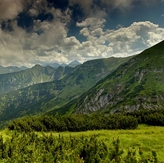
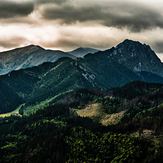
Giewont Photos
View all
Tatras photos (182) |
Carpathian Mountains photos (366) |
photos from mountains in Poland (290) |
all photos
 Upload new photo
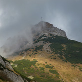
 See 12 more Giewont photos
Giewont
Giewont Tatry
Giewont
Giewont
Giewont
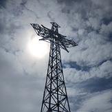
Krzyż w słońcu