
– Lat/Long: 8.53° N 71.09° W
 El Toro
Weather Forecast, VenezuelaIssued: 7 pm Fri 17 Jul Local TimeUpdates in: hr min sUpdate imminent
Issued: 7 pm Fri 17 Jul Local Time
Updates in:
Update imminent hr min s

Issued: 7 pm Fri 17 Jul Local Time
Updates in:
Update imminent hr min s
Days 1–4 Weather SummaryModerate rain (total 15mm), heaviest on Mon afternoon. Mild temperatures (max 6°C on Fri night, min 4°C on Fri night). Wind will be generally light. | Days 5–7 Weather SummaryHeavy rain (total 61mm), heaviest during Tue night. Mild temperatures (max 5°C on Mon night, min 4°C on Mon night). Wind will be generally light. | ||||||||||||||||||
Saturday 18 | Sunday 19 | Monday 20 | Tuesday 21 | Wednesday 22 | Thursday 23 | ||||||||||||||
night | AM | PM | night | AM | PM | night | AM | PM | night | AM | PM | night | AM | PM | night | AM | PM | night | |
rain shwrs | rain shwrs | risk tstorm | rain shwrs | rain shwrs | risk tstorm | rain shwrs | rain shwrs | risk tstorm | rain shwrs | rain shwrs | risk tstorm | heavy rain | mod. rain | light rain | light rain | rain shwrs | light rain | mod. rain | |
Cloud base (m) | 2800 | 3100 | 2850 | 2850 | 2950 | 3000 | 2800 | 2800 | 2800 | 2850 | 2800 | 2800 | 2800 | 2800 | 2800 | 2850 | 2800 | 2800 | 2800 |
km/h | |||||||||||||||||||
 |  |  |  |  |  |  | |||||||||||||
— | — | — | — | — | — | — | — | — | — | — | — | — | — | — | — | — | — | — | |
mm | 0.4 | 0.1 | 4 | 1.6 | 0.1 | 4 | 1.4 | 0.5 | 4 | 4 | 1.2 | 4 | 33 | 10 | 2 | 1.2 | 2 | 4 | 7 |
max °C | 6 | 6 | 6 | 5 | 6 | 6 | 5 | 5 | 5 | 5 | 5 | 5 | 5 | 4 | 5 | 5 | 4 | 4 | 4 |
min °C | 4 | 4 | 5 | 4 | 4 | 5 | 4 | 4 | 5 | 4 | 5 | 5 | 4 | 4 | 4 | 4 | 4 | 4 | 3 |
chill °C | 0 | 0 | 2 | 0 | 1 | 3 | 1 | 1 | 3 | 1 | 2 | 3 | 2 | 1 | 2 | 3 | 3 | 1 | 0 |
Freezing level m | 4850 | 5000 | 4950 | 4800 | 5000 | 5000 | 4850 | 4900 | 4950 | 4850 | 4850 | 4950 | 4900 | 4800 | 4900 | 4800 | 4750 | 4750 | 4750 |
— | 6:33 | — | — | 6:33 | — | — | 6:33 | — | — | 6:33 | — | — | 6:33 | — | — | 6:33 | — | — | |
— | — | 7:07 | — | — | 7:07 | — | — | 7:07 | — | — | 7:07 | — | — | 7:07 | — | — | 7:06 | — | |
Loading...
El Toro Weather (Days 0-3):
The weather forecast for El Toro is: Moderate rain (total 15mm), heaviest on Mon afternoon. Mild temperatures (max 6°C on Fri night, min 4°C on Fri night). Wind will be generally light.
El Toro Weather (Days 3-6):
Heavy rain (total 61mm), heaviest during Tue night. Mild temperatures (max 5°C on Mon night, min 4°C on Mon night). Wind will be generally light.
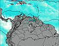
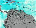
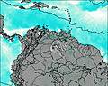
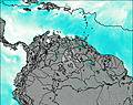
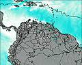
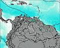
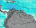
This table gives the weather forecast for El Toro at the specific elevation of 4000 m. Our advanced weather models allow us to provide distinct weather forecasts for several elevations of El Toro. To see the weather forecasts for the other elevations, use the tab navigation above the table. For a wider overview of the weather, consult the Weather Map of Venezuela.
| Weather Station | Temp. | Weather | Wind | Gusts | Cloud / Visibility |
|---|---|---|---|---|---|
Arauc / antiago Pérez Quiroz Airport | |||||
Cúcut / amilo Daza International Airport | |||||
Bucaramang / alonegro Airport | |||||
Valledupa / eropuerto Alfonso López Pumarejo Airport | |||||
Barrancabermej / ariguíes Airport | |||||
Yopa / l Alcarav | |||||
Riohach / lmirante Padilla Airport | |||||
Zim Valencia International Airport | |||||
EL Libertador (A |
* NOTE: not all weather observatories update at the same frequency which is the reason why some locations may show data from stations that are further away than known closer ones.