
– Lat/Long: 48.43° N 24.37° E
 Doboshanka
Weather Forecast, UkraineIssued: 2 pm Mon 03 Aug Local TimeUpdates in: hr min sUpdate imminent
Issued: 2 pm Mon 03 Aug Local Time
Updates in:
Update imminent hr min s

Issued: 2 pm Mon 03 Aug Local Time
Updates in:
Update imminent hr min s
Days 1–4 Weather SummaryMostly dry. Warm (max 29°C on Wed afternoon, min 21°C on Mon night). Wind will be generally light. | Days 5–7 Weather SummaryHeavy rain (total 20mm), heaviest during Fri afternoon. Warm (max 29°C on Thu afternoon, min 12°C on Sat night). Wind will be generally light. | ||||||||||||||||
Mon 3 | Tuesday 4 | Wednesday 5 | Thursday 6 | Friday 7 | Saturday 8 | ||||||||||||
PM | night | AM | PM | night | AM | PM | night | AM | PM | night | AM | PM | night | AM | PM | night | |
some clouds | clear | clear | some clouds | clear | clear | some clouds | clear | clear | some clouds | rain shwrs | risk tstorm | risk tstorm | rain shwrs | rain shwrs | risk tstorm | light rain | |
Cloud base (m) | 3400 | 3700 | 4350 | 3750 | 4550 | 4450 | 3750 | 4100 | 4400 | 2950 | 750 | 900 | 750 | ||||
km/h | |||||||||||||||||
 |  |  |  |  |  | ||||||||||||
— | — | — | — | — | — | — | — | — | — | — | — | — | — | — | — | — | |
mm | — | — | — | — | — | — | — | — | — | — | 0.7 | 0.7 | 6 | 6 | 0.1 | 5 | 1.4 |
max °C | 24 | 23 | 26 | 27 | 25 | 28 | 29 | 27 | 29 | 29 | 26 | 26 | 25 | 21 | 18 | 18 | 14 |
min °C | 24 | 21 | 24 | 27 | 24 | 25 | 28 | 25 | 27 | 28 | 23 | 24 | 22 | 17 | 17 | 16 | 12 |
chill °C | 24 | 21 | 24 | 27 | 24 | 25 | 28 | 25 | 27 | 28 | 23 | 24 | 22 | 17 | 17 | 16 | 11 |
Freezing level m | 4100 | 4150 | 4200 | 4300 | 4400 | 4400 | 4550 | 4600 | 4500 | 4550 | 4550 | 4400 | 4300 | 4250 | 4200 | 4200 | 4150 |
— | — | 6:00 | — | — | 6:01 | — | — | 6:01 | — | — | 6:03 | — | — | 6:05 | — | — | |
8:57 | — | — | 8:55 | — | — | 8:53 | — | — | 8:52 | — | — | 8:51 | — | — | 8:49 | — | |
Loading...
Doboshanka Weather (Days 0-3):
The weather forecast for Doboshanka is: Mostly dry. Warm (max 29°C on Wed afternoon, min 21°C on Mon night). Wind will be generally light.
Doboshanka Weather (Days 3-6):
Heavy rain (total 20mm), heaviest during Fri afternoon. Warm (max 29°C on Thu afternoon, min 12°C on Sat night). Wind will be generally light.
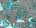
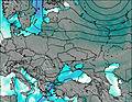
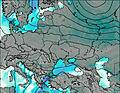
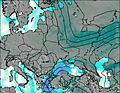
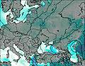
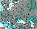
This table gives the weather forecast for Doboshanka at the specific elevation of 1000 m. Our advanced weather models allow us to provide distinct weather forecasts for several elevations of Doboshanka. To see the weather forecasts for the other elevations, use the tab navigation above the table. For a wider overview of the weather, consult the Weather Map of Ukraine.
| Weather Station | Temp. | Weather | Wind | Gusts | Cloud / Visibility |
|---|---|---|---|---|---|
Ivano -Frankivsk | |||||
thunderstorm affecting Bocicoiu Mare | |||||
thunderstorm affecting Sredneye Vodyanoye | |||||
lightning 5km NNW of Bistra | |||||
thunderstorm affecting Rona de Sus | |||||
thunderstorm affecting Rona de Jos | |||||
thunderstorm affecting Birsana | |||||
lightning 5km SSW of Poienile de sub Munte | |||||
lightning 6km W of Poienile Izei |
* NOTE: not all weather observatories update at the same frequency which is the reason why some locations may show data from stations that are further away than known closer ones.