
– Lat/Long: 15.38° N 109.12° E
 Cu-Lao Re Group
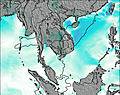
Weather Forecast, VietNamIssued: 12 pm Mon 03 Aug Local TimeUpdates in: hr min sUpdate imminent
Issued: 12 pm Mon 03 Aug Local Time
Updates in:
Update imminent hr min s

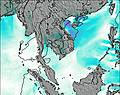
Issued: 12 pm Mon 03 Aug Local Time
Updates in:
Update imminent hr min s
Days 1–3 Weather SummaryLight rain (total 8mm), mostly falling on Tue night. Warm (max 29°C on Mon afternoon, min 27°C on Mon night). Wind will be generally light. | Days 4–6 Weather SummaryMostly dry. Warm (max 29°C on Thu morning, min 27°C on Thu night). Wind will be generally light. | |||||||||||||||||
Monday 3 | Tuesday 4 | Wednesday 5 | Thursday 6 | Friday 7 | Saturday 8 | |||||||||||||
AM | PM | night | AM | PM | night | AM | PM | night | AM | PM | night | AM | PM | night | AM | PM | night | |
some clouds | rain shwrs | risk tstorm | some clouds | risk tstorm | risk tstorm | cloudy | risk tstorm | some clouds | some clouds | some clouds | rain shwrs | light rain | cloudy | cloudy | cloudy | light rain | some clouds | |
Cloud base (m) | 4050 | 5750 | 1750 | 5250 | 1700 | 850 | 2050 | 1950 | 2650 | 2500 | 4600 | 300 | 2750 | 2050 | 2250 | 750 | 2750 | |
km/h | ||||||||||||||||||
 |  |  |  |  |  | |||||||||||||
— | — | — | — | — | — | — | — | — | — | — | — | — | — | — | — | — | — | |
mm | — | 0.6 | 3 | — | 0.5 | 4 | — | 0.1 | — | — | — | 0.1 | 0.1 | — | — | — | 0.1 | — |
max °C | 28 | 29 | 27 | 29 | 29 | 29 | 28 | 28 | 28 | 29 | 29 | 28 | 28 | 28 | 28 | 28 | 28 | 29 |
min °C | 28 | 29 | 27 | 28 | 29 | 27 | 28 | 28 | 28 | 28 | 29 | 27 | 27 | 28 | 28 | 28 | 28 | 28 |
chill °C | 28 | 29 | 27 | 28 | 29 | 27 | 28 | 28 | 28 | 28 | 29 | 27 | 27 | 28 | 28 | 28 | 28 | 28 |
Freezing level m | 5200 | 5300 | 5200 | 5200 | 5250 | 5150 | 5200 | 5250 | 5200 | 5250 | 5400 | 5300 | 5250 | 5350 | 5300 | 5300 | 5300 | 5300 |
5:26 | — | — | 5:26 | — | — | 5:26 | — | — | 5:26 | — | — | 5:26 | — | — | 5:26 | — | — | |
— | 6:13 | — | — | 6:12 | — | — | 6:12 | — | — | 6:10 | — | — | 6:10 | — | — | 6:09 | — | |
Loading...
Cu-Lao Re Group Weather (Days 0-3):
The weather forecast for Cu-Lao Re Group is: Light rain (total 8mm), mostly falling on Tue night. Warm (max 29°C on Mon afternoon, min 27°C on Mon night). Wind will be generally light.
Cu-Lao Re Group Weather (Days 3-6):
Mostly dry. Warm (max 29°C on Thu morning, min 27°C on Thu night). Wind will be generally light.
This table gives the weather forecast for Cu-Lao Re Group at the specific elevation of 181 m. Our advanced weather models allow us to provide distinct weather forecasts for several elevations of Cu-Lao Re Group. To see the weather forecasts for the other elevations, use the tab navigation above the table. For a wider overview of the weather, consult the Weather Map of VietNam.
| Weather Station | Temp. | Weather | Wind | Gusts | Cloud / Visibility |
|---|---|---|---|---|---|
Da Nang International Airport | |||||
Hue Phubai Airport | |||||
Sanhu Dao | |||||
Sanya | |||||
Pakse International Airport | |||||
Cam Ranh Bay Airport | |||||
Xisha Dao | |||||
Dongfang | |||||
Ubon Ratchathani Agromet |
* NOTE: not all weather observatories update at the same frequency which is the reason why some locations may show data from stations that are further away than known closer ones.