
– Lat/Long: 82.40° N 76.75° W
 Commonwealth Mountain
Weather Forecast, CanadaIssued: 8 pm Wed 08 Jul Local TimeUpdates in: hr min sUpdate imminent
Issued: 8 pm Wed 08 Jul Local Time
Updates in:
Update imminent hr min s

Issued: 8 pm Wed 08 Jul Local Time
Updates in:
Update imminent hr min s
Days 1–4 Weather SummaryMostly dry. Temperatures will be below freezing (max 0°C on Fri morning, min -4°C on Wed night). Wind will be generally light. | Days 5–7 Weather SummaryMostly dry. Freeze-thaw conditions (max 1°C on Sun afternoon, min -2°C on Sun night). Wind will be generally light. | ||||||||||||||||||
Thursday 9 | Friday 10 | Saturday 11 | Sunday 12 | Monday 13 | Tuesday 14 | ||||||||||||||
night | AM | PM | night | AM | PM | night | AM | PM | night | AM | PM | night | AM | PM | night | AM | PM | night | |
some clouds | clear | clear | some clouds | clear | cloudy | some clouds | cloudy | cloudy | cloudy | cloudy | cloudy | some clouds | some clouds | some clouds | some clouds | clear | clear | clear | |
km/h | |||||||||||||||||||
 |  |  |  |  |  |  | |||||||||||||
— | — | — | — | — | — | — | — | — | — | — | — | — | — | — | — | — | — | — | |
mm | — | — | — | — | — | — | — | — | — | — | — | — | — | — | — | — | — | — | — |
max °C | -3 | -2 | -1 | -1 | 0 | 0 | -1 | -1 | 0 | 0 | 0 | 1 | 0 | 0 | 0 | 0 | 0 | 1 | 0 |
min °C | -4 | -3 | -1 | -2 | -1 | 0 | -3 | -1 | -1 | -1 | -1 | 0 | -2 | -1 | 0 | -2 | -1 | 1 | -1 |
chill °C | -4 | -3 | -1 | -2 | -1 | 0 | -3 | -1 | -1 | -1 | -3 | -2 | -5 | -4 | -2 | -5 | -3 | 1 | -4 |
Freezing level m | 100 | 0 | 300 | 250 | 350 | 550 | 100 | 300 | 400 | 350 | 400 | 550 | 400 | 300 | 550 | 300 | 350 | 600 | 200 |
Cloud base (m) | 700 | 700 | 750 | 700 | 700 | 700 | 700 | 700 | 700 | 700 | 700 | 700 | 700 | 700 | 700 | 700 | 700 | 750 | 750 |
— | 12:00 | — | — | 12:00 | — | — | 12:00 | — | — | 12:00 | — | — | 12:00 | — | — | 12:00 | — | — | |
— | 12:00 | — | — | 12:00 | — | — | 12:00 | — | — | 12:00 | — | — | 12:00 | — | — | 12:00 | — | — | |
Loading...
Commonwealth Mountain Weather (Days 0-3):
The weather forecast for Commonwealth Mountain is: Mostly dry. Temperatures will be below freezing (max 0°C on Fri morning, min -4°C on Wed night). Wind will be generally light.
Commonwealth Mountain Weather (Days 3-6):
Mostly dry. Freeze-thaw conditions (max 1°C on Sun afternoon, min -2°C on Sun night). Wind will be generally light.
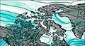
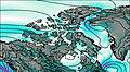
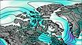
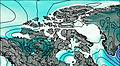
This table gives the weather forecast for Commonwealth Mountain at the specific elevation of 500 m. Our advanced weather models allow us to provide distinct weather forecasts for several elevations of Commonwealth Mountain. To see the weather forecasts for the other elevations, use the tab navigation above the table. For a wider overview of the weather, consult the Weather Map of Nunavut.