– Lat/Long: 44.13° N 73.96° W
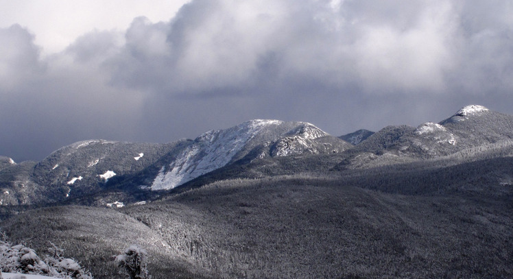
 Colden
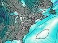
Weather Forecast, United StatesIssued: 7 pm Thu 02 Jul Local TimeUpdates in: hr min sUpdate imminent
Issued: 7 pm Thu 02 Jul Local Time
Updates in:
Update imminent hr min s

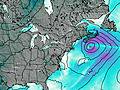
Issued: 7 pm Thu 02 Jul Local Time
Updates in:
Update imminent hr min s
Days 1–4 Weather SummaryLight rain (total 3mm), mostly falling on Fri night. Warm (max 20°C on Thu night, min 12°C on Sat night). Winds decreasing (near gales from the WNW on Thu night, calm by Sun morning). | Days 5–7 Weather SummaryHeavy rain (total 37mm), heaviest during Mon afternoon. Very mild (max 16°C on Sun night, min 10°C on Mon afternoon). Winds decreasing (near gales from the SSE on Mon morning, calm by Tue morning). | ||||||||||||||||||
Friday 3 | Saturday 4 | Sunday 5 | Monday 6 | Tuesday 7 | Wednesday 8 | ||||||||||||||
night | AM | PM | night | AM | PM | night | AM | PM | night | AM | PM | night | AM | PM | night | AM | PM | night | |
risk tstorm | clear | rain shwrs | rain shwrs | rain shwrs | clear | some clouds | some clouds | cloudy | some clouds | light rain | heavy rain | heavy rain | light rain | rain shwrs | light rain | rain shwrs | rain shwrs | some clouds | |
km/h | |||||||||||||||||||
 |  |  |  |  |  |  | |||||||||||||
— | — | — | — | — | — | — | — | — | — | — | — | — | — | — | — | — | — | — | |
mm | 0.4 | — | 0.1 | 1.8 | 0.3 | — | — | — | — | — | 4 | 16 | 14 | 1.6 | 0.1 | 0.3 | 0.5 | 0.2 | — |
max °C | 20 | 18 | 20 | 17 | 14 | 14 | 13 | 14 | 17 | 16 | 14 | 12 | 14 | 13 | 13 | 13 | 13 | 16 | 16 |
min °C | 17 | 17 | 20 | 16 | 14 | 14 | 12 | 12 | 16 | 15 | 11 | 10 | 14 | 13 | 13 | 12 | 12 | 14 | 15 |
chill °C | 15 | 15 | 19 | 14 | 12 | 12 | 9 | 12 | 16 | 13 | 7 | 6 | 12 | 12 | 13 | 11 | 11 | 14 | 15 |
Freezing level m | 4800 | 4750 | 4600 | 4400 | 3850 | 4200 | 4150 | 4250 | 4450 | 4250 | 4150 | 4100 | 4050 | 4000 | 4200 | 4150 | 4300 | 4250 | 4050 |
Cloud base (m) | 2550 | 8450 | 1750 | 6800 | 6650 | 6350 | 700 | 550 | 600 | 500 | 600 | 550 | 700 | 1900 | 6450 | ||||
— | 5:16 | — | — | 5:16 | — | — | 5:18 | — | — | 5:18 | — | — | 5:18 | — | — | 5:20 | — | — | |
— | — | — | 8:42 | — | — | 8:42 | — | — | 8:42 | — | — | 8:40 | — | — | 8:40 | — | — | 8:39 | |
Loading...
Colden Weather (Days 0-3):
The weather forecast for Colden is: Light rain (total 3mm), mostly falling on Fri night. Warm (max 20°C on Thu night, min 12°C on Sat night). Winds decreasing (near gales from the WNW on Thu night, calm by Sun morning).
Colden Weather (Days 3-6):
Heavy rain (total 37mm), heaviest during Mon afternoon. Very mild (max 16°C on Sun night, min 10°C on Mon afternoon). Winds decreasing (near gales from the SSE on Mon morning, calm by Tue morning).
This table gives the weather forecast for Colden at the specific elevation of 1437 m. Our advanced weather models allow us to provide distinct weather forecasts for several elevations of Colden. To see the weather forecasts for the other elevations, use the tab navigation above the table. For a wider overview of the weather, consult the Weather Map of New-York.
| Weather Station | Temp. | Weather | Wind | Gusts | Cloud / Visibility |
|---|---|---|---|---|---|
Saranac Lake Airport | |||||
BUOY-45178 |
* NOTE: not all weather observatories update at the same frequency which is the reason why some locations may show data from stations that are further away than known closer ones.
Colden Photos
View all
Adirondacks photos (69) |
Laurentian Mountains photos (80) |
photos from mountains in United States (3052) |
all photos
 Upload new photo
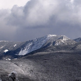

Gothics and Basin Mountains
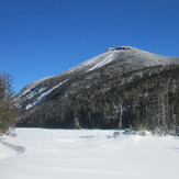
Mt Colden from Colden Lake
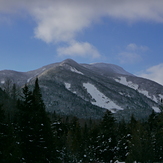
Colden from Marcy Dam
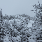
Mt. Colden Summit, Whiteout Conditions
Colden's Trap Dike and Trap Dike Slide