
– Lat/Long: 16.71° N 62.18° W
 Chances Peak
Weather Forecast, MontserratIssued: 7 am Mon 03 Aug Local TimeUpdates in: hr min sUpdate imminent
Issued: 7 am Mon 03 Aug Local Time
Updates in:
Update imminent hr min s

Issued: 7 am Mon 03 Aug Local Time
Updates in:
Update imminent hr min s
Days 1–3 Weather SummaryLight rain (total 4mm), mostly falling on Tue afternoon. Warm (max 23°C on Mon afternoon, min 21°C on Mon morning). Mainly strong winds. | Days 4–6 Weather SummaryLight rain (total 2mm), mostly falling on Fri morning. Warm (max 22°C on Thu morning, min 21°C on Thu morning). Mainly strong winds. | |||||||||||||||||
Monday 3 | Tuesday 4 | Wednesday 5 | Thursday 6 | Friday 7 | Saturday 8 | |||||||||||||
AM | PM | night | AM | PM | night | AM | PM | night | AM | PM | night | AM | PM | night | AM | PM | night | |
risk tstorm | clear | rain shwrs | risk tstorm | risk tstorm | risk tstorm | clear | clear | risk tstorm | risk tstorm | clear | rain shwrs | risk tstorm | clear | clear | risk tstorm | risk tstorm | rain shwrs | |
Cloud base (m) | 9800 | 400 | 450 | 450 | 8750 | 8300 | ||||||||||||
km/h | ||||||||||||||||||
 |  |  |  |  |  | |||||||||||||
— | — | — | — | — | — | — | — | — | — | — | — | — | — | — | — | — | — | |
mm | 0.3 | — | 0.1 | 0.1 | 2 | 1.1 | — | — | 0.4 | 0.2 | — | 0.2 | 0.7 | — | — | 0.5 | 0.1 | 0.4 |
max °C | 21 | 23 | 22 | 22 | 21 | 21 | 21 | 21 | 22 | 22 | 22 | 22 | 21 | 22 | 22 | 21 | 22 | 22 |
min °C | 21 | 22 | 21 | 21 | 21 | 21 | 21 | 21 | 21 | 21 | 22 | 21 | 21 | 22 | 21 | 21 | 22 | 21 |
chill °C | 21 | 22 | 21 | 21 | 21 | 21 | 21 | 21 | 21 | 21 | 22 | 21 | 21 | 22 | 21 | 21 | 22 | 21 |
Freezing level m | 4950 | 4950 | 4850 | 4750 | 4750 | 4700 | 4750 | 4800 | 4850 | 4950 | 4950 | 4950 | 5000 | 4850 | 4850 | 4850 | 4800 | 4800 |
5:48 | — | — | 5:48 | — | — | 5:50 | — | — | 5:50 | — | — | 5:50 | — | — | 5:50 | — | — | |
— | 6:39 | — | — | 6:38 | — | — | 6:38 | — | — | 6:37 | — | — | 6:37 | — | — | 6:37 | — | |
Loading...
Chances Peak Weather (Days 0-3):
The weather forecast for Chances Peak is: Light rain (total 4mm), mostly falling on Tue afternoon. Warm (max 23°C on Mon afternoon, min 21°C on Mon morning). Mainly strong winds.
Chances Peak Weather (Days 3-6):
Light rain (total 2mm), mostly falling on Fri morning. Warm (max 22°C on Thu morning, min 21°C on Thu morning). Mainly strong winds.
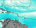
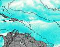
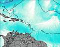
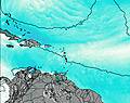
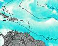
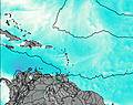
This table gives the weather forecast for Chances Peak at the specific elevation of 915 m. Our advanced weather models allow us to provide distinct weather forecasts for several elevations of Chances Peak. To see the weather forecasts for the other elevations, use the tab navigation above the table. For a wider overview of the weather, consult the Weather Map of Montserrat.
| Weather Station | Temp. | Weather | Wind | Gusts | Cloud / Visibility |
|---|---|---|---|---|---|
John Osborne Airport | |||||
Coolidg / ntigua Airport | |||||
Charlestow / ance W. Amory International Airport | |||||
Le Raizet Airport | |||||
Golden Rock / aint Kitts and Nevis Airport | |||||
876 | |||||
Eastern Caribbean Buoy | |||||
F.D. Roosevelt Airpor / ranjestad |
* NOTE: not all weather observatories update at the same frequency which is the reason why some locations may show data from stations that are further away than known closer ones.