
– Lat/Long: 46.45° N 10.62° E
 Cevedale
Weather Forecast, ItalyIssued: 1 am Wed 22 Jul Local TimeUpdates in: hr min sUpdate imminent
Issued: 1 am Wed 22 Jul Local Time
Updates in:
Update imminent hr min s

Issued: 1 am Wed 22 Jul Local Time
Updates in:
Update imminent hr min s
Days 1–3 Weather SummaryMostly dry. Freeze-thaw conditions (max 3°C on Fri afternoon, min -3°C on Wed morning). Mainly fresh winds. | Days 4–6 Weather SummaryMild with light rain (total 5mm) on Sat night Becoming colder with a light covering of snow, mostly falling on Sun afternoon. Freeze-thaw conditions (max 5°C on Mon afternoon, min -1°C on Sun morning). Wind will be generally light. | |||||||||||||||||
Wednesday 22 | Thursday 23 | Friday 24 | Saturday 25 | Sunday 26 | Monday 27 | |||||||||||||
AM | PM | night | AM | PM | night | AM | PM | night | AM | PM | night | AM | PM | night | AM | PM | night | |
clear | clear | some clouds | some clouds | some clouds | clear | clear | clear | clear | clear | rain shwrs | risk tstorm | snow shwrs | snow shwrs | snow shwrs | clear | clear | clear | |
Cloud base (m) | 7050 | 5300 | 4200 | 9350 | 9100 | 4400 | 2450 | 2700 | 2550 | 3950 | 4100 | |||||||
km/h | ||||||||||||||||||
 |  |  |  |  |  | |||||||||||||
— | — | — | — | — | — | — | — | — | — | — | — | 1 | 5 | 1 | — | — | — | |
mm | — | — | — | — | — | — | — | — | — | — | 1 | 4 | — | — | — | — | — | — |
max °C | -2 | 1 | 1 | -1 | 0 | -1 | -1 | 3 | 2 | 2 | 4 | 4 | 0 | 1 | 1 | 1 | 5 | 5 |
min °C | -3 | 0 | -1 | -2 | -1 | -3 | -1 | 2 | 1 | 1 | 3 | 0 | -1 | 0 | 0 | 1 | 4 | 4 |
chill °C | -8 | -5 | -7 | -8 | -7 | -10 | -7 | -3 | -3 | -2 | 0 | -5 | -5 | -3 | -4 | -3 | 1 | 3 |
Freezing level m | 3350 | 3950 | 3700 | 3500 | 3700 | 3400 | 3650 | 4250 | 4000 | 3950 | 4300 | 4000 | 3700 | 3800 | 3900 | 4000 | 4650 | 4500 |
5:46 | — | — | 5:47 | — | — | 5:48 | — | — | 5:48 | — | — | 5:50 | — | — | 5:50 | — | — | |
— | — | 9:00 | — | — | 8:59 | — | — | 8:58 | — | — | 8:57 | — | — | 8:55 | — | — | 8:54 | |
Loading...
Cevedale Weather (Days 0-3):
The weather forecast for Cevedale is: Mostly dry. Freeze-thaw conditions (max 3°C on Fri afternoon, min -3°C on Wed morning). Mainly fresh winds.
Cevedale Weather (Days 3-6):
Mild with light rain (total 5mm) on Sat night Becoming colder with a light covering of snow, mostly falling on Sun afternoon. Freeze-thaw conditions (max 5°C on Mon afternoon, min -1°C on Sun morning). Wind will be generally light.
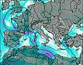
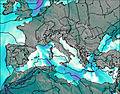
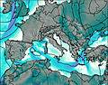
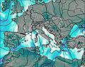
This table gives the weather forecast for Cevedale at the specific elevation of 3769 m. Our advanced weather models allow us to provide distinct weather forecasts for several elevations of Cevedale. To see the weather forecasts for the other elevations, use the tab navigation above the table. For a wider overview of the weather, consult the Weather Map of Italy.
| Weather Station | Temp. | Weather | Wind | Gusts | Cloud / Visibility |
|---|---|---|---|---|---|
Lagalb Bergstation | |||||
Brento Exit | |||||
Hinterer Brunnenkogel (Ötztaler Alpen) | |||||
Bolzano | |||||
Brento LZ | |||||
Muottas Muragl | |||||
Samedan Airport |
* NOTE: not all weather observatories update at the same frequency which is the reason why some locations may show data from stations that are further away than known closer ones.