
– Lat/Long: 38.37° S 71.08° W
 Cerro Chapulul
Weather Forecast, ChileIssued: 8 pm Sat 04 Jul Local TimeUpdates in: hr min sUpdate imminent
Issued: 8 pm Sat 04 Jul Local Time
Updates in:
Update imminent hr min s

Issued: 8 pm Sat 04 Jul Local Time
Updates in:
Update imminent hr min s
Days 1–4 Weather SummaryA dusting of snow turning to light rain (total 3mm) on Tue morning. Freeze-thaw conditions (max 6°C on Tue afternoon, min -4°C on Sat night). Winds increasing (calm on Sun night, fresh winds from the WNW by Tue afternoon). | Days 5–7 Weather SummaryHeavy rain (total 55mm), heaviest during Wed morning. Mild temperatures (max 6°C on Tue night, min 3°C on Thu night). Winds decreasing (fresh winds from the WNW on Tue night, calm by Thu night). | ||||||||||||||||||
Sunday 5 | Monday 6 | Tuesday 7 | Wednesday 8 | Thursday 9 | Friday 10 | ||||||||||||||
night | AM | PM | night | AM | PM | night | AM | PM | night | AM | PM | night | AM | PM | night | AM | PM | night | |
some clouds | some clouds | clear | clear | clear | some clouds | rain shwrs | light snow | rain shwrs | rain shwrs | heavy rain | mod. rain | light rain | light rain | rain shwrs | cloudy | some clouds | light rain | mod. snow | |
km/h | |||||||||||||||||||
 |  |  |  |  |  |  | |||||||||||||
— | — | — | — | — | — | — | 2 | — | — | — | — | — | — | — | — | — | — | 7 | |
mm | — | — | — | — | — | — | 0.1 | 2 | 0.6 | 10 | 32 | 8 | 1.7 | 1.2 | 0.4 | — | — | 2 | 15 |
max °C | -2 | -1 | 1 | 0 | 3 | 5 | 3 | 3 | 6 | 6 | 5 | 6 | 6 | 4 | 4 | 5 | 6 | 4 | 3 |
min °C | -4 | -3 | 0 | -1 | 1 | 4 | 2 | 0 | 5 | 5 | 5 | 6 | 5 | 4 | 4 | 3 | 5 | 3 | 1 |
chill °C | -7 | -6 | -2 | -3 | -1 | 2 | -1 | -5 | 0 | -1 | 0 | 3 | 2 | 1 | 2 | 2 | 4 | 0 | -2 |
Freezing level m | 1000 | 1000 | 1650 | 1250 | 3150 | 3150 | 2550 | 3100 | 2900 | 3000 | 2700 | 2650 | 2500 | 2200 | 2150 | 2500 | 3050 | 2450 | 2700 |
Cloud base (m) | 2400 | 1850 | 1800 | 1800 | 6900 | 3250 | 2200 | 1800 | 1800 | 1800 | 1800 | 1800 | 1800 | 1800 | 1900 | 2300 | 1800 | ||
— | 9:00 | — | — | 9:00 | — | — | 9:00 | — | — | 9:00 | — | — | 9:00 | — | — | 9:00 | — | — | |
— | — | 6:36 | — | — | 6:37 | — | — | 6:37 | — | — | 6:37 | — | — | 6:37 | — | — | 6:38 | — | |
Loading...
Cerro Chapulul Weather (Days 0-3):
The weather forecast for Cerro Chapulul is: A dusting of snow turning to light rain (total 3mm) on Tue morning. Freeze-thaw conditions (max 6°C on Tue afternoon, min -4°C on Sat night). Winds increasing (calm on Sun night, fresh winds from the WNW by Tue afternoon).
Cerro Chapulul Weather (Days 3-6):
Heavy rain (total 55mm), heaviest during Wed morning. Mild temperatures (max 6°C on Tue night, min 3°C on Thu night). Winds decreasing (fresh winds from the WNW on Tue night, calm by Thu night).
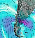
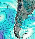
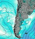
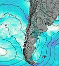
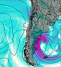
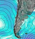
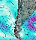
This table gives the weather forecast for Cerro Chapulul at the specific elevation of 1500 m. Our advanced weather models allow us to provide distinct weather forecasts for several elevations of Cerro Chapulul. To see the weather forecasts for the other elevations, use the tab navigation above the table. For a wider overview of the weather, consult the Weather Map of Chile.
| Weather Station | Temp. | Weather | Wind | Gusts | Cloud / Visibility |
|---|---|---|---|---|---|
Temuco | |||||
Temuco Airport | |||||
Maquehue -Ufro | |||||
Maria Dolores Airport | |||||
Chillán Mayulermo | |||||
Chilla / eneral Bernardo O'Higgins Airport | |||||
Valdivi / ichoy Airport | |||||
Valdivia |
* NOTE: not all weather observatories update at the same frequency which is the reason why some locations may show data from stations that are further away than known closer ones.