
– Lat/Long: 45.01° N 116.15° W
 Brundage Mountain Resort Bike Park
Weather Forecast, United StatesIssued: 5 pm Sun 24 May Local TimeUpdates in: hr min sUpdate imminent
Issued: 5 pm Sun 24 May Local Time
Updates in:
Update imminent hr min s

Issued: 5 pm Sun 24 May Local Time
Updates in:
Update imminent hr min s
Days 1–4 Weather SummaryModerate rain (total 15mm), heaviest on Tue night. Very mild (max 16°C on Mon afternoon, min 4°C on Tue morning). Winds decreasing (strong winds from the SSW on Mon afternoon, calm by Tue afternoon). | Days 5–7 Weather SummaryHeavy rain (total 36mm), heaviest during Wed afternoon. Very mild (max 12°C on Thu morning, min 3°C on Fri night). Wind will be generally light. | ||||||||||||||||
Sun 24 | Monday 25 | Tuesday 26 | Wednesday 27 | Thursday 28 | Friday 29 | ||||||||||||
PM | night | AM | PM | night | AM | PM | night | AM | PM | night | AM | PM | night | AM | PM | night | |
some clouds | clear | clear | some clouds | rain shwrs | light rain | rain shwrs | mod. rain | rain shwrs | mod. rain | rain shwrs | risk tstorm | rain shwrs | rain shwrs | rain shwrs | risk tstorm | rain shwrs | |
km/h | |||||||||||||||||
 |  |  |  |  |  | ||||||||||||
— | — | — | — | — | — | — | — | — | — | — | — | — | — | — | — | — | |
— | — | — | — | 1.8 | 1.3 | 2 | 9 | 0.4 | 9 | 1.5 | 0.4 | 13 | 5 | 1 | 4 | 0.8 | |
max °C | 13 | 11 | 14 | 16 | 10 | 5 | 5 | 6 | 10 | 9 | 8 | 12 | 9 | 7 | 6 | 7 | 5 |
min °C | 12 | 9 | 12 | 15 | 6 | 4 | 5 | 4 | 7 | 6 | 7 | 10 | 7 | 4 | 5 | 6 | 3 |
10 | 7 | 9 | 12 | 1 | 0 | 5 | 1 | 3 | 4 | 6 | 8 | 4 | -1 | 1 | 4 | 1 | |
3850 | 4000 | 3950 | 4150 | 3750 | 3100 | 2950 | 3550 | 3650 | 3400 | 3750 | 3950 | 3550 | 3650 | 3100 | 3050 | 2900 | |
Cloud base (m) | 4200 | 4700 | 2950 | 4050 | 2350 | 1650 | 1550 | 2400 | 1800 | 6550 | 3150 | 1850 | 1600 | 2900 | |||
— | — | 6:05 | — | — | 6:03 | — | — | 6:03 | — | — | 6:03 | — | — | 6:01 | — | — | |
— | 9:16 | — | — | 9:17 | — | — | 9:19 | — | — | 9:20 | — | — | 9:21 | — | — | 9:21 | |
Loading...
Brundage Mountain Resort Weather (Days 0-3):
The weather forecast for Brundage Mountain Resort is: Moderate rain (total 15mm), heaviest on Tue night. Very mild (max 16°C on Mon afternoon, min 4°C on Tue morning). Winds decreasing (strong winds from the SSW on Mon afternoon, calm by Tue afternoon).
Brundage Mountain Resort Weather (Days 3-6):
Heavy rain (total 36mm), heaviest during Wed afternoon. Very mild (max 12°C on Thu morning, min 3°C on Fri night). Wind will be generally light.
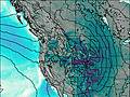
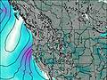
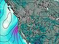
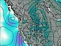
This table gives the weather forecast for Brundage Mountain Resort at the specific elevation of 2324 m. Our advanced weather models allow us to provide distinct weather forecasts for several elevations of Brundage Mountain Resort. To see the weather forecasts for the other elevations, use the tab navigation above the table. For a wider overview of the weather, consult the Weather Map of Idaho.
| Weather Station | Temp. | Weather | Wind | Gusts | Cloud / Visibility |
|---|---|---|---|---|---|
Mccall Airport | |||||
Joseph State Airport (Oregon) | |||||
Stanley Airport | |||||
Lowel / lk City | |||||
Boise Airport | |||||
* NOTE: not all weather observatories update at the same frequency which is the reason why some locations may show data from stations that are further away than known closer ones.