
– Lat/Long: 18.05° N 76.58° W
 Blue Mountain Peak
Weather Forecast, JamaicaIssued: 6 am Fri 03 Jul Local TimeUpdates in: hr min sUpdate imminent
Issued: 6 am Fri 03 Jul Local Time
Updates in:
Update imminent hr min s

Issued: 6 am Fri 03 Jul Local Time
Updates in:
Update imminent hr min s
Days 1–3 Weather SummaryLight rain (total 6mm), mostly falling on Sat night. Very mild (max 15°C on Fri morning, min 13°C on Sat night). Winds increasing (light winds from the E on Sat afternoon, near gales from the ESE by Sun night). | Days 4–6 Weather SummaryLight rain (total 9mm), mostly falling on Wed night. Very mild (max 15°C on Tue night, min 13°C on Mon morning). Mainly strong winds. | |||||||||||||||||
Friday 3 | Saturday 4 | Sunday 5 | Monday 6 | Tuesday 7 | Wednesday 8 | |||||||||||||
AM | PM | night | AM | PM | night | AM | PM | night | AM | PM | night | AM | PM | night | AM | PM | night | |
risk tstorm | clear | clear | clear | rain shwrs | risk tstorm | rain shwrs | risk tstorm | risk tstorm | risk tstorm | light rain | risk tstorm | risk tstorm | risk tstorm | risk tstorm | risk tstorm | risk tstorm | rain shwrs | |
km/h | ||||||||||||||||||
 |  |  |  |  |  | |||||||||||||
— | — | — | — | — | — | — | — | — | — | — | — | — | — | — | — | — | — | |
mm | 0.1 | — | — | — | 0.4 | 3 | 0.7 | 0.6 | 1.2 | 1.4 | 0.9 | 1.5 | 0.4 | 0.7 | 0.6 | 1.3 | 0.8 | 1.6 |
max °C | 15 | 15 | 15 | 15 | 15 | 14 | 14 | 14 | 13 | 13 | 13 | 14 | 14 | 14 | 15 | 14 | 15 | 15 |
min °C | 14 | 15 | 15 | 15 | 14 | 13 | 13 | 13 | 13 | 13 | 13 | 13 | 14 | 14 | 14 | 14 | 14 | 14 |
chill °C | 12 | 14 | 13 | 13 | 12 | 10 | 11 | 10 | 10 | 10 | 10 | 10 | 11 | 11 | 11 | 12 | 12 | 11 |
Freezing level m | 4750 | 4750 | 4800 | 4800 | 4700 | 4650 | 4800 | 4600 | 4500 | 4600 | 4550 | 4750 | 4850 | 4850 | 4900 | 4800 | 4800 | 4750 |
Cloud base (m) | 9050 | 5900 | 4850 | 5200 | 2400 | 2900 | 4600 | 4750 | 3150 | |||||||||
5:35 | — | — | 5:35 | — | — | 5:35 | — | — | 5:35 | — | — | 5:35 | — | — | 5:35 | — | — | |
— | 6:45 | — | — | 6:45 | — | — | 6:45 | — | — | 6:45 | — | — | 6:45 | — | — | 6:45 | — | |
Loading...
Blue Mountain Peak Weather (Days 0-3):
The weather forecast for Blue Mountain Peak is: Light rain (total 6mm), mostly falling on Sat night. Very mild (max 15°C on Fri morning, min 13°C on Sat night). Winds increasing (light winds from the E on Sat afternoon, near gales from the ESE by Sun night).
Blue Mountain Peak Weather (Days 3-6):
Light rain (total 9mm), mostly falling on Wed night. Very mild (max 15°C on Tue night, min 13°C on Mon morning). Mainly strong winds.
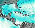
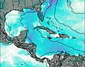
This table gives the weather forecast for Blue Mountain Peak at the specific elevation of 2256 m. Our advanced weather models allow us to provide distinct weather forecasts for several elevations of Blue Mountain Peak. To see the weather forecasts for the other elevations, use the tab navigation above the table. For a wider overview of the weather, consult the Weather Map of Jamaica.
| Weather Station | Temp. | Weather | Wind | Gusts | Cloud / Visibility |
|---|---|---|---|---|---|
lightning 79km N of Port Maria | |||||
lightning 94km ESE of Niquero | |||||
lightning 88km SSW of Guisa | |||||
lightning 57km SSW of El Cobre | |||||
lightning 71km ESE of Media Luna | |||||
lightning 43km S of Santiago de Cuba | |||||
lightning 57km S of Yara |
* NOTE: not all weather observatories update at the same frequency which is the reason why some locations may show data from stations that are further away than known closer ones.