– Lat/Long: 41.73° S 172.93° E
 Beebys Knob
Weather Forecast, New ZealandIssued: 5 pm Mon 03 Aug Local TimeUpdates in: hr min sUpdate imminent
Issued: 5 pm Mon 03 Aug Local Time
Updates in:
Update imminent hr min s

Issued: 5 pm Mon 03 Aug Local Time
Updates in:
Update imminent hr min s
Days 1–4 Weather SummaryMostly dry. Freeze-thaw conditions (max 1°C on Mon afternoon, min -6°C on Tue afternoon). Winds decreasing (strong winds from the WSW on Mon afternoon, light winds from the SW by Wed morning). | Days 5–7 Weather SummaryMostly dry. Freeze-thaw conditions (max 3°C on Fri night, min 0°C on Thu afternoon). Wind will be generally light. | ||||||||||||||||
Mon 3 | Tuesday 4 | Wednesday 5 | Thursday 6 | Friday 7 | Saturday 8 | ||||||||||||
PM | night | AM | PM | night | AM | PM | night | AM | PM | night | AM | PM | night | AM | PM | night | |
some clouds | some clouds | some clouds | clear | clear | clear | clear | clear | clear | clear | some clouds | some clouds | cloudy | rain shwrs | cloudy | light rain | some clouds | |
Cloud base (m) | 650 | 650 | 800 | 8700 | 8150 | 5050 | 850 | 650 | 1850 | 2550 | 650 | ||||||
km/h | |||||||||||||||||
 |  |  |  |  |  | ||||||||||||
— | — | — | — | — | — | — | — | — | — | — | — | — | — | — | — | — | |
mm | — | — | — | — | — | — | — | — | — | — | — | — | — | 0.1 | — | 0.1 | — |
max °C | 1 | 0 | -4 | -5 | -4 | -1 | 0 | -1 | 0 | 1 | 1 | 1 | 1 | 3 | 3 | 3 | 1 |
min °C | 0 | -2 | -5 | -6 | -6 | -3 | -1 | -2 | 0 | 0 | 0 | 0 | 1 | 2 | 3 | 1 | 1 |
chill °C | -8 | -8 | -12 | -13 | -13 | -6 | -4 | -5 | -2 | -3 | -2 | -4 | -3 | -1 | 0 | -1 | -3 |
Freezing level m | 1600 | 1300 | 900 | 850 | 300 | 950 | 1450 | 1000 | 1350 | 1550 | 1450 | 1750 | 1550 | 1900 | 1950 | 1800 | 1650 |
— | — | 7:33 | — | — | 7:33 | — | — | 7:31 | — | — | 7:31 | — | — | 7:30 | — | — | |
5:32 | — | — | 5:34 | — | — | 5:35 | — | — | 5:36 | — | — | 5:37 | — | — | 5:37 | — | |
Loading...
Beebys Knob Weather (Days 0-3):
The weather forecast for Beebys Knob is: Mostly dry. Freeze-thaw conditions (max 1°C on Mon afternoon, min -6°C on Tue afternoon). Winds decreasing (strong winds from the WSW on Mon afternoon, light winds from the SW by Wed morning).
Beebys Knob Weather (Days 3-6):
Mostly dry. Freeze-thaw conditions (max 3°C on Fri night, min 0°C on Thu afternoon). Wind will be generally light.
This table gives the weather forecast for Beebys Knob at the specific elevation of 1442 m. Our advanced weather models allow us to provide distinct weather forecasts for several elevations of Beebys Knob. To see the weather forecasts for the other elevations, use the tab navigation above the table. For a wider overview of the weather, consult the Weather Map of New Zealand.
Beebys Knob Photos
View all
Richmond Range photos (10) |
New Zealand photos (156) |
photos from mountains in New Zealand (160) |
all photos
 Upload new photo
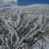
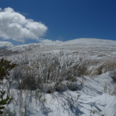
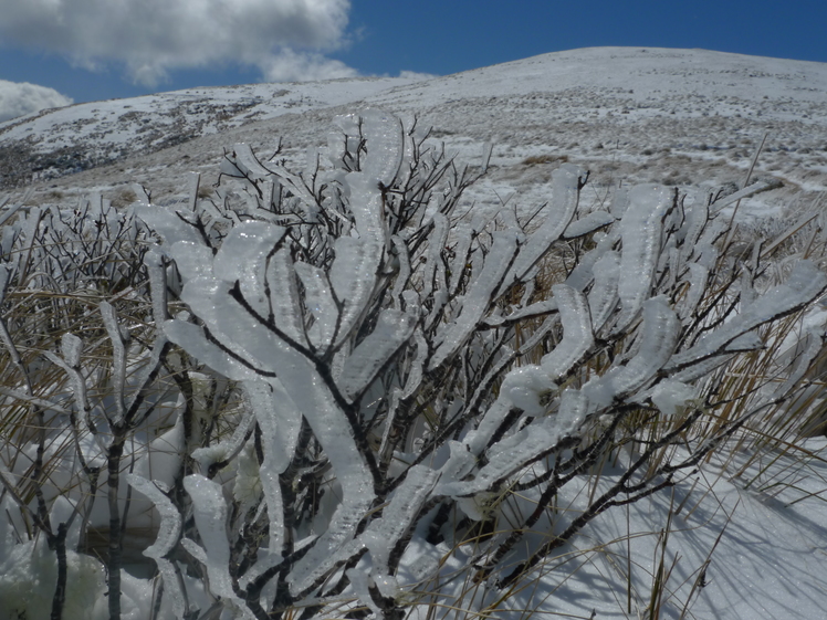
Rime encrusted twigs
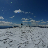
Beebys Knob Summit Trig
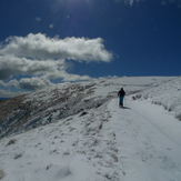
Splitboarding on Beeby's Knob