
– Lat/Long: 38.08° N 127.44° E
 Baegunsan (Gangwon/Gyeonggi)
Weather Forecast, Korea SIssued: 2 am Tue 04 Aug Local TimeUpdates in: hr min sUpdate imminent
Issued: 2 am Tue 04 Aug Local Time
Updates in:
Update imminent hr min s

Issued: 2 am Tue 04 Aug Local Time
Updates in:
Update imminent hr min s
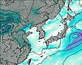
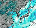
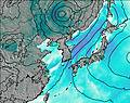
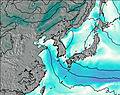
Days 1–3 Weather SummaryLight rain (total 2mm), mostly falling on Tue afternoon. Warm (max 27°C on Tue afternoon, min 22°C on Thu night). Wind will be generally light. | Days 4–6 Weather SummaryMostly dry. Warm (max 28°C on Fri afternoon, min 16°C on Sun night). Winds increasing (calm on Fri morning, gales from the ENE by Sun night). | |||||||||||||||||
Tuesday 4 | Wednesday 5 | Thursday 6 | Friday 7 | Saturday 8 | Sunday 9 | |||||||||||||
AM | PM | night | AM | PM | night | AM | PM | night | AM | PM | night | AM | PM | night | AM | PM | night | |
clear | risk tstorm | risk tstorm | clear | clear | risk tstorm | clear | clear | clear | clear | clear | clear | clear | clear | some clouds | cloudy | cloudy | cloudy | |
Cloud base (m) | 350 | 1650 | 9500 | 2050 | 350 | 1500 | 600 | 450 | 500 | 600 | ||||||||
km/h | ||||||||||||||||||
 |  |  |  |  |  | |||||||||||||
— | — | — | — | — | — | — | — | — | — | — | — | — | — | — | — | — | — | |
mm | — | 2 | 0.2 | — | — | 0.1 | — | — | — | — | — | — | — | — | — | — | — | — |
max °C | 26 | 27 | 25 | 26 | 27 | 25 | 26 | 27 | 25 | 26 | 28 | 25 | 24 | 22 | 20 | 18 | 18 | 18 |
min °C | 24 | 26 | 23 | 25 | 27 | 23 | 24 | 27 | 22 | 24 | 27 | 21 | 23 | 22 | 18 | 18 | 18 | 16 |
chill °C | 24 | 26 | 23 | 25 | 27 | 23 | 24 | 27 | 22 | 24 | 27 | 21 | 23 | 22 | 16 | 16 | 16 | 13 |
Freezing level m | 5500 | 5500 | 5700 | 5600 | 5650 | 5700 | 5650 | 5650 | 5650 | 5500 | 5500 | 5350 | 5150 | 5100 | 5150 | 5150 | 5150 | 5350 |
5:35 | — | — | 5:35 | — | — | 5:35 | — | — | 5:37 | — | — | 5:37 | — | — | 5:39 | — | — | |
— | 7:37 | — | — | 7:35 | — | — | 7:34 | — | — | 7:32 | — | — | 7:31 | — | — | 7:30 | — | |
Loading...
Baegunsan (Gangwon/Gyeonggi) Weather (Days 0-3):
The weather forecast for Baegunsan (Gangwon/Gyeonggi) is: Light rain (total 2mm), mostly falling on Tue afternoon. Warm (max 27°C on Tue afternoon, min 22°C on Thu night). Wind will be generally light.
Baegunsan (Gangwon/Gyeonggi) Weather (Days 3-6):
Mostly dry. Warm (max 28°C on Fri afternoon, min 16°C on Sun night). Winds increasing (calm on Fri morning, gales from the ENE by Sun night).
This table gives the weather forecast for Baegunsan (Gangwon/Gyeonggi) at the specific elevation of 904 m. Our advanced weather models allow us to provide distinct weather forecasts for several elevations of Baegunsan (Gangwon/Gyeonggi). To see the weather forecasts for the other elevations, use the tab navigation above the table. For a wider overview of the weather, consult the Weather Map of South Korea.
| Weather Station | Temp. | Weather | Wind | Gusts | Cloud / Visibility |
|---|---|---|---|---|---|
Sachang | |||||
Yangku Airport | |||||
Hongcheon Airport | |||||
Munsan Rws Airport | |||||
Chajang Airport | |||||
Gwangjuup Airport | |||||
Seoul East Airport | |||||
Seou / impo International Airport |
* NOTE: not all weather observatories update at the same frequency which is the reason why some locations may show data from stations that are further away than known closer ones.