
– Lat/Long: 45.46° N 110.96° W
 Window Rock Cabin
Weather Forecast, United StatesIssued: 11 am Wed 15 Jul Local TimeUpdates in: hr min sUpdate imminent
Issued: 11 am Wed 15 Jul Local Time
Updates in:
Update imminent hr min s

Issued: 11 am Wed 15 Jul Local Time
Updates in:
Update imminent hr min s
Days 1–3 Weather SummaryHeavy rain (total 30mm), heaviest during Thu afternoon. Warm (max 26°C on Fri afternoon, min 16°C on Wed night). Wind will be generally light. | Days 4–6 Weather SummaryMostly dry. Warm (max 26°C on Sun afternoon, min 15°C on Mon night). Wind will be generally light. | |||||||||||||||||
Wednesday 15 | Thursday 16 | Friday 17 | Saturday 18 | Sunday 19 | Monday 20 | |||||||||||||
AM | PM | night | AM | PM | night | AM | PM | night | AM | PM | night | AM | PM | night | AM | PM | night | |
light rain | risk tstorm | risk tstorm | clear | risk tstorm | risk tstorm | some clouds | light rain | risk tstorm | clear | rain shwrs | risk tstorm | clear | clear | clear | clear | some clouds | rain shwrs | |
km/h | ||||||||||||||||||
 |  |  |  |  |  | |||||||||||||
— | — | — | — | — | — | — | — | — | — | — | — | — | — | — | — | — | — | |
mm | 1.5 | 1.2 | 4 | — | 13 | 0.3 | — | 4 | 5 | — | 0.1 | 0.4 | — | — | — | — | — | 0.3 |
max °C | 20 | 21 | 16 | 24 | 23 | 18 | 24 | 26 | 19 | 24 | 25 | 23 | 24 | 26 | 22 | 24 | 26 | 21 |
min °C | 18 | 21 | 16 | 20 | 19 | 17 | 21 | 21 | 16 | 20 | 25 | 18 | 22 | 26 | 17 | 22 | 26 | 15 |
chill °C | 18 | 21 | 16 | 20 | 19 | 17 | 21 | 21 | 16 | 20 | 25 | 18 | 22 | 26 | 17 | 22 | 26 | 15 |
Freezing level m | 5100 | 5100 | 5000 | 5100 | 5150 | 5200 | 5200 | 5550 | 5250 | 5100 | 5350 | 5250 | 5200 | 5350 | 5200 | 5100 | 5250 | 5400 |
Cloud base (m) | 5350 | 4000 | 7500 | 4700 | 5350 | 7000 | 2350 | 4800 | 5350 | 5600 | 5800 | |||||||
5:50 | — | — | 5:50 | — | — | 5:52 | — | — | 5:52 | — | — | 5:54 | — | — | 5:54 | — | — | |
— | — | 9:07 | — | — | 9:07 | — | — | 9:07 | — | — | 9:06 | — | — | 9:05 | — | — | 9:04 | |
Loading...
Window Rock Cabin Weather (Days 0-3):
The weather forecast for Window Rock Cabin is: Heavy rain (total 30mm), heaviest during Thu afternoon. Warm (max 26°C on Fri afternoon, min 16°C on Wed night). Wind will be generally light.
Window Rock Cabin Weather (Days 3-6):
Mostly dry. Warm (max 26°C on Sun afternoon, min 15°C on Mon night). Wind will be generally light.
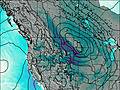
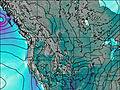
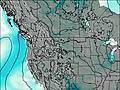
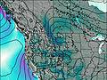
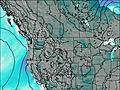
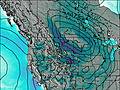
This table gives the weather forecast for Window Rock Cabin at the specific elevation of 2072 m. Our advanced weather models allow us to provide distinct weather forecasts for several elevations of Window Rock Cabin. To see the weather forecasts for the other elevations, use the tab navigation above the table. For a wider overview of the weather, consult the Weather Map of Montana.
| Weather Station | Temp. | Weather | Wind | Gusts | Cloud / Visibility |
|---|---|---|---|---|---|
Livingston Airport | |||||
Ennis Big Sky Airport (Montana) |
* NOTE: not all weather observatories update at the same frequency which is the reason why some locations may show data from stations that are further away than known closer ones.