
– Lat/Long: 46.26° N 15.73° E
 Planinski Dom Pod Donačko Goro - Rudijev Dom (Planinski Dom Pod Donacko Goro - Rudijev Dom)
Weather Forecast, SloveniaIssued: 1 pm Wed 15 Jul Local TimeUpdates in: hr min sUpdate imminent
Issued: 1 pm Wed 15 Jul Local Time
Updates in:
Update imminent hr min s

Issued: 1 pm Wed 15 Jul Local Time
Updates in:
Update imminent hr min s
Days 1–4 Weather SummaryModerate rain (total 15mm), heaviest on Thu morning. Warm (max 29°C on Fri afternoon, min 18°C on Thu morning). Wind will be generally light. | Days 5–7 Weather SummaryHeavy rain (total 45mm), heaviest during Sat night. Warm (max 24°C on Sat afternoon, min 12°C on Sun night). Mainly fresh winds. | ||||||||||||||||
Wed 15 | Thursday 16 | Friday 17 | Saturday 18 | Sunday 19 | Monday 20 | ||||||||||||
PM | night | AM | PM | night | AM | PM | night | AM | PM | night | AM | PM | night | AM | PM | night | |
clear | rain shwrs | mod. rain | clear | clear | clear | clear | rain shwrs | rain shwrs | some clouds | rain shwrs | clear | clear | rain shwrs | clear | some clouds | some clouds | |
km/h | |||||||||||||||||
 |  |  |  |  |  | ||||||||||||
— | — | — | — | — | — | — | — | — | — | — | — | — | — | — | — | — | |
mm | — | 0.7 | 6 | — | — | — | — | 8 | 0.1 | — | 41 | — | — | 3 | — | — | — |
max °C | 28 | 21 | 18 | 23 | 22 | 26 | 29 | 26 | 21 | 24 | 17 | 20 | 24 | 14 | 17 | 21 | 19 |
min °C | 26 | 19 | 18 | 22 | 19 | 21 | 28 | 19 | 19 | 22 | 16 | 17 | 23 | 12 | 13 | 20 | 14 |
chill °C | 26 | 19 | 18 | 22 | 19 | 21 | 28 | 19 | 19 | 22 | 15 | 17 | 23 | 12 | 13 | 20 | 13 |
Freezing level m | 4150 | 4200 | 4000 | 4450 | 4450 | 4350 | 4350 | 4300 | 4050 | 3950 | 3650 | 3600 | 3700 | 3450 | 3350 | 3350 | 3100 |
Cloud base (m) | 4650 | 3100 | 300 | 8950 | 4800 | 5450 | 2900 | 3400 | 400 | 4350 | 3150 | 5750 | |||||
— | — | 5:20 | — | — | 5:22 | — | — | 5:22 | — | — | 5:24 | — | — | 5:24 | — | — | |
— | 8:45 | — | — | 8:44 | — | — | 8:43 | — | — | 8:42 | — | — | 8:42 | — | — | 8:40 | |
Loading...
Planinski Dom Pod Donačko Goro - Rudijev Dom Weather (Days 0-3):
The weather forecast for Planinski Dom Pod Donačko Goro - Rudijev Dom is: Moderate rain (total 15mm), heaviest on Thu morning. Warm (max 29°C on Fri afternoon, min 18°C on Thu morning). Wind will be generally light.
Planinski Dom Pod Donačko Goro - Rudijev Dom Weather (Days 3-6):
Heavy rain (total 45mm), heaviest during Sat night. Warm (max 24°C on Sat afternoon, min 12°C on Sun night). Mainly fresh winds.
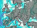
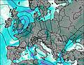
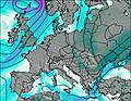
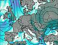
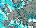
This table gives the weather forecast for Planinski Dom Pod Donačko Goro - Rudijev Dom at the specific elevation of 592 m. Our advanced weather models allow us to provide distinct weather forecasts for several elevations of Planinski Dom Pod Donačko Goro - Rudijev Dom. To see the weather forecasts for the other elevations, use the tab navigation above the table. For a wider overview of the weather, consult the Weather Map of Slovenia.
| Weather Station | Temp. | Weather | Wind | Gusts | Cloud / Visibility |
|---|---|---|---|---|---|
thunderstorm affecting Slovenska Bistrica | |||||
Celje | |||||
* NOTE: not all weather observatories update at the same frequency which is the reason why some locations may show data from stations that are further away than known closer ones.