
– Lat/Long: 40.83° S 175.41° E
 Mcgregor Bivvy
Weather Forecast, New ZealandIssued: 5 am Thu 25 Jun Local TimeUpdates in: hr min sUpdate imminent
Issued: 5 am Thu 25 Jun Local Time
Updates in:
Update imminent hr min s

Issued: 5 am Thu 25 Jun Local Time
Updates in:
Update imminent hr min s
Days 1–3 Weather SummaryA light covering of new snow mostly falling on Fri morning will be washed away by heavy rain (total 63mm) on Fri afternoon. Freeze-thaw conditions (max 6°C on Fri night, min -1°C on Thu night). Winds increasing (light winds from the SSE on Thu morning, stormy winds from the S by Thu night). | Days 4–6 Weather SummarySome drizzle, heaviest during Mon afternoon. Freeze-thaw conditions (max 4°C on Sun morning, min 0°C on Tue morning). Winds decreasing (fresh winds from the SSE on Mon morning, calm by Tue night). | |||||||||||||||||
Thursday 25 | Friday 26 | Saturday 27 | Sunday 28 | Monday 29 | Tuesday 30 | |||||||||||||
AM | PM | night | AM | PM | night | AM | PM | night | AM | PM | night | AM | PM | night | AM | PM | night | |
light rain | light snow | light snow | light snow | heavy rain | heavy rain | light rain | light rain | light rain | some clouds | clear | clear | rain shwrs | rain shwrs | some clouds | some clouds | some clouds | clear | |
km/h | ||||||||||||||||||
 |  |  |  |  |  | |||||||||||||
— | 1 | 3 | 3 | — | — | — | — | — | — | — | — | — | — | — | — | — | — | |
mm | 0.1 | — | — | 9 | 22 | 26 | 2 | 3 | 1.2 | — | — | — | 0.3 | 0.8 | — | — | — | — |
max °C | 4 | 0 | 1 | 3 | 5 | 6 | 5 | 5 | 4 | 4 | 3 | 2 | 2 | 2 | 1 | 1 | 1 | 1 |
min °C | 2 | 0 | -1 | 1 | 5 | 5 | 5 | 4 | 4 | 3 | 3 | 1 | 2 | 2 | 1 | 0 | 1 | 1 |
chill °C | -4 | -9 | -12 | -8 | -2 | -1 | -2 | -3 | -3 | -2 | -1 | -5 | -4 | -4 | -4 | -2 | 1 | 1 |
Freezing level m | 2050 | 1150 | 1250 | 1450 | 2200 | 2300 | 2450 | 2250 | 2100 | 1850 | 1750 | 1550 | 1450 | 1500 | 1350 | 1200 | 1350 | 1450 |
Cloud base (m) | 600 | 450 | 450 | 450 | 450 | 450 | 500 | 450 | 500 | 650 | 650 | 600 | 850 | 650 | 550 | 550 | 800 | 800 |
7:43 | — | — | 7:43 | — | — | 7:43 | — | — | 7:43 | — | — | 7:43 | — | — | 7:43 | — | — | |
— | 4:58 | — | — | 4:58 | — | — | 4:59 | — | — | 4:59 | — | — | 5:00 | — | — | 5:00 | — | |
Loading...
Mcgregor Bivvy Weather (Days 0-3):
The weather forecast for Mcgregor Bivvy is: A light covering of new snow mostly falling on Fri morning will be washed away by heavy rain (total 63mm) on Fri afternoon. Freeze-thaw conditions (max 6°C on Fri night, min -1°C on Thu night). Winds increasing (light winds from the SSE on Thu morning, stormy winds from the S by Thu night).
Mcgregor Bivvy Weather (Days 3-6):
Some drizzle, heaviest during Mon afternoon. Freeze-thaw conditions (max 4°C on Sun morning, min 0°C on Tue morning). Winds decreasing (fresh winds from the SSE on Mon morning, calm by Tue night).
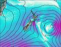
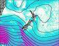
This table gives the weather forecast for Mcgregor Bivvy at the specific elevation of 1176 m. Our advanced weather models allow us to provide distinct weather forecasts for several elevations of Mcgregor Bivvy. To see the weather forecasts for the other elevations, use the tab navigation above the table. For a wider overview of the weather, consult the Weather Map of New Zealand.
| Weather Station | Temp. | Weather | Wind | Gusts | Cloud / Visibility |
|---|---|---|---|---|---|
Kapiti Aeromodellers | |||||
Paekakariki | |||||
Ohakea Airport | |||||
Wellington International Airport | |||||
Baring Head | |||||
ASCATB176E41S | |||||
ASCATB177E41S | |||||
ASCATB177E40S | |||||
ASCATB176E42S | |||||
Te Mata Peak |
* NOTE: not all weather observatories update at the same frequency which is the reason why some locations may show data from stations that are further away than known closer ones.