
– Lat/Long: 44.75° S 168.66° E
 Ballarat Hut - Flood Burn
Weather Forecast, New ZealandIssued: 11 am Sat 20 Jun Local TimeUpdates in: hr min sUpdate imminent
Issued: 11 am Sat 20 Jun Local Time
Updates in:
Update imminent hr min s

Issued: 11 am Sat 20 Jun Local Time
Updates in:
Update imminent hr min s
Days 1–3 Weather SummaryHeavy rain (total 47mm), heaviest during Sat morning. Very mild (max 10°C on Sat morning, min 2°C on Mon night). Wind will be generally light. | Days 4–6 Weather SummaryModerate rain (total 16mm) heaviest on Wed morning, then becoming colder with a dusting of snow on Wed night. Freeze-thaw conditions (max 5°C on Tue afternoon, min -3°C on Thu night). Wind will be generally light. | |||||||||||||||||
Saturday 20 | Sunday 21 | Monday 22 | Tuesday 23 | Wednesday 24 | Thursday 25 | |||||||||||||
AM | PM | night | AM | PM | night | AM | PM | night | AM | PM | night | AM | PM | night | AM | PM | night | |
heavy rain | mod. rain | rain shwrs | some clouds | clear | clear | clear | clear | clear | some clouds | cloudy | light rain | heavy rain | light rain | light snow | clear | clear | clear | |
km/h | ||||||||||||||||||
 |  |  |  |  |  | |||||||||||||
— | — | — | — | — | — | — | — | — | — | — | — | — | — | 1 | — | — | — | |
mm | 38 | 6 | 2 | — | — | — | — | — | — | — | — | 0.1 | 11 | 5 | — | — | — | — |
max °C | 10 | 7 | 6 | 5 | 6 | 4 | 5 | 6 | 3 | 4 | 5 | 4 | 2 | 2 | 2 | 1 | 0 | -1 |
min °C | 9 | 7 | 4 | 4 | 5 | 3 | 3 | 5 | 2 | 3 | 4 | 4 | 2 | 2 | 2 | 0 | -2 | -3 |
chill °C | 8 | 5 | 3 | 4 | 4 | 3 | 2 | 5 | 0 | 1 | 2 | 2 | 1 | 2 | -2 | -3 | -5 | -6 |
Freezing level m | 2400 | 2050 | 1750 | 1550 | 1750 | 1600 | 1550 | 1800 | 1250 | 1300 | 1600 | 1500 | 1250 | 1200 | 1100 | 950 | 850 | 0 |
Cloud base (m) | 700 | 700 | 750 | 900 | 1550 | 850 | 1650 | 950 | 800 | 900 | 850 | 800 | 700 | 750 | 750 | 800 | 800 | |
8:22 | — | — | 8:22 | — | — | 8:22 | — | — | 8:22 | — | — | 8:22 | — | — | 8:22 | — | — | |
— | 5:09 | — | — | 5:10 | — | — | 5:10 | — | — | 5:10 | — | — | 5:10 | — | — | 5:12 | — | |
Loading...
Ballarat Hut - Flood Burn Weather (Days 0-3):
The weather forecast for Ballarat Hut - Flood Burn is: Heavy rain (total 47mm), heaviest during Sat morning. Very mild (max 10°C on Sat morning, min 2°C on Mon night). Wind will be generally light.
Ballarat Hut - Flood Burn Weather (Days 3-6):
Moderate rain (total 16mm) heaviest on Wed morning, then becoming colder with a dusting of snow on Wed night. Freeze-thaw conditions (max 5°C on Tue afternoon, min -3°C on Thu night). Wind will be generally light.
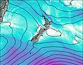
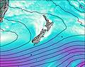
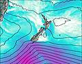
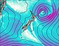
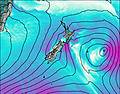
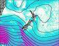
This table gives the weather forecast for Ballarat Hut - Flood Burn at the specific elevation of 857 m. Our advanced weather models allow us to provide distinct weather forecasts for several elevations of Ballarat Hut - Flood Burn. To see the weather forecasts for the other elevations, use the tab navigation above the table. For a wider overview of the weather, consult the Weather Map of New Zealand.