
– Lat/Long: 47.51° N 116.12° W
 Silver Mountain Resort Bike Park
Weather Forecast, United StatesIssued: 10 pm Tue 28 Jul Local TimeUpdates in: hr min sUpdate imminent
Issued: 10 pm Tue 28 Jul Local Time
Updates in:
Update imminent hr min s

Issued: 10 pm Tue 28 Jul Local Time
Updates in:
Update imminent hr min s
Days 1–4 Weather SummaryMostly dry. Warm (max 22°C on Fri afternoon, min 12°C on Wed morning). Winds decreasing (fresh winds from the WSW on Thu afternoon, light winds from the WSW by Fri morning). | Days 5–7 Weather SummaryMostly dry. Warm (max 22°C on Fri night, min 6°C on Sun morning). Winds decreasing (near gales from the WSW on Sat night, calm by Sun night). | ||||||||||||||||||
Wednesday 29 | Thursday 30 | Friday 31 | Saturday 1 | Sunday 2 | Monday 3 | ||||||||||||||
night | AM | PM | night | AM | PM | night | AM | PM | night | AM | PM | night | AM | PM | night | AM | PM | night | |
clear | clear | clear | clear | clear | clear | clear | clear | clear | clear | clear | clear | clear | clear | clear | clear | clear | clear | clear | |
Cloud base (m) | 9450 | 7150 | 9400 | 9500 | |||||||||||||||
km/h | |||||||||||||||||||
 |  |  |  |  |  |  | |||||||||||||
— | — | — | — | — | — | — | — | — | — | — | — | — | — | — | — | — | — | — | |
mm | — | — | — | — | — | — | — | — | — | — | — | — | — | — | — | — | — | — | — |
max °C | 17 | 15 | 19 | 19 | 18 | 21 | 20 | 18 | 22 | 22 | 21 | 22 | 19 | 9 | 13 | 13 | 12 | 15 | 15 |
min °C | 13 | 12 | 18 | 16 | 15 | 20 | 16 | 16 | 21 | 20 | 20 | 21 | 7 | 6 | 11 | 11 | 9 | 14 | 13 |
chill °C | 11 | 10 | 17 | 16 | 14 | 20 | 16 | 16 | 21 | 20 | 20 | 20 | 3 | 2 | 8 | 11 | 8 | 13 | 13 |
Freezing level m | 4150 | 4100 | 4300 | 4450 | 4450 | 4600 | 4650 | 4750 | 4800 | 5050 | 5050 | 4700 | 4200 | 3600 | 3600 | 3300 | 3200 | 3600 | 3550 |
— | 5:18 | — | — | 5:20 | — | — | 5:20 | — | — | 5:22 | — | — | 5:24 | — | — | 5:24 | — | — | |
— | — | — | 8:22 | — | — | 8:20 | — | — | 8:19 | — | — | 8:16 | — | — | 8:15 | — | — | 8:15 | |
Loading...
Silver Mountain Resort Weather (Days 0-3):
The weather forecast for Silver Mountain Resort is: Mostly dry. Warm (max 22°C on Fri afternoon, min 12°C on Wed morning). Winds decreasing (fresh winds from the WSW on Thu afternoon, light winds from the WSW by Fri morning).
Silver Mountain Resort Weather (Days 3-6):
Mostly dry. Warm (max 22°C on Fri night, min 6°C on Sun morning). Winds decreasing (near gales from the WSW on Sat night, calm by Sun night).
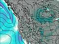
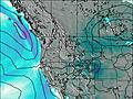
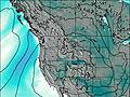
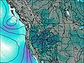
This table gives the weather forecast for Silver Mountain Resort at the specific elevation of 1915 m. Our advanced weather models allow us to provide distinct weather forecasts for several elevations of Silver Mountain Resort. To see the weather forecasts for the other elevations, use the tab navigation above the table. For a wider overview of the weather, consult the Weather Map of Idaho.
| Weather Station | Temp. | Weather | Wind | Gusts | Cloud / Visibility |
|---|---|---|---|---|---|
Mullan Pass Airport | |||||
Spokan / elts Field Aviation Airport | |||||
* NOTE: not all weather observatories update at the same frequency which is the reason why some locations may show data from stations that are further away than known closer ones.