
– Lat/Long: 44.36° N 73.86° W
 Whiteface Mountain Ski Center Bike Park
Weather Forecast, United StatesIssued: 7 pm Sun 24 May Local TimeUpdates in: hr min sUpdate imminent
Issued: 7 pm Sun 24 May Local Time
Updates in:
Update imminent hr min s

Issued: 7 pm Sun 24 May Local Time
Updates in:
Update imminent hr min s
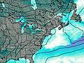
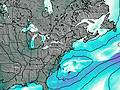
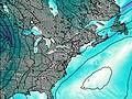
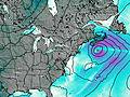
Days 1–4 Weather SummaryModerate rain (total 17mm), heaviest on Sun night. Very mild (max 18°C on Tue afternoon, min 9°C on Sun night). Winds increasing (light winds from the W on Mon morning, near gales from the W by Tue night). | Days 5–7 Weather SummaryModerate rain (total 18mm) heaviest on Wed night, then becoming colder with a dusting of snow on Fri night. Freeze-thaw conditions (max 12°C on Wed night, min 0°C on Fri night). Winds decreasing (strong winds from the WSW on Fri morning, light winds from the N by Fri night). | ||||||||||||||||||
Monday 25 | Tuesday 26 | Wednesday 27 | Thursday 28 | Friday 29 | Saturday 30 | ||||||||||||||
night | AM | PM | night | AM | PM | night | AM | PM | night | AM | PM | night | AM | PM | night | AM | PM | night | |
mod. rain | mod. rain | cloudy | clear | clear | clear | rain shwrs | rain shwrs | rain shwrs | rain shwrs | light rain | light rain | rain shwrs | light rain | rain shwrs | light snow | light rain | light rain | rain shwrs | |
km/h | |||||||||||||||||||
 |  |  |  |  |  |  | |||||||||||||
— | — | — | — | — | — | — | — | — | — | — | — | — | — | — | 1 | — | — | — | |
8 | 6 | — | — | — | — | 0.6 | 0.3 | 1.8 | 8 | 3 | 0.7 | 0.1 | 2 | 3 | — | 0.2 | 0.6 | 0.4 | |
max °C | 10 | 11 | 11 | 11 | 16 | 18 | 16 | 14 | 13 | 12 | 6 | 10 | 8 | 9 | 5 | 2 | 3 | 4 | 4 |
min °C | 9 | 10 | 11 | 11 | 14 | 18 | 13 | 13 | 13 | 8 | 6 | 9 | 7 | 6 | 4 | 0 | 1 | 3 | 2 |
5 | 8 | 8 | 8 | 12 | 17 | 10 | 11 | 11 | 4 | 2 | 6 | 4 | 0 | -2 | -6 | -5 | -2 | -3 | |
3400 | 3350 | 3450 | 3450 | 3300 | 3550 | 3550 | 3350 | 3000 | 2550 | 2100 | 2700 | 2350 | 1850 | 1450 | 1100 | 1400 | 1450 | 1450 | |
Cloud base (m) | 500 | 500 | 500 | 5650 | 5150 | 700 | 600 | 2400 | 800 | 450 | 1500 | 2050 | 750 | 450 | 500 | 450 | 450 | 800 | |
— | 5:18 | — | — | 5:16 | — | — | 5:16 | — | — | 5:16 | — | — | 5:15 | — | — | 5:15 | — | — | |
— | — | — | 8:25 | — | — | 8:27 | — | — | 8:28 | — | — | 8:29 | — | — | 8:30 | — | — | 8:30 | |
Loading...
Whiteface Mountain Ski Center Weather (Days 0-3):
The weather forecast for Whiteface Mountain Ski Center is: Moderate rain (total 17mm), heaviest on Sun night. Very mild (max 18°C on Tue afternoon, min 9°C on Sun night). Winds increasing (light winds from the W on Mon morning, near gales from the W by Tue night).
Whiteface Mountain Ski Center Weather (Days 3-6):
Moderate rain (total 18mm) heaviest on Wed night, then becoming colder with a dusting of snow on Fri night. Freeze-thaw conditions (max 12°C on Wed night, min 0°C on Fri night). Winds decreasing (strong winds from the WSW on Fri morning, light winds from the N by Fri night).
This table gives the weather forecast for Whiteface Mountain Ski Center at the specific elevation of 926 m. Our advanced weather models allow us to provide distinct weather forecasts for several elevations of Whiteface Mountain Ski Center. To see the weather forecasts for the other elevations, use the tab navigation above the table. For a wider overview of the weather, consult the Weather Map of New-York.
| Weather Station | Temp. | Weather | Wind | Gusts | Cloud / Visibility |
|---|---|---|---|---|---|
Saranac Lake Airport | |||||
Plattsburgh Air Force Base Airport | |||||
* NOTE: not all weather observatories update at the same frequency which is the reason why some locations may show data from stations that are further away than known closer ones.