
– Lat/Long: 48.47° N 68.21° W
 Parc du Mont-Comi (Parc Du Mont-Comi) Bike Park
Weather Forecast, CanadaIssued: 7 pm Sun 24 May Local TimeUpdates in: hr min sUpdate imminent
Issued: 7 pm Sun 24 May Local Time
Updates in:
Update imminent hr min s

Issued: 7 pm Sun 24 May Local Time
Updates in:
Update imminent hr min s
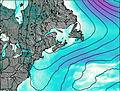
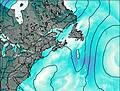
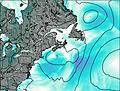
Days 1–4 Weather SummaryHeavy rain (total 33mm), heaviest during Tue afternoon. Very mild (max 14°C on Sun night, min 7°C on Sun night). Mainly fresh winds. | Days 5–7 Weather SummaryLight rain (total 4mm), mostly falling on Thu morning. Mild temperatures (max 8°C on Wed night, min 2°C on Thu night). Winds increasing (calm on Thu night, fresh winds from the NE by Sat afternoon). | ||||||||||||||||||
Monday 25 | Tuesday 26 | Wednesday 27 | Thursday 28 | Friday 29 | Saturday 30 | ||||||||||||||
night | AM | PM | night | AM | PM | night | AM | PM | night | AM | PM | night | AM | PM | night | AM | PM | night | |
light rain | mod. rain | mod. rain | rain shwrs | some clouds | mod. rain | light rain | light rain | rain shwrs | rain shwrs | light rain | light rain | rain shwrs | light rain | light rain | light rain | light rain | rain shwrs | some clouds | |
km/h | |||||||||||||||||||
 |  |  |  |  |  |  | |||||||||||||
— | — | — | — | — | — | — | — | — | — | — | — | — | — | — | — | — | — | — | |
2 | 7 | 10 | 1.3 | — | 7 | 4 | 0.6 | 0.6 | 0.3 | 1 | 0.3 | 0.8 | 0.3 | 0.5 | 0.3 | 0.2 | 0.2 | — | |
max °C | 14 | 8 | 8 | 8 | 13 | 14 | 11 | 8 | 11 | 8 | 7 | 3 | 2 | 2 | 4 | 4 | 4 | 5 | 4 |
min °C | 7 | 7 | 8 | 7 | 10 | 11 | 8 | 8 | 10 | 6 | 5 | 3 | 2 | 2 | 3 | 2 | 4 | 5 | 3 |
3 | 3 | 5 | 4 | 8 | 8 | 6 | 6 | 8 | 4 | 1 | -2 | -3 | -1 | -2 | -3 | -1 | 0 | 3 | |
2650 | 2800 | 2500 | 2250 | 2650 | 2850 | 2700 | 2300 | 2200 | 1950 | 1450 | 1100 | 950 | 950 | 1150 | 1050 | 1150 | 1250 | 1700 | |
Cloud base (m) | 2450 | 150 | 150 | 150 | 650 | 250 | 200 | 200 | 600 | 500 | 150 | 150 | 150 | 150 | 150 | 550 | 300 | 750 | 4050 |
— | 4:39 | — | — | 4:39 | — | — | 4:39 | — | — | 4:37 | — | — | 4:37 | — | — | 4:35 | — | — | |
— | — | — | 8:19 | — | — | 8:20 | — | — | 8:21 | — | — | 8:22 | — | — | 8:22 | — | — | 8:23 | |
Loading...
Parc du Mont-Comi Weather (Days 0-3):
The weather forecast for Parc du Mont-Comi is: Heavy rain (total 33mm), heaviest during Tue afternoon. Very mild (max 14°C on Sun night, min 7°C on Sun night). Mainly fresh winds.
Parc du Mont-Comi Weather (Days 3-6):
Light rain (total 4mm), mostly falling on Thu morning. Mild temperatures (max 8°C on Wed night, min 2°C on Thu night). Winds increasing (calm on Thu night, fresh winds from the NE by Sat afternoon).
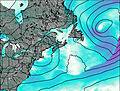
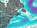
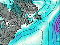
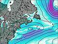
This table gives the weather forecast for Parc du Mont-Comi at the specific elevation of 574 m. Our advanced weather models allow us to provide distinct weather forecasts for several elevations of Parc du Mont-Comi. To see the weather forecasts for the other elevations, use the tab navigation above the table. For a wider overview of the weather, consult the Weather Map of New-Brunswick.
| Weather Station | Temp. | Weather | Wind | Gusts | Cloud / Visibility |
|---|---|---|---|---|---|
Mont-JoliA- Que | |||||
Pointe -AU -Pere (Inrs)- Que | |||||
Ile Bicquette- Que | |||||
Baie Comeau Airport | |||||
Baie-Comeau-Que (71691 -0) | |||||
Baie-Comeau-Que (71829 -0) | |||||
Ile Rouge Airport | |||||
IleRouge-Que |
* NOTE: not all weather observatories update at the same frequency which is the reason why some locations may show data from stations that are further away than known closer ones.