
– Lat/Long: 82.02° N 74.53° W
 Mount Whisler
Weather Forecast, CanadaIssued: 7 pm Thu 04 Dec Local TimeUpdates in: hr min sUpdate imminent
Issued: 7 pm Thu 04 Dec Local Time
Updates in:
Update imminent hr min s

Issued: 7 pm Thu 04 Dec Local Time
Updates in:
Update imminent hr min s
Days 1–4 Weather SummaryMostly dry. Extremely cold (max -20°C on Sun morning, min -28°C on Thu night). Wind will be generally light. | Days 5–7 Weather SummaryMostly dry. Extremely cold (max -16°C on Tue night, min -21°C on Mon afternoon). Winds increasing (light winds from the S on Sun night, fresh winds from the WSW by Wed morning). | ||||||||||||||||||
Friday 5 | Saturday 6 | Sunday 7 | Monday 8 | Tuesday 9 | Wednesday 10 | ||||||||||||||
night | AM | PM | night | AM | PM | night | AM | PM | night | AM | PM | night | AM | PM | night | AM | PM | night | |
clear | clear | clear | clear | clear | clear | clear | clear | clear | clear | some clouds | clear | clear | cloudy | some clouds | some clouds | some clouds | clear | clear | |
km/h | |||||||||||||||||||
 |  |  |  |  |  |  | |||||||||||||
— | — | — | — | — | — | — | — | — | — | — | — | — | — | — | — | — | — | — | |
— | — | — | — | — | — | — | — | — | — | — | — | — | — | — | — | — | — | — | |
max°C | -28 | -27 | -26 | -26 | -27 | -24 | -21 | -20 | -20 | -20 | -20 | -20 | -19 | -18 | -17 | -16 | -16 | -16 | -16 |
min°C | -28 | -28 | -27 | -28 | -27 | -26 | -23 | -20 | -20 | -20 | -20 | -21 | -20 | -18 | -18 | -18 | -16 | -16 | -17 |
-28 | -37 | -40 | -35 | -27 | -37 | -35 | -20 | -24 | -26 | -28 | -30 | -30 | -26 | -26 | -27 | -27 | -27 | -17 | |
0 | 0 | 0 | 0 | 0 | 0 | 0 | 0 | 0 | 0 | 0 | 0 | 0 | 0 | 0 | 0 | 0 | 0 | 0 | |
Cloud base (m) | 3700 | 5450 | 2000 | 4650 | 4300 | 4250 | 2950 | 4750 | 5100 | 5500 | 7800 | 8400 | |||||||
— | 12:00 | — | — | 12:00 | — | — | 12:00 | — | — | 12:00 | — | — | 12:00 | — | — | 12:00 | — | — | |
— | 12:00 | — | — | 12:00 | — | — | 12:00 | — | — | 12:00 | — | — | 12:00 | — | — | 12:00 | — | — | |
Loading...
Mount Whisler Weather (Days 0-3):
The weather forecast for Mount Whisler is: Mostly dry. Extremely cold (max -20°C on Sun morning, min -28°C on Thu night). Wind will be generally light.
Mount Whisler Weather (Days 3-6):
Mostly dry. Extremely cold (max -16°C on Tue night, min -21°C on Mon afternoon). Winds increasing (light winds from the S on Sun night, fresh winds from the WSW by Wed morning).
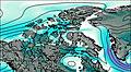
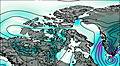
This table gives the weather forecast for Mount Whisler at the specific elevation of 2500 m. Our advanced weather models allow us to provide distinct weather forecasts for several elevations of Mount Whisler. To see the weather forecasts for the other elevations, use the tab navigation above the table. For a wider overview of the weather, consult the Weather Map of Nunavut.
| Weather Station | Temp. | Weather | Wind | Gusts | Cloud / Visibility |
|---|---|---|---|---|---|
Alert | |||||
Svartevaeg- NU | |||||
Eureka Airport | |||||
Eureka Climate | |||||
MittarfikQaanaaq | |||||
Kap Morris Jesup | |||||
Thule Air Base Airport | |||||
Grise Fiord Climate- NU |
* NOTE: not all weather observatories update at the same frequency which is the reason why some locations may show data from stations that are further away than known closer ones.