
– Lat/Long: 61.28° N 147.22° W
 Mount Michelson (Chugach Mountains)
Weather Forecast, United StatesIssued: 9 am Wed 01 May Local TimeUpdates in: hr min sUpdate imminent
Mount Michelson (Chugach Mountains)Weather Forecast, United States
Issued: 9 am Wed 01 May Local Time
Updates in:
Update imminent hr min s

Issued: 9 am Wed 01 May Local Time
Updates in:
Update imminent hr min s
Days 1–3 Weather SummaryA heavy fall of snow, heaviest during Fri night. Temperatures will be well below freezing (max -9°C on Fri morning, min -12°C on Wed afternoon). Winds increasing (light winds from the SSW on Wed morning, near gales from the SSE by Fri afternoon). | Days 4–6 Weather SummaryA heavy fall of snow, heaviest during Sat morning. Temperatures will be well below freezing (max -9°C on Sun afternoon, min -13°C on Mon afternoon). Winds decreasing (strong winds from the SSE on Sat morning, calm by Sun night). | Days 7–9 Weather SummaryA heavy fall of snow, heaviest during Thu night. Extremely cold (max -12°C on Tue afternoon, min -15°C on Wed night). Winds increasing (light winds from the S on Tue night, strong winds from the SE by Thu afternoon). | Days 10–12 Weather SummaryA heavy fall of snow, heaviest during Fri morning. Extremely cold (max -12°C on Sun morning, min -15°C on Fri night). Wind will be generally light. | |||||||||||||||||||||||||||||||||
Wednesday 1 | Thursday 2 | Friday 3 | Saturday 4 | Sunday 5 | Monday 6 | Tuesday 7 | Wednesday 8 | Thursday 9 | Friday 10 | Saturday 11 | Sunday 12 | |||||||||||||||||||||||||
AM | PM | night | AM | PM | night | AM | PM | night | AM | PM | night | AM | PM | night | AM | PM | night | AM | PM | night | AM | PM | night | AM | PM | night | AM | PM | night | AM | PM | night | AM | PM | night | |
light snow | cloudy | light snow | light snow | light snow | cloudy | mod. snow | mod. snow | heavy snow | heavy snow | mod. snow | mod. snow | cloudy | cloudy | heavy snow | mod. snow | mod. snow | mod. snow | mod. snow | heavy snow | heavy snow | light snow | light snow | light snow | light snow | light snow | heavy snow | heavy snow | light snow | snow shwrs | some clouds | some clouds | some clouds | clear | clear | some clouds | |
km/h | ||||||||||||||||||||||||||||||||||||
Wave Height Map | 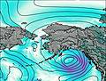 | 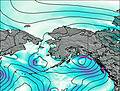 | 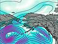 | 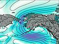 | 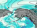 | 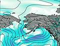 | 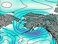 | 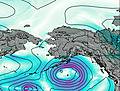 | 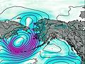 | 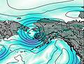 | 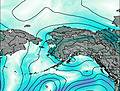 | 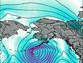 | ||||||||||||||||||||||||
2.0 | — | 1.0 | 2.0 | 1.0 | — | 6 | 10 | 35 | 14 | 9 | 9 | — | — | 11 | 9 | 6 | 6 | 9 | 13 | 14 | 3 | 4 | 4 | 5 | 3 | 32 | 14 | 5 | 1.0 | — | — | — | — | — | — | |
— | — | — | — | — | — | — | — | — | — | — | — | — | — | — | — | — | — | — | — | — | — | — | — | — | — | — | — | — | — | — | — | — | — | — | — | |
max°C | -11 | -11 | -11 | -11 | -11 | -10 | -9 | -10 | -10 | -10 | -11 | -11 | -11 | -9 | -10 | -12 | -12 | -12 | -13 | -12 | -13 | -13 | -14 | -14 | -13 | -12 | -12 | -14 | -14 | -15 | -15 | -14 | -13 | -12 | -12 | -12 |
min°C | -11 | -12 | -12 | -11 | -11 | -11 | -10 | -10 | -11 | -10 | -11 | -12 | -11 | -10 | -12 | -12 | -13 | -13 | -13 | -13 | -13 | -14 | -14 | -15 | -13 | -13 | -15 | -14 | -14 | -15 | -15 | -14 | -13 | -12 | -12 | -13 |
-18 | -20 | -20 | -20 | -19 | -20 | -18 | -20 | -22 | -21 | -22 | -20 | -18 | -13 | -17 | -18 | -18 | -18 | -20 | -21 | -20 | -22 | -22 | -25 | -24 | -21 | -26 | -22 | -18 | -19 | -20 | -18 | -19 | -12 | -12 | -19 | |
800 | 850 | 550 | 900 | 1150 | 1150 | 1100 | 1250 | 1000 | 1000 | 900 | 800 | 1000 | 1100 | 900 | 800 | 850 | 600 | 750 | 850 | 700 | 700 | 700 | 500 | 700 | 850 | 700 | 600 | 600 | 0 | 450 | 650 | 200 | 850 | 900 | 250 | |
Cloud base (m) | 900 | 900 | 1550 | 1500 | 900 | 1900 | 1650 | 850 | 1350 | 1350 | 1350 | 1350 | 1350 | 1450 | 1400 | 1400 | 1350 | 850 | 850 | 850 | 900 | 900 | 900 | 900 | 850 | 850 | 900 | 900 | 900 | 900 | 900 | 1500 | 2400 | 900 | 900 | |
5:37 | — | — | 5:33 | — | — | 5:31 | — | — | 5:28 | — | — | 5:26 | — | — | 5:22 | — | — | 5:20 | — | — | 5:16 | — | — | 5:13 | — | — | 5:11 | — | — | 5:09 | — | — | 5:07 | — | — | |
— | 9:55 | — | — | 9:58 | — | — | — | 10:00 | — | — | 10:04 | — | — | 10:06 | — | — | 10:08 | — | — | 10:12 | — | — | 10:14 | — | — | 10:16 | — | — | 10:20 | — | — | 10:22 | — | — | 10:24 | |
Mount Michelson (Chugach Mountains) Weather (Days 0-3):
The weather forecast for Mount Michelson (Chugach Mountains) is: A heavy fall of snow, heaviest during Fri night. Temperatures will be well below freezing (max -9°C on Fri morning, min -12°C on Wed afternoon). Winds increasing (light winds from the SSW on Wed morning, near gales from the SSE by Fri afternoon).
Mount Michelson (Chugach Mountains) Weather (Days 3-6):
A heavy fall of snow, heaviest during Sat morning. Temperatures will be well below freezing (max -9°C on Sun afternoon, min -13°C on Mon afternoon). Winds decreasing (strong winds from the SSE on Sat morning, calm by Sun night).
Mount Michelson (Chugach Mountains) Weather (Days 6-9):
A heavy fall of snow, heaviest during Thu night. Extremely cold (max -12°C on Tue afternoon, min -15°C on Wed night). Winds increasing (light winds from the S on Tue night, strong winds from the SE by Thu afternoon).
This table gives the weather forecast for Mount Michelson (Chugach Mountains) at the specific elevation of 2652 m. Our advanced weather models allow us to provide distinct weather forecasts for several elevations of Mount Michelson (Chugach Mountains). To see the weather forecasts for the other elevations, use the tab navigation above the table. For a wider overview of the weather, consult the Weather Map of Alaska United States.
 Like us
 Follow us
