
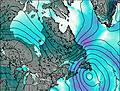
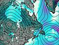
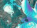
– Lat/Long: 47.09° N 70.92° W
 Mont-Sainte-Anne DH Park
Weather Forecast, CanadaIssued: 7 pm Sun 24 May Local TimeUpdates in: hr min sUpdate imminent
Issued: 7 pm Sun 24 May Local Time
Updates in:
Update imminent hr min s

Issued: 7 pm Sun 24 May Local Time
Updates in:
Update imminent hr min s
Days 1–4 Weather SummaryHeavy rain (total 26mm), heaviest during Tue afternoon. Very mild (max 18°C on Wed afternoon, min 8°C on Sun night). Winds increasing (calm on Mon morning, fresh winds from the WSW by Tue afternoon). | Days 5–7 Weather SummaryModerate rain (total 18mm), heaviest on Fri night. Very mild (max 15°C on Wed night, min 6°C on Fri night). Winds increasing (calm on Thu night, fresh winds from the ENE by Fri night). | ||||||||||||||||||
Monday 25 | Tuesday 26 | Wednesday 27 | Thursday 28 | Friday 29 | Saturday 30 | ||||||||||||||
night | AM | PM | night | AM | PM | night | AM | PM | night | AM | PM | night | AM | PM | night | AM | PM | night | |
light rain | mod. rain | rain shwrs | some clouds | some clouds | rain shwrs | rain shwrs | some clouds | rain shwrs | some clouds | some clouds | rain shwrs | light rain | light rain | light rain | heavy rain | some clouds | rain shwrs | clear | |
km/h | |||||||||||||||||||
 |  |  |  |  |  |  | |||||||||||||
— | — | — | — | — | — | — | — | — | — | — | — | — | — | — | — | — | — | — | |
1.7 | 7 | 3 | — | — | 12 | 1.4 | — | 0.3 | — | — | 0.2 | 1.9 | 0.3 | 2 | 13 | — | 0.4 | — | |
max °C | 12 | 9 | 11 | 11 | 16 | 17 | 17 | 17 | 18 | 15 | 12 | 14 | 11 | 7 | 8 | 7 | 8 | 9 | 9 |
min °C | 8 | 9 | 10 | 10 | 13 | 16 | 12 | 14 | 18 | 9 | 12 | 13 | 8 | 7 | 7 | 6 | 7 | 9 | 5 |
8 | 9 | 10 | 8 | 12 | 14 | 11 | 13 | 18 | 8 | 12 | 11 | 8 | 4 | 3 | 1 | 2 | 5 | 3 | |
3200 | 2850 | 2900 | 2900 | 2900 | 3100 | 3200 | 2400 | 2450 | 2100 | 1850 | 2050 | 1650 | 1500 | 1450 | 1200 | 1150 | 1300 | 1500 | |
Cloud base (m) | 500 | 200 | 200 | 450 | 350 | 500 | 1800 | 1900 | 2100 | 800 | 1600 | 300 | 300 | 150 | 200 | 550 | 750 | 900 | |
— | 4:56 | — | — | 4:56 | — | — | 4:54 | — | — | 4:54 | — | — | 4:54 | — | — | 4:52 | — | — | |
— | — | — | 8:23 | — | — | 8:24 | — | — | 8:25 | — | — | 8:27 | — | — | 8:28 | — | — | 8:29 | |
Loading...
Mont-Sainte-Anne DH Park Weather (Days 0-3):
The weather forecast for Mont-Sainte-Anne DH Park is: Heavy rain (total 26mm), heaviest during Tue afternoon. Very mild (max 18°C on Wed afternoon, min 8°C on Sun night). Winds increasing (calm on Mon morning, fresh winds from the WSW by Tue afternoon).
Mont-Sainte-Anne DH Park Weather (Days 3-6):
Moderate rain (total 18mm), heaviest on Fri night. Very mild (max 15°C on Wed night, min 6°C on Fri night). Winds increasing (calm on Thu night, fresh winds from the ENE by Fri night).
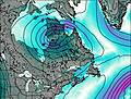
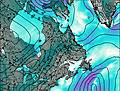
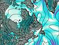
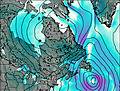
This table gives the weather forecast for Mont-Sainte-Anne DH Park at the specific elevation of 182 m. Our advanced weather models allow us to provide distinct weather forecasts for several elevations of Mont-Sainte-Anne DH Park. To see the weather forecasts for the other elevations, use the tab navigation above the table. For a wider overview of the weather, consult the Weather Map of Quebec.
| Weather Station | Temp. | Weather | Wind | Gusts | Cloud / Visibility |
|---|---|---|---|---|---|
Fort Maginnis (Grass Range) (Montana) | |||||
Cap-Tourmente-Que | |||||
Ile D orleans- Que | |||||
Ice Aux Grues Airport | |||||
Charlevoix Airport | |||||
Charlevoix(Mrc)-Que | |||||
Foret Montmorenc Airport |
* NOTE: not all weather observatories update at the same frequency which is the reason why some locations may show data from stations that are further away than known closer ones.