
– Lat/Long: 11.45° N 85.52° W
 Maderas
Weather Forecast, NicaraguaIssued: 5 am Mon 03 Aug Local TimeUpdates in: hr min sUpdate imminent
Issued: 5 am Mon 03 Aug Local Time
Updates in:
Update imminent hr min s

Issued: 5 am Mon 03 Aug Local Time
Updates in:
Update imminent hr min s
Days 1–3 Weather SummaryHeavy rain (total 46mm), heaviest during Wed night. Warm (max 20°C on Mon afternoon, min 18°C on Mon night). Mainly near gales. | Days 4–6 Weather SummaryHeavy rain (total 27mm), heaviest during Thu afternoon. Very mild (max 19°C on Thu morning, min 17°C on Thu night). Mainly near gales. | |||||||||||||||||
Monday 3 | Tuesday 4 | Wednesday 5 | Thursday 6 | Friday 7 | Saturday 8 | |||||||||||||
AM | PM | night | AM | PM | night | AM | PM | night | AM | PM | night | AM | PM | night | AM | PM | night | |
rain shwrs | risk tstorm | risk tstorm | risk tstorm | risk tstorm | risk tstorm | risk tstorm | risk tstorm | risk tstorm | risk tstorm | mod. rain | risk tstorm | risk tstorm | risk tstorm | risk tstorm | risk tstorm | risk tstorm | light rain | |
Cloud base (m) | 300 | 4900 | 5200 | 1600 | 6750 | 550 | 4950 | 400 | 900 | 300 | 650 | 600 | 500 | 350 | 250 | 200 | ||
km/h | ||||||||||||||||||
 |  |  |  |  |  | |||||||||||||
— | — | — | — | — | — | — | — | — | — | — | — | — | — | — | — | — | — | |
mm | 0.1 | 5 | 3 | 0.4 | 0.7 | 14 | 4 | 3 | 16 | 4 | 8 | 5 | 3 | 0.8 | 0.7 | 0.8 | 1.8 | 1.2 |
max °C | 19 | 20 | 19 | 19 | 20 | 19 | 19 | 19 | 19 | 19 | 18 | 17 | 18 | 18 | 18 | 18 | 17 | 17 |
min °C | 19 | 19 | 18 | 18 | 19 | 18 | 18 | 19 | 18 | 18 | 18 | 17 | 17 | 18 | 17 | 17 | 17 | 17 |
chill °C | 18 | 18 | 16 | 16 | 18 | 17 | 16 | 18 | 16 | 16 | 16 | 15 | 15 | 17 | 16 | 15 | 15 | 15 |
Freezing level m | 5000 | 5050 | 5150 | 5100 | 5050 | 4950 | 4950 | 5000 | 4900 | 4950 | 4850 | 4850 | 4850 | 5000 | 5000 | 4950 | 4850 | 4950 |
5:30 | — | — | 5:30 | — | — | 5:30 | — | — | 5:30 | — | — | 5:30 | — | — | 5:30 | — | — | |
— | 6:06 | — | — | 6:05 | — | — | 6:05 | — | — | 6:05 | — | — | 6:04 | — | — | 6:04 | — | |
Loading...
Maderas Weather (Days 0-3):
The weather forecast for Maderas is: Heavy rain (total 46mm), heaviest during Wed night. Warm (max 20°C on Mon afternoon, min 18°C on Mon night). Mainly near gales.
Maderas Weather (Days 3-6):
Heavy rain (total 27mm), heaviest during Thu afternoon. Very mild (max 19°C on Thu morning, min 17°C on Thu night). Mainly near gales.
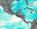
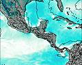
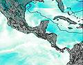
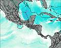
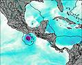
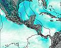
This table gives the weather forecast for Maderas at the specific elevation of 1394 m. Our advanced weather models allow us to provide distinct weather forecasts for several elevations of Maderas. To see the weather forecasts for the other elevations, use the tab navigation above the table. For a wider overview of the weather, consult the Weather Map of Nicaragua.
| Weather Station | Temp. | Weather | Wind | Gusts | Cloud / Visibility |
|---|---|---|---|---|---|
Liberi / omas Guardia Airport | |||||
Bluefields Airport | |||||
Tobias Bolano Airport | |||||
* NOTE: not all weather observatories update at the same frequency which is the reason why some locations may show data from stations that are further away than known closer ones.