
– Lat/Long: 46.60° N 90.09° W
 Copper Peak Bike Park
Weather Forecast, United StatesIssued: 7 am Fri 03 Apr Local TimeUpdates in: hr min sUpdate imminent
Issued: 7 am Fri 03 Apr Local Time
Updates in:
Update imminent hr min s

Issued: 7 am Fri 03 Apr Local Time
Updates in:
Update imminent hr min s
Days 1–3 Weather SummaryA light covering of new snow mostly falling on Fri night. Freeze-thaw conditions (max 2°C on Sat morning, min -2°C on Fri morning). Mainly fresh winds. | Days 4–6 Weather SummaryA dusting of snow on Mon morning. Freezing level rising with drizzle on Wed night. Freeze-thaw conditions (max 9°C on Wed night, min -11°C on Tue morning). Winds increasing (light winds from the WNW on Mon night, strong winds from the SW by Wed night). | |||||||||||||||||
Friday 3 | Saturday 4 | Sunday 5 | Monday 6 | Tuesday 7 | Wednesday 8 | |||||||||||||
AM | PM | night | AM | PM | night | AM | PM | night | AM | PM | night | AM | PM | night | AM | PM | night | |
cloudy | cloudy | light snow | light snow | cloudy | light snow | cloudy | cloudy | cloudy | light snow | light snow | cloudy | some clouds | cloudy | cloudy | cloudy | light rain | rain shwrs | |
km/h | ||||||||||||||||||
 |  |  |  |  |  | |||||||||||||
— | — | 4 | 1 | — | 3 | — | — | — | 3 | 1 | — | — | — | — | — | — | — | |
— | — | — | — | — | — | — | — | — | — | — | — | — | — | — | — | 0.1 | 1.6 | |
max °C | -2 | 0 | 1 | 2 | 1 | -1 | -2 | 0 | 1 | -4 | -6 | -6 | -5 | 0 | 0 | 4 | 8 | 9 |
min °C | -2 | -1 | -1 | 1 | 1 | -2 | -2 | -1 | -2 | -6 | -6 | -10 | -11 | -2 | -1 | 2 | 5 | 2 |
-8 | -6 | -6 | -2 | -1 | -9 | -8 | -7 | -9 | -14 | -14 | -14 | -17 | -6 | -5 | -5 | -1 | -5 | |
0 | 200 | 0 | 600 | 500 | 0 | 0 | 350 | 300 | 0 | 0 | 0 | 0 | 250 | 200 | 2550 | 2500 | 850 | |
Cloud base (m) | 350 | 350 | 500 | 300 | 300 | 300 | 350 | 350 | 350 | 350 | 500 | 600 | 350 | 550 | 2150 | 400 | 250 | 600 |
7:35 | — | — | 7:33 | — | — | 7:31 | — | — | 7:28 | — | — | 7:26 | — | — | 7:24 | — | — | |
— | — | 8:31 | — | — | 8:32 | — | — | 8:35 | — | — | 8:36 | — | — | 8:37 | — | — | 8:38 | |
Loading...
Copper Peak Weather (Days 0-3):
The weather forecast for Copper Peak is: A light covering of new snow mostly falling on Fri night. Freeze-thaw conditions (max 2°C on Sat morning, min -2°C on Fri morning). Mainly fresh winds.
Copper Peak Weather (Days 3-6):
A dusting of snow on Mon morning. Freezing level rising with drizzle on Wed night. Freeze-thaw conditions (max 9°C on Wed night, min -11°C on Tue morning). Winds increasing (light winds from the WNW on Mon night, strong winds from the SW by Wed night).
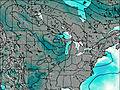
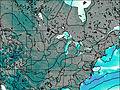
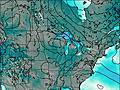
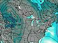
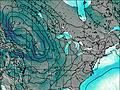
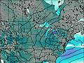
This table gives the weather forecast for Copper Peak at the specific elevation of 317 m. Our advanced weather models allow us to provide distinct weather forecasts for several elevations of Copper Peak. To see the weather forecasts for the other elevations, use the tab navigation above the table. For a wider overview of the weather, consult the Weather Map of Michigan.
| Weather Station | Temp. | Weather | Wind | Gusts | Cloud / Visibility |
|---|---|---|---|---|---|
BUOY-SXHW3 | |||||
Manitowish Water Airport | |||||
* NOTE: not all weather observatories update at the same frequency which is the reason why some locations may show data from stations that are further away than known closer ones.