This was a two day hiking trip with the first day to the top of Mount Hachimantai (八幡平) and overnight in the nearby Toshichi Onsen (藤七温泉) and the next day is the trip down. The hiking time in each day was just 5-6 hours (we are average speed hikers) as we prefer relaxed hiking and also want to be more conservative in places where we are not familiar with. Fast hikers could probably finish the entire route in one day.
Date: July 27-28, 2019 (Sat & Sun)
Weather: mostly cloudy with drizzles
Temperature: mostly in the low to mid 20s
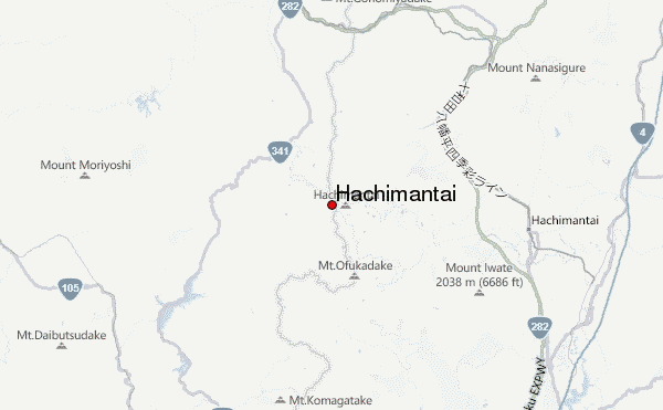
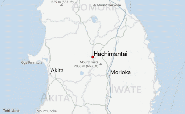
Starting point: Appi Kogen (安比高原)
Finishing point: Matsukawa Onsen (松川温泉)
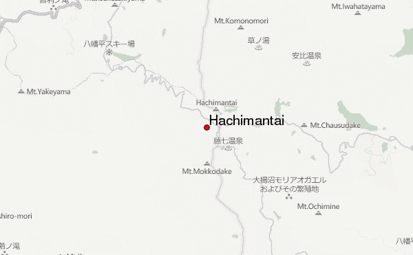
Day 1 – Appi Kogen -> Hachimantai peak -> Toshichi Onsen
We arrived Appi Kogen Ski Resort (630m) at 08:20, where the gondola brough us to near the top of Mount Maemori (前森山, 1,300m). We start our hike from the upper gondola station at 08:45.
The first part of going down Mount Maemori to about 1150m and then up Mount Nishimori (西森山, 1328m) was actually the most challenging part as the slopes are steep and the trail is rough. The trail is also not obvious but luckily it was well marked with pink ribbons tied on to the trees. Nevertheless, the hike is safe as long as you pay proper attention. This part lasted about 1 hour and the trail then turned easier and easier as it goes, and became even family friendly.
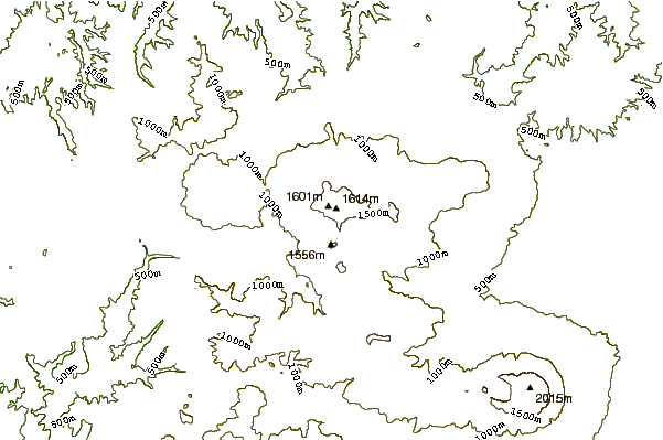
We arrived the resting hut that is just 5 minute from the peak of Chausudake (茶臼岳, 1,578m) at 11:45 and take our 20min lunch break. If you are injured or already exhausted, a bus stop is just 45 minute away (make sure you know the bus schedule before going). After a brief side trip to Chaususake, we continued our hike towards Mount Hachimantai (1,613m) and arrived the peak at 14:15. It was another 15 minutes from the peak to the visitor center where food and buses are available (buses are seasonal and infrequent, so make sure you check the schedule before if you intend to use it). Toshichi Onsen was another 2km away at 1400m.
Do note the followings:
1) The route from Mount Maemori to the resting hut was just opened in 2016. I was unable to find any detailed maps (physical or digital) and has to rely on GPX data downloaded from Japanese hiking websites.
2) We met no other hikers (it was Saturday!) until we reached the resting hut. If anything goes wrong, you are most likely on your own.
3) Mobile phone signal was good in the first 2 hours, but became unstable afterward.
4) Some signs are in Japanese only
Day 2 – Toshichi Onsen -> Matsukawa Onsen
We started our hike to Matsukawa at 07:45. The initial part was a slow ascend to Morobidake (諸桧岳, 1,516m) and we arrived at around 08:30. The trail then turned into mostly mild ups and downs for about 2.5 hours until the sharp descend that started at around 11:00. We reached Matsukawa Onsen (860m) at around 12:30.
The trail on the second day was also very safe with just a couple of tricky points that need more attention.
Access Information:
There is a train station at Appi Kogen and is connected to the major Shinkansen station Morioka (盛岡). The train ride from Morioka to Appi Kogen was about 1.5 hours and was very infrequent. There are a number of hotels and B&B to choose at Appi Kogen. The schedule of the gondola going up Mount Maemori was very seasonal and did not operate daily until end of July.
The hotel at Toshichi Onsen was primitive compare to those in the city and most rooms do not have toilet. There is no Wifi and mobile phone reception is poor.
There are 3 daily buses that run from Matsukawa Onsen to Morioka, leaving at 09:45, 14:45, and 16:20 and takes about 1h45m. Matsukawa Onsen also had a few hotels.
 Hachimantai – Climbing, Hiking & Mountaineering information
 Like us
 Follow us
