– Lat/Long: 56.80° N 5.00° W
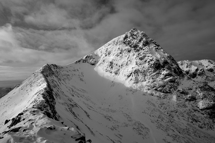
 Ben Nevis
Weather Forecast, United KingdomIssued: 6 am Sat 27 Apr Local TimeUpdates in: hr min sUpdate imminent
Ben NevisWeather Forecast, United Kingdom
Issued: 6 am Sat 27 Apr Local Time
Updates in:
Update imminent hr min s

Issued: 6 am Sat 27 Apr Local Time
Updates in:
Update imminent hr min s
Days 1–3 Weather SummaryA moderate fall of snow, heaviest on Mon afternoon. Freeze-thaw conditions (max 1°C on Mon night, min -4°C on Sat morning). Winds increasing (calm on Sat night, near gales from the SSE by Mon afternoon). | Days 4–6 Weather SummaryLight rain (total 7mm), mostly falling on Tue afternoon. Freeze-thaw conditions (max 8°C on Thu morning, min 0°C on Tue morning). Winds increasing (moderate winds from the ESE on Wed afternoon, gales from the ESE by Thu night). | |||||||||||||||||
Saturday 27 | Sunday 28 | Monday 29 | Tuesday 30 | Wednesday 1 | Thursday 2 | |||||||||||||
AM | PM | night | AM | PM | night | AM | PM | night | AM | PM | night | AM | PM | night | AM | PM | night | |
light snow | light snow | snow shwrs | cloudy | some clouds | some clouds | snow shwrs | light snow | light snow | cloudy | light rain | light rain | light rain | rain shwrs | some clouds | some clouds | some clouds | clear | |
km/h | ||||||||||||||||||
Wave Height Map |  |  |  |  |  |  | ||||||||||||
1.0 | 2.0 | 2.0 | — | — | — | 1.0 | 3 | 4 | — | — | — | — | — | — | — | — | — | |
— | — | — | — | — | — | — | — | — | — | 4 | 3 | 0.2 | 0.2 | — | — | — | — | |
max°C | -3 | -2 | -3 | -3 | -2 | -3 | -1 | 0 | 1 | 1 | 3 | 3 | 4 | 5 | 6 | 8 | 8 | 8 |
min°C | -4 | -2 | -3 | -3 | -2 | -3 | -3 | -1 | 0 | 0 | 2 | 2 | 3 | 5 | 6 | 7 | 7 | 8 |
-8 | -5 | -3 | -8 | -7 | -10 | -10 | -9 | -5 | -6 | -6 | -6 | -4 | 1 | 1 | 2 | 2 | 2 | |
900 | 1100 | 900 | 900 | 1100 | 800 | 1000 | 1250 | 1500 | 1350 | 1800 | 1800 | 1850 | 2200 | 2450 | 3000 | 3250 | 3350 | |
Cloud base (m) | 1600 | 800 | 350 | 400 | 700 | 650 | 400 | 250 | 250 | 400 | 300 | 250 | 300 | 850 | 800 | 550 | 450 | 350 |
5:41 | — | — | 5:37 | — | — | 5:35 | — | — | 5:33 | — | — | 5:31 | — | — | 5:28 | — | — | |
— | 8:54 | — | — | 8:57 | — | — | 8:59 | — | — | 9:00 | — | — | 9:02 | — | — | 9:05 | — | |
Ben Nevis Weather (Days 0-3):
The weather forecast for Ben Nevis is: A moderate fall of snow, heaviest on Mon afternoon. Freeze-thaw conditions (max 1°C on Mon night, min -4°C on Sat morning). Winds increasing (calm on Sat night, near gales from the SSE by Mon afternoon).
Ben Nevis Weather (Days 3-6):
Light rain (total 7mm), mostly falling on Tue afternoon. Freeze-thaw conditions (max 8°C on Thu morning, min 0°C on Tue morning). Winds increasing (moderate winds from the ESE on Wed afternoon, gales from the ESE by Thu night).
This table gives the weather forecast for Ben Nevis at the specific elevation of 1344 m. Our advanced weather models allow us to provide distinct weather forecasts for several elevations of Ben Nevis. To see the weather forecasts for the other elevations, use the tab navigation above the table. For a wider overview of the weather, consult the Weather Map of United Kingdom.
Ben Nevis Photos
View all
Grampians photos (137) |
Scottish Highlands photos (262) |
photos from mountains in United Kingdom (1743) |
all photos
 Upload new photo
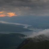
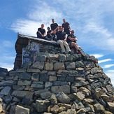
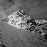 See 44 more Ben Nevis photos
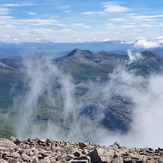
Orographic Lift on Ben Nevis
Misty View
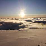
Top of The Ben
Ben Nevis
 Like us
 Follow us
