– Lat/Long: 28.73° S 28.88° E
 Sentinel
Weather Forecast, South AfricaIssued: 1 pm Sat 01 Jun Local TimeUpdates in: hr min sUpdate imminent
SentinelWeather Forecast, South Africa
Issued: 1 pm Sat 01 Jun Local Time
Updates in:
Update imminent hr min s

Issued: 1 pm Sat 01 Jun Local Time
Updates in:
Update imminent hr min s
Days 1–4 Weather SummaryA light covering of new snow mostly falling on Sun afternoon. Becoming milder with moderate rain (total 15mm) heaviest on Mon morning. Freeze-thaw conditions (max 5°C on Sat afternoon, min -5°C on Mon night). Winds increasing (light winds from the NNW on Sat night, gales from the NNW by Mon afternoon). | Days 5–7 Weather SummaryMostly dry. Freeze-thaw conditions (max 5°C on Tue night, min -2°C on Fri morning). Winds decreasing (strong winds from the WNW on Wed night, light winds from the NNW by Thu night). | ||||||||||||||||
Sat 1 | Sunday 2 | Monday 3 | Tuesday 4 | Wednesday 5 | Thursday 6 | ||||||||||||
PM | night | AM | PM | night | AM | PM | night | AM | PM | night | AM | PM | night | AM | PM | night | |
clear | some clouds | clear | light snow | snow shwrs | heavy rain | snow shwrs | clear | clear | clear | clear | clear | clear | clear | clear | clear | some clouds | |
km/h | |||||||||||||||||
Wave Height Map | 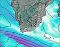 | 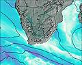 | 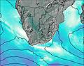 | 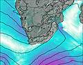 | 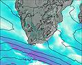 | 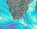 | |||||||||||
— | — | — | 3 | 3 | — | 3 | — | — | — | — | — | — | — | — | — | — | |
— | — | — | 0.2 | 2 | 12 | — | — | — | — | — | — | — | — | — | — | — | |
max°C | 5 | 5 | 3 | 3 | 2 | 2 | 0 | -1 | 0 | 3 | 5 | 5 | 5 | 4 | 5 | 5 | 5 |
min°C | 5 | 3 | 2 | 0 | 1 | 2 | -3 | -5 | 0 | 2 | 4 | 4 | 4 | 4 | 4 | 5 | 0 |
0 | -2 | -3 | -6 | -6 | -6 | -13 | -15 | -7 | -5 | -1 | -1 | -1 | -2 | -2 | -1 | -3 | |
3950 | 3700 | 3600 | 3200 | 3450 | 3450 | 2650 | 2350 | 3200 | 3650 | 3950 | 3900 | 3900 | 3800 | 3950 | 3850 | 3450 | |
Cloud base (m) | 3700 | 2650 | 2450 | 2300 | 2050 | 1750 | |||||||||||
— | — | 6:50 | — | — | 6:50 | — | — | 6:50 | — | — | 6:50 | — | — | 6:52 | — | — | |
5:14 | — | — | 5:14 | — | — | 5:14 | — | — | 5:14 | — | — | 5:14 | — | — | 5:14 | — | |
Sentinel Weather (Days 0-3):
The weather forecast for Sentinel is: A light covering of new snow mostly falling on Sun afternoon. Becoming milder with moderate rain (total 15mm) heaviest on Mon morning. Freeze-thaw conditions (max 5°C on Sat afternoon, min -5°C on Mon night). Winds increasing (light winds from the NNW on Sat night, gales from the NNW by Mon afternoon).
Sentinel Weather (Days 3-6):
Mostly dry. Freeze-thaw conditions (max 5°C on Tue night, min -2°C on Fri morning). Winds decreasing (strong winds from the WNW on Wed night, light winds from the NNW by Thu night).
This table gives the weather forecast for Sentinel at the specific elevation of 3165 m. Our advanced weather models allow us to provide distinct weather forecasts for several elevations of Sentinel. To see the weather forecasts for the other elevations, use the tab navigation above the table. For a wider overview of the weather, consult the Weather Map of South Africa.
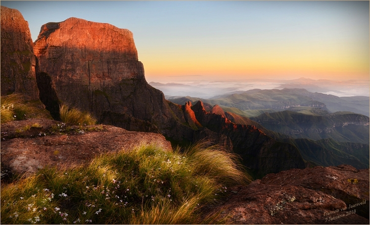
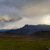
Sentinel Photos
View all
Drakensberg photos (40) |
Southern Africa photos (71) |
photos from mountains in South Africa (65) |
all photos
 Upload new photo


 See 9 more Sentinel photos
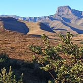
Sentinel Peak
Sentinel
Sentinel Peak
Storm coming
 Like us
 Follow us
