
– Lat/Long: 15.50° N 61.42° W
 Mt Diablotin or Morne Diablotins
Weather Forecast, DominicaIssued: 1 pm Fri 14 Jun Local TimeUpdates in: hr min sUpdate imminent
Mt Diablotin or Morne DiablotinsWeather Forecast, Dominica
Issued: 1 pm Fri 14 Jun Local Time
Updates in:
Update imminent hr min s

Issued: 1 pm Fri 14 Jun Local Time
Updates in:
Update imminent hr min s
Days 1–4 Weather SummaryLight rain (total 5mm), mostly falling on Fri afternoon. Warm (max 20°C on Sat night, min 17°C on Sat morning). Mainly fresh winds. | Days 5–7 Weather SummaryModerate rain (total 12mm), heaviest on Tue night. Very mild (max 19°C on Mon night, min 18°C on Mon afternoon). Winds increasing (light winds from the E on Mon afternoon, strong winds from the E by Wed night). | Days 8–10 Weather SummaryHeavy rain (total 23mm), heaviest during Sat afternoon. Very mild (max 19°C on Thu afternoon, min 18°C on Thu afternoon). Winds increasing (light winds from the ESE on Thu afternoon, near gales from the E by Sat night). | Days 11–13 Weather SummaryHeavy rain (total 21mm), heaviest during Mon afternoon. Very mild (max 19°C on Sun afternoon, min 18°C on Mon morning). Winds increasing (moderate winds from the ESE on Mon afternoon, strong winds from the E by Tue night). | |||||||||||||||||||||||||||||||||
Fri 14 | Saturday 15 | Sunday 16 | Monday 17 | Tuesday 18 | Wednesday 19 | Thursday 20 | Friday 21 | Saturday 22 | Sunday 23 | Monday 24 | Tuesday 25 | Wed 26 | ||||||||||||||||||||||||
PM | night | AM | PM | night | AM | PM | night | AM | PM | night | AM | PM | night | AM | PM | night | AM | PM | night | AM | PM | night | AM | PM | night | AM | PM | night | AM | PM | night | AM | PM | night | AM | |
risk tstorm | rain shwrs | risk tstorm | risk tstorm | clear | risk tstorm | risk tstorm | risk tstorm | risk tstorm | risk tstorm | risk tstorm | rain shwrs | risk tstorm | risk tstorm | risk tstorm | rain shwrs | risk tstorm | risk tstorm | risk tstorm | risk tstorm | risk tstorm | risk tstorm | risk tstorm | risk tstorm | risk tstorm | risk tstorm | risk tstorm | risk tstorm | risk tstorm | risk tstorm | risk tstorm | risk tstorm | risk tstorm | risk tstorm | risk tstorm | risk tstorm | |
km/h | ||||||||||||||||||||||||||||||||||||
Wave Height Map | 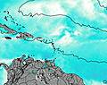 | 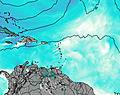 |  | 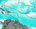 | 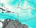 | 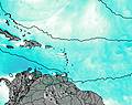 | 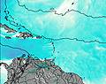 | 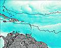 | 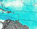 | 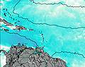 | 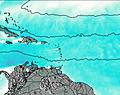 | 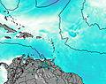 | 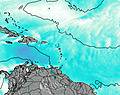 | |||||||||||||||||||||||
— | — | — | — | — | — | — | — | — | — | — | — | — | — | — | — | — | — | — | — | — | — | — | — | — | — | — | — | — | — | — | — | — | — | — | — | |
1.9 | 1.2 | 0.1 | 0.1 | — | 0.2 | 0.2 | 0.9 | 0.3 | 0.5 | 1.5 | 0.2 | 1.9 | 3 | 0.5 | 0.7 | 3 | 1.4 | 0.2 | 2 | 1.3 | 1.9 | 3 | 2 | 4 | 5 | 3 | 2 | 5 | 3 | 4 | 4 | 1.3 | 0.7 | 0.9 | 0.3 | |
max°C | 18 | 18 | 18 | 18 | 20 | 19 | 18 | 19 | 18 | 18 | 19 | 18 | 18 | 19 | 19 | 18 | 18 | 18 | 19 | 19 | 18 | 19 | 19 | 18 | 19 | 19 | 19 | 19 | 19 | 19 | 18 | 19 | 19 | 19 | 19 | 18 |
min°C | 18 | 18 | 17 | 17 | 19 | 18 | 18 | 18 | 18 | 18 | 18 | 18 | 18 | 18 | 18 | 18 | 18 | 18 | 18 | 18 | 18 | 18 | 18 | 18 | 19 | 19 | 18 | 19 | 19 | 18 | 18 | 19 | 19 | 18 | 19 | 18 |
18 | 18 | 16 | 16 | 19 | 17 | 18 | 17 | 18 | 18 | 18 | 18 | 18 | 17 | 17 | 17 | 17 | 17 | 18 | 17 | 17 | 17 | 17 | 17 | 18 | 18 | 17 | 18 | 18 | 17 | 17 | 18 | 18 | 17 | 18 | 16 | |
4900 | 4800 | 4800 | 4900 | 4750 | 4850 | 4900 | 4750 | 4800 | 4850 | 4750 | 4800 | 4850 | 4650 | 4850 | 4850 | 4800 | 4950 | 5000 | 4850 | 4900 | 4850 | 4800 | 4850 | 4850 | 4800 | 4850 | 4800 | 4850 | 4850 | 4850 | 4850 | 4900 | 4950 | 4850 | 4900 | |
Cloud base (m) | 300 | 7250 | 850 | 700 | 850 | 400 | 350 | 9000 | 7050 | 700 | 2750 | 5550 | 6600 | 7350 | 9900 | 9600 | ||||||||||||||||||||
— | — | 5:35 | — | — | 5:35 | — | — | 5:35 | — | — | 5:35 | — | — | 5:35 | — | — | 5:35 | — | — | 5:35 | — | — | 5:35 | — | — | 5:35 | — | — | 5:37 | — | — | 5:37 | — | — | 5:37 | |
6:37 | — | — | 6:37 | — | — | 6:37 | — | — | 6:37 | — | — | 6:37 | — | — | 6:37 | — | — | 6:38 | — | — | 6:38 | — | — | 6:38 | — | — | 6:38 | — | — | 6:38 | — | — | 6:38 | — | — | |
Mt Diablotin or Morne Diablotins Weather (Days 0-3):
The weather forecast for Mt Diablotin or Morne Diablotins is: Light rain (total 5mm), mostly falling on Fri afternoon. Warm (max 20°C on Sat night, min 17°C on Sat morning). Mainly fresh winds.
Mt Diablotin or Morne Diablotins Weather (Days 3-6):
Moderate rain (total 12mm), heaviest on Tue night. Very mild (max 19°C on Mon night, min 18°C on Mon afternoon). Winds increasing (light winds from the E on Mon afternoon, strong winds from the E by Wed night).
Mt Diablotin or Morne Diablotins Weather (Days 6-9):
Heavy rain (total 23mm), heaviest during Sat afternoon. Very mild (max 19°C on Thu afternoon, min 18°C on Thu afternoon). Winds increasing (light winds from the ESE on Thu afternoon, near gales from the E by Sat night).
This table gives the weather forecast for Mt Diablotin or Morne Diablotins at the specific elevation of 1447 m. Our advanced weather models allow us to provide distinct weather forecasts for several elevations of Mt Diablotin or Morne Diablotins. To see the weather forecasts for the other elevations, use the tab navigation above the table. For a wider overview of the weather, consult the Weather Map of Dominica.
| Weather Station | Temp. | Weather | Wind | Gusts | Cloud / Visibility |
|---|---|---|---|---|---|
Canefield Airport | |||||
Melville Hall AR Airport | |||||
Rhum JM | |||||
Pointe-à-Pitre International Airport |
* NOTE: not all weather observatories update at the same frequency which is the reason why some locations may show data from stations that are further away than known closer ones.
 Like us
 Follow us
