– Lat/Long: 63.07° N 151.00° W
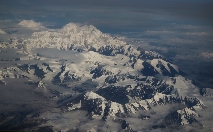
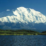
 Mount McKinley
Weather Forecast, United StatesIssued: 9 pm Fri 14 Jun Local TimeUpdates in: hr min sUpdate imminent
Mount McKinleyWeather Forecast, United States
Issued: 9 pm Fri 14 Jun Local Time
Updates in:
Update imminent hr min s

Issued: 9 pm Fri 14 Jun Local Time
Updates in:
Update imminent hr min s
Days 1–4 Weather SummaryA light covering of new snow mostly falling on Sun afternoon. Temperatures will be below freezing (max -5°C on Sun afternoon, min -6°C on Fri night). Wind will be generally light. | Days 5–7 Weather SummaryA moderate fall of snow, heaviest on Tue afternoon. Temperatures will be well below freezing (max -6°C on Mon night, min -8°C on Tue morning). Wind will be generally light. | Days 8–10 Weather SummaryA light covering of new snow mostly falling on Thu night. Temperatures will be below freezing (max -5°C on Sat night, min -8°C on Thu night). Wind will be generally light. | Days 11–13 Weather SummaryA heavy fall of snow, heaviest during Wed morning. Temperatures will be below freezing (max -5°C on Sun night, min -9°C on Wed night). Wind will be generally light. | |||||||||||||||||||||||||||||||||
Saturday 15 | Sunday 16 | Monday 17 | Tuesday 18 | Wednesday 19 | Thursday 20 | Friday 21 | Saturday 22 | Sunday 23 | Monday 24 | Tuesday 25 | Wed 26 | |||||||||||||||||||||||||
night | AM | PM | night | AM | PM | night | AM | PM | night | AM | PM | night | AM | PM | night | AM | PM | night | AM | PM | night | AM | PM | night | AM | PM | night | AM | PM | night | AM | PM | night | AM | PM | |
clear | clear | clear | clear | clear | snow shwrs | clear | snow shwrs | snow shwrs | clear | snow shwrs | snow shwrs | snow shwrs | clear | snow shwrs | snow shwrs | clear | snow shwrs | snow shwrs | snow shwrs | snow shwrs | clear | clear | some clouds | some clouds | some clouds | snow shwrs | some clouds | some clouds | snow shwrs | snow shwrs | clear | snow shwrs | snow shwrs | snow shwrs | light snow | |
km/h | ||||||||||||||||||||||||||||||||||||
Wave Height Map |  |  |  |  | 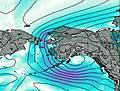 | 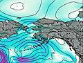 | 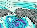 | 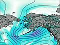 |  |  |  |  | 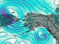 | |||||||||||||||||||||||
— | — | — | — | — | 3 | — | 1.0 | 3 | — | 1.0 | 3 | 1.0 | — | 2.0 | 2.0 | — | 3 | 5 | 1.0 | 2.0 | — | — | — | — | — | 1.0 | — | — | 1.0 | 3 | — | 2.0 | 4 | 6 | 2.0 | |
— | — | — | — | — | — | — | — | — | — | — | — | — | — | — | — | — | — | — | — | — | — | — | — | — | — | — | — | — | — | — | — | — | — | — | — | |
max°C | -6 | -6 | -6 | -6 | -6 | -5 | -5 | -6 | -6 | -6 | -7 | -8 | -8 | -8 | -8 | -8 | -8 | -7 | -7 | -7 | -6 | -6 | -6 | -6 | -5 | -6 | -5 | -5 | -5 | -5 | -5 | -5 | -5 | -6 | -7 | -8 |
min°C | -6 | -6 | -6 | -6 | -6 | -5 | -6 | -6 | -6 | -7 | -8 | -8 | -8 | -8 | -8 | -8 | -8 | -7 | -8 | -8 | -7 | -7 | -7 | -6 | -5 | -6 | -5 | -5 | -5 | -5 | -6 | -6 | -5 | -7 | -8 | -8 |
-11 | -9 | -9 | -9 | -8 | -7 | -6 | -6 | -6 | -10 | -12 | -12 | -14 | -12 | -11 | -8 | -8 | -7 | -11 | -12 | -7 | -10 | -7 | -6 | -5 | -6 | -5 | -7 | -7 | -5 | -9 | -10 | -8 | -13 | -14 | -14 | |
2450 | 2550 | 2650 | 2550 | 2650 | 2750 | 2650 | 2650 | 2650 | 2500 | 2450 | 2400 | 1900 | 2300 | 2400 | 2250 | 2350 | 2500 | 2400 | 2400 | 2550 | 2600 | 2600 | 2650 | 2650 | 2650 | 2750 | 2700 | 2700 | 2800 | 2700 | 2600 | 2700 | 2500 | 2350 | 2200 | |
Cloud base (m) | 2650 | 2600 | 2600 | 2650 | 2750 | 2600 | 2600 | 3150 | 2600 | 2600 | 2650 | 2600 | 2600 | 5550 | 2600 | 2600 | 2650 | 2600 | 2600 | 2600 | 2700 | 2800 | 2600 | 2800 | 2750 | 2600 | 2650 | 3000 | 2600 | 2600 | 2600 | 2600 | 2600 | 2600 | 2600 | |
— | 3:56 | — | — | 3:55 | — | — | 3:55 | — | — | 3:55 | — | — | 3:55 | — | — | 3:55 | — | — | 3:55 | — | — | 3:55 | — | — | 3:56 | — | — | 3:56 | — | — | 3:57 | — | — | 3:58 | — | |
— | 12:12 | — | — | 12:13 | — | — | 12:14 | — | — | 12:15 | — | — | 12:15 | — | — | 12:16 | — | — | 12:16 | — | — | 12:16 | — | — | 12:16 | — | — | 12:16 | — | — | 12:15 | — | — | 12:15 | — | |
Mount McKinley Weather (Days 0-3):
The weather forecast for Mount McKinley is: A light covering of new snow mostly falling on Sun afternoon. Temperatures will be below freezing (max -5°C on Sun afternoon, min -6°C on Fri night). Wind will be generally light.
Mount McKinley Weather (Days 3-6):
A moderate fall of snow, heaviest on Tue afternoon. Temperatures will be well below freezing (max -6°C on Mon night, min -8°C on Tue morning). Wind will be generally light.
Mount McKinley Weather (Days 6-9):
A light covering of new snow mostly falling on Thu night. Temperatures will be below freezing (max -5°C on Sat night, min -8°C on Thu night). Wind will be generally light.
This table gives the weather forecast for Mount McKinley at the specific elevation of 3500 m. Our advanced weather models allow us to provide distinct weather forecasts for several elevations of Mount McKinley. To see the weather forecasts for the other elevations, use the tab navigation above the table. For a wider overview of the weather, consult the Weather Map of Alaska United States.
| Weather Station | Temp. | Weather | Wind | Gusts | Cloud / Visibility |
|---|---|---|---|---|---|
Talkeetna | |||||
Mckinley Park Airport | |||||
Wasilla Airport |
* NOTE: not all weather observatories update at the same frequency which is the reason why some locations may show data from stations that are further away than known closer ones.
Mount McKinley Photos
View all
Alaska Range photos (8) |
Alaska/Yukon Ranges photos (53) |
photos from mountains in United States (2764) |
all photos
 Upload new photo
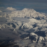

Central Alaska Range
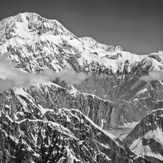
At "the edge of the world"
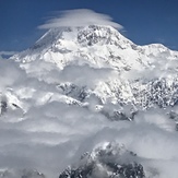
Lenticular clouds above Denali
Mount McKinley
 Like us
 Follow us
