– Lat/Long: 38.06° N 107.51° W
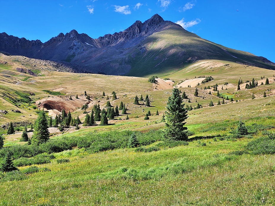
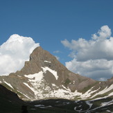
 Wetterhorn Peak
Weather Forecast, United StatesIssued: 5 pm Sat 04 May Local TimeUpdates in: hr min sUpdate imminent
Wetterhorn PeakWeather Forecast, United States
Issued: 5 pm Sat 04 May Local Time
Updates in:
Update imminent hr min s

Issued: 5 pm Sat 04 May Local Time
Updates in:
Update imminent hr min s
Days 1–4 Weather SummaryA heavy fall of snow, heaviest during Sun night. Freeze-thaw conditions (max 5°C on Sat afternoon, min -11°C on Sun night). Winds increasing (light winds from the S on Sat night, gales from the W by Tue morning). | Days 5–7 Weather SummaryA dusting of new snow. Freeze-thaw conditions (max 1°C on Thu afternoon, min -12°C on Tue night). Winds decreasing (near gales from the W on Tue afternoon, calm by Wed night). | Days 8–10 Weather SummaryLight rain (total 3mm) at first, then becoming colder with a dusting of snow on Sun afternoon. Freeze-thaw conditions (max 6°C on Sat afternoon, min -2°C on Sun night). Winds decreasing (fresh winds from the W on Sun morning, calm by Sun night). | Days 11–13 Weather SummaryModerate rain (total 11mm), heaviest on Mon afternoon giving way to a moderate fall of snow, heaviest on Wed night. Freeze-thaw conditions (max 5°C on Mon afternoon, min -4°C on Wed night). Wind will be generally light. | |||||||||||||||||||||||||||||||||
Sat 4 | Sunday 5 | Monday 6 | Tuesday 7 | Wednesday 8 | Thursday 9 | Friday 10 | Saturday 11 | Sunday 12 | Monday 13 | Tuesday 14 | Wednesday 15 | Thu 16 | ||||||||||||||||||||||||
PM | night | AM | PM | night | AM | PM | night | AM | PM | night | AM | PM | night | AM | PM | night | AM | PM | night | AM | PM | night | AM | PM | night | AM | PM | night | AM | PM | night | AM | PM | night | AM | |
rain shwrs | clear | clear | snow shwrs | snow shwrs | snow shwrs | snow shwrs | snow shwrs | clear | some clouds | snow shwrs | clear | clear | clear | clear | some clouds | some clouds | snow shwrs | rain shwrs | some clouds | some clouds | rain shwrs | rain shwrs | some clouds | snow shwrs | snow shwrs | rain shwrs | rain shwrs | some clouds | rain shwrs | risk tstorm | rain shwrs | snow shwrs | light snow | snow shwrs | light snow | |
km/h | ||||||||||||||||||||||||||||||||||||
Wave Height Map | 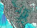 | 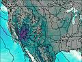 | 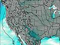 | 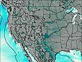 | 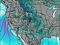 | 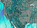 | 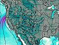 |  |  |  |  | 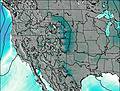 | 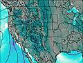 | |||||||||||||||||||||||
— | — | — | 1.0 | 18 | 2.0 | 1.0 | 1.0 | — | — | 1.0 | — | — | — | — | — | — | 2.0 | — | — | — | — | — | — | 2.0 | 1.0 | — | — | — | — | — | — | 2.0 | 4 | 5 | 4 | |
0.2 | — | — | — | — | — | — | — | — | — | — | — | — | — | — | — | — | — | 1.1 | — | — | 0.3 | 0.9 | — | — | — | 0.2 | 4 | — | 1.3 | 4 | 0.1 | — | 2 | — | — | |
max°C | 5 | 0 | 4 | 4 | -1 | -7 | -5 | -6 | -3 | -2 | -8 | -7 | -4 | -7 | -1 | 1 | -1 | 1 | 4 | 1 | 5 | 6 | 2 | 3 | 1 | 0 | 4 | 5 | 1 | 4 | 3 | 2 | 2 | 2 | -2 | -1 |
min°C | 4 | -1 | 2 | 1 | -11 | -9 | -6 | -9 | -4 | -3 | -12 | -11 | -5 | -8 | -4 | 1 | -4 | -2 | 3 | -1 | 3 | 5 | 0 | 2 | 1 | -2 | 1 | 4 | 0 | 3 | 2 | 0 | 1 | 0 | -4 | -2 |
0 | -5 | -3 | -6 | -22 | -19 | -16 | -18 | -14 | -12 | -22 | -19 | -10 | -11 | -6 | -3 | -8 | -5 | -1 | -5 | -1 | 1 | -5 | -4 | -4 | -5 | 0 | 1 | -3 | 0 | 0 | -3 | -3 | -4 | -9 | -7 | |
3950 | 3400 | 3800 | 4100 | 3100 | 2050 | 2700 | 2100 | 2900 | 3150 | 1900 | 1800 | 2800 | 2350 | 2950 | 3600 | 3050 | 3250 | 3850 | 3350 | 3900 | 4200 | 3850 | 3700 | 3550 | 3200 | 3600 | 4150 | 3600 | 3850 | 3900 | 3700 | 3750 | 3850 | 2850 | 3350 | |
Cloud base (m) | 5050 | 3600 | 4500 | 5000 | 3550 | 3600 | 3600 | 4800 | 4250 | 3600 | 3950 | 4600 | 5300 | 3550 | 4600 | 3600 | 6400 | 4950 | 4900 | 3850 | 3650 | 5500 | 5450 | 4300 | 4650 | 5650 | 3550 | 3600 | ||||||||
— | — | 6:07 | — | — | 6:07 | — | — | 6:05 | — | — | 6:05 | — | — | 6:03 | — | — | 6:03 | — | — | 6:01 | — | — | 6:01 | — | — | 6:00 | — | — | 5:58 | — | — | 5:58 | — | — | 5:58 | |
8:04 | — | — | 8:05 | — | — | 8:06 | — | — | 8:07 | — | — | 8:07 | — | — | 8:07 | — | — | 8:08 | — | — | 8:09 | — | — | 8:10 | — | — | 8:12 | — | — | 8:13 | — | — | 8:14 | — | — | |
Wetterhorn Peak Weather (Days 0-3):
The weather forecast for Wetterhorn Peak is: A heavy fall of snow, heaviest during Sun night. Freeze-thaw conditions (max 5°C on Sat afternoon, min -11°C on Sun night). Winds increasing (light winds from the S on Sat night, gales from the W by Tue morning).
Wetterhorn Peak Weather (Days 3-6):
A dusting of new snow. Freeze-thaw conditions (max 1°C on Thu afternoon, min -12°C on Tue night). Winds decreasing (near gales from the W on Tue afternoon, calm by Wed night).
Wetterhorn Peak Weather (Days 6-9):
Light rain (total 3mm) at first, then becoming colder with a dusting of snow on Sun afternoon. Freeze-thaw conditions (max 6°C on Sat afternoon, min -2°C on Sun night). Winds decreasing (fresh winds from the W on Sun morning, calm by Sun night).
This table gives the weather forecast for Wetterhorn Peak at the specific elevation of 3500 m. Our advanced weather models allow us to provide distinct weather forecasts for several elevations of Wetterhorn Peak. To see the weather forecasts for the other elevations, use the tab navigation above the table. For a wider overview of the weather, consult the Weather Map of Colorado.
| Weather Station | Temp. | Weather | Wind | Gusts | Cloud / Visibility |
|---|---|---|---|---|---|
* NOTE: not all weather observatories update at the same frequency which is the reason why some locations may show data from stations that are further away than known closer ones.
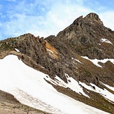
Wetterhorn Peak Photos
View all
San Juan Mountains photos (9) |
Rocky Mountains (USA) photos (225) |
photos from mountains in United States (2751) |
all photos
 Upload new photo
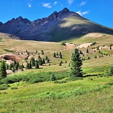
Wetterhorn Peak
Wetterhorn Peak
Wetterhorn Peak
 Like us
 Follow us
