
– Lat/Long: 40.59° N 111.72° W
 Twin Peaks (Utah)
Weather Forecast, United StatesIssued: 11 pm Fri 03 May Local TimeUpdates in: hr min sUpdate imminent
Twin Peaks (Utah)Weather Forecast, United States
Issued: 11 pm Fri 03 May Local Time
Updates in:
Update imminent hr min s

Issued: 11 pm Fri 03 May Local Time
Updates in:
Update imminent hr min s
Days 1–4 Weather SummaryDrizzle on Sun morning followed by colder weather and a heavy fall of snow, heaviest during Sun morning. Freeze-thaw conditions (max 10°C on Sat afternoon, min -5°C on Sun night). Winds increasing (light winds from the E on Fri night, fresh winds from the SSW by Sat night). | Days 5–7 Weather SummaryA heavy fall of snow, heaviest during Tue morning. Becoming milder with drizzle, on Thu afternoon. Freeze-thaw conditions (max 3°C on Thu afternoon, min -7°C on Tue night). Winds decreasing (fresh winds from the WNW on Tue afternoon, calm by Thu afternoon). | ||||||||||||||||||
Saturday 4 | Sunday 5 | Monday 6 | Tuesday 7 | Wednesday 8 | Thursday 9 | ||||||||||||||
night | AM | PM | night | AM | PM | night | AM | PM | night | AM | PM | night | AM | PM | night | AM | PM | night | |
clear | clear | some clouds | light rain | mod. snow | mod. snow | snow shwrs | light snow | snow shwrs | mod. snow | mod. snow | snow shwrs | snow shwrs | some clouds | clear | some clouds | some clouds | light rain | rain shwrs | |
km/h | |||||||||||||||||||
Wave Height Map |  | 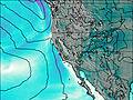 | 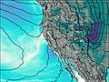 | 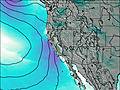 | 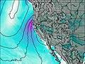 | 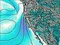 | 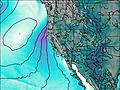 | ||||||||||||
— | — | — | — | 7 | 7 | 4 | 3 | 2.0 | 8 | 6 | 2.0 | 5 | — | — | — | — | — | — | |
— | — | — | 0.1 | 1.4 | — | — | — | — | — | — | — | — | — | — | — | — | 1.0 | 0.3 | |
max°C | 3 | 9 | 10 | 9 | 2 | -3 | -4 | -3 | -1 | -1 | -5 | -5 | -6 | -5 | -1 | -2 | 1 | 3 | 2 |
min°C | 1 | 6 | 10 | 4 | -2 | -4 | -5 | -5 | -2 | -3 | -6 | -5 | -7 | -6 | -3 | -2 | 0 | 2 | 0 |
-1 | 3 | 7 | 0 | -9 | -9 | -11 | -13 | -8 | -10 | -14 | -14 | -14 | -10 | -7 | -6 | -3 | -1 | 0 | |
2750 | 3450 | 3800 | 3700 | 2750 | 2000 | 1800 | 1750 | 2250 | 2100 | 1800 | 1900 | 1500 | 1650 | 2200 | 2050 | 2450 | 2850 | 2850 | |
Cloud base (m) | 9600 | 4750 | 4100 | 2400 | 2050 | 2400 | 2050 | 2250 | 2300 | 2050 | 2150 | 2300 | 2100 | 2450 | 2700 | 2850 | 2800 | ||
— | 6:20 | — | — | 6:20 | — | — | 6:18 | — | — | 6:16 | — | — | 6:16 | — | — | 6:15 | — | — | |
— | — | 8:25 | — | — | 8:27 | — | — | 8:28 | — | — | 8:29 | — | — | 8:30 | — | — | 8:30 | — | |
Twin Peaks (Utah) Weather (Days 0-3):
The weather forecast for Twin Peaks (Utah) is: Drizzle on Sun morning followed by colder weather and a heavy fall of snow, heaviest during Sun morning. Freeze-thaw conditions (max 10°C on Sat afternoon, min -5°C on Sun night). Winds increasing (light winds from the E on Fri night, fresh winds from the SSW by Sat night).
Twin Peaks (Utah) Weather (Days 3-6):
A heavy fall of snow, heaviest during Tue morning. Becoming milder with drizzle, on Thu afternoon. Freeze-thaw conditions (max 3°C on Thu afternoon, min -7°C on Tue night). Winds decreasing (fresh winds from the WNW on Tue afternoon, calm by Thu afternoon).
This table gives the weather forecast for Twin Peaks (Utah) at the specific elevation of 2500 m. Our advanced weather models allow us to provide distinct weather forecasts for several elevations of Twin Peaks (Utah). To see the weather forecasts for the other elevations, use the tab navigation above the table. For a wider overview of the weather, consult the Weather Map of Utah.
 Like us
 Follow us
