– Lat/Long: 37.09° S 12.28° W
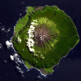
 Queen Mary's Peak
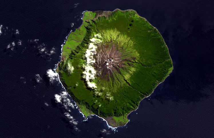
Weather Forecast, Tristan Da CunhaIssued: 11 am Sat 14 Jun Local TimeUpdates in: hr min sUpdate imminent
Issued: 11 am Sat 14 Jun Local Time
Updates in:
Update imminent hr min s

Issued: 11 am Sat 14 Jun Local Time
Updates in:
Update imminent hr min s
Days 1–3 Weather SummaryA dusting of new snow. Freeze-thaw conditions (max 1°C on Mon morning, min -10°C on Sat morning). Winds decreasing (near gales from the SW on Sat morning, moderate winds from the SSW by Sun night). | Days 4–6 Weather SummaryLight rain (total 3mm), mostly falling on Wed night. Freeze-thaw conditions (max 4°C on Tue night, min 0°C on Tue morning). Winds increasing (fresh winds from the WSW on Tue afternoon, stormy winds from the WNW by Thu night). | |||||||||||||||||
Saturday 14 | Sunday 15 | Monday 16 | Tuesday 17 | Wednesday 18 | Thursday 19 | |||||||||||||
AM | PM | night | AM | PM | night | AM | PM | night | AM | PM | night | AM | PM | night | AM | PM | night | |
snow shwrs | snow shwrs | some clouds | some clouds | some clouds | clear | clear | clear | clear | clear | clear | clear | clear | rain shwrs | rain shwrs | rain shwrs | light rain | light rain | |
km/h | ||||||||||||||||||
1 | 2 | — | — | — | — | — | — | — | — | — | — | — | — | — | — | — | — | |
— | — | — | — | — | — | — | — | — | — | — | — | — | 0.2 | 1.8 | 0.5 | 0.4 | 0.5 | |
max°C | -9 | -8 | -5 | -4 | -3 | 0 | 1 | 0 | 0 | 1 | 1 | 4 | 4 | 4 | 4 | 4 | 4 | 3 |
min°C | -10 | -8 | -6 | -5 | -3 | -2 | 0 | 0 | 0 | 0 | 1 | 1 | 4 | 4 | 3 | 3 | 4 | 2 |
-22 | -19 | -16 | -14 | -11 | -9 | -7 | -7 | -7 | -7 | -6 | -6 | -3 | -3 | -4 | -4 | -3 | -6 | |
950 | 1100 | 1100 | 1150 | 1300 | 2000 | 2400 | 1950 | 1850 | 3200 | 3450 | 3550 | 3300 | 3050 | 2950 | 2750 | 2900 | 2800 | |
Cloud base (m) | 1500 | 800 | 750 | 600 | 500 | 500 | 450 | 600 | 500 | 600 | 500 | 550 | 300 | 250 | 1000 | 1850 | 450 | |
8:00 | — | — | 8:00 | — | — | 8:00 | — | — | 8:00 | — | — | 8:00 | — | — | 8:02 | — | — | |
— | 5:37 | — | — | 5:37 | — | — | 5:37 | — | — | 5:37 | — | — | 5:37 | — | — | 5:37 | — | |
Loading...
Queen Mary's Peak Weather (Days 0-3):
The weather forecast for Queen Mary's Peak is: A dusting of new snow. Freeze-thaw conditions (max 1°C on Mon morning, min -10°C on Sat morning). Winds decreasing (near gales from the SW on Sat morning, moderate winds from the SSW by Sun night).
Queen Mary's Peak Weather (Days 3-6):
Light rain (total 3mm), mostly falling on Wed night. Freeze-thaw conditions (max 4°C on Tue night, min 0°C on Tue morning). Winds increasing (fresh winds from the WSW on Tue afternoon, stormy winds from the WNW by Thu night).
This table gives the weather forecast for Queen Mary's Peak at the specific elevation of 2062 m. Our advanced weather models allow us to provide distinct weather forecasts for several elevations of Queen Mary's Peak. To see the weather forecasts for the other elevations, use the tab navigation above the table.