R.Tri Prayudhi from INDONESIA writes:
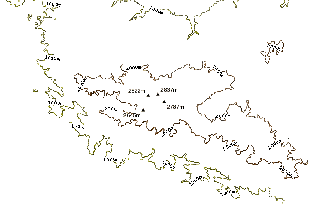
Mount Patah is a mountain in the wilderness of tropical rain forest, the ascent is very extreme, because to cross the river and rattan forest for days, climbing at an altitude ranging from 400 meters above sea level, from village Manau Sembilan Padangguci, run through plantations, paddy villagers,
Down Padangguci river, for 1 day (8 hours walk) after that, just enter the tropical rain forest of diverse species of birds, large mammals, to be rattan forest, trees with large diameter, two to three people to embrace one tree, to the summit will pass the road on the left and right of the abyss, and slightly elongated cliff, and had to use climbing equipment for the safety of the body, at an altitude of 2450 meters above sea level will find a lake more than 3 hectares, the water in the lake is very cold, like water in the refrigerator.
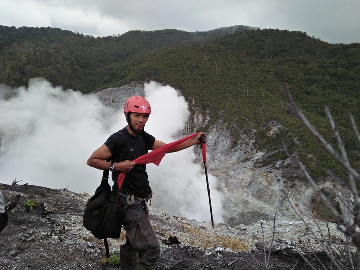
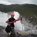
From the north of the lake will be visible chasm white colored crater steaming sulfur, from the highest peak of the crater will look at the rock cliff landslide that mountain peak Patah.
2015-04-19 |
 Mount Patah – Climbing, Hiking & Mountaineering information

 Like us
 Follow us
