
– Lat/Long: 46.90° S 37.77° E
 Mascarin Peak
Weather Forecast, South AfricaIssued: 1 pm Fri 10 May Local TimeUpdates in: hr min sUpdate imminent
Mascarin PeakWeather Forecast, South Africa
Issued: 1 pm Fri 10 May Local Time
Updates in:
Update imminent hr min s

Issued: 1 pm Fri 10 May Local Time
Updates in:
Update imminent hr min s
Days 1–4 Weather SummaryModerate rain (total 11mm) heaviest on Fri night, then becoming colder with a dusting of snow on Sun night. Freeze-thaw conditions (max 7°C on Fri night, min 0°C on Sun afternoon). Winds increasing (moderate winds from the NNW on Fri afternoon, severe gales from the SSW by Sun night). | Days 5–7 Weather SummaryModerate rain (total 20mm), heaviest on Wed afternoon. Freeze-thaw conditions (max 9°C on Wed morning, min 0°C on Mon afternoon). Winds increasing (light winds from the SSW on Mon night, stormy winds from the WSW by Wed night). | Days 8–10 Weather SummaryHeavy rain (total 28mm), heaviest during Sat night. Mild temperatures (max 9°C on Sun morning, min 2°C on Fri afternoon). Winds decreasing (severe gales from the WSW on Fri afternoon, light winds from the WSW by Sat morning). | Days 11–13 Weather SummaryModerate rain (total 18mm), heaviest on Tue night. Very mild (max 11°C on Mon morning, min 1°C on Wed afternoon). Winds decreasing (extremely windy from the WNW on Mon morning, moderate winds from the WNW by Tue morning). | |||||||||||||||||||||||||||||||||
Fri 10 | Saturday 11 | Sunday 12 | Monday 13 | Tuesday 14 | Wednesday 15 | Thursday 16 | Friday 17 | Saturday 18 | Sunday 19 | Monday 20 | Tuesday 21 | Wed 22 | ||||||||||||||||||||||||
PM | night | AM | PM | night | AM | PM | night | AM | PM | night | AM | PM | night | AM | PM | night | AM | PM | night | AM | PM | night | AM | PM | night | AM | PM | night | AM | PM | night | AM | PM | night | AM | |
cloudy | rain shwrs | rain shwrs | clear | rain shwrs | cloudy | cloudy | snow shwrs | some clouds | some clouds | some clouds | some clouds | light rain | mod. rain | some clouds | heavy rain | rain shwrs | some clouds | rain shwrs | heavy rain | light rain | light rain | rain shwrs | some clouds | cloudy | heavy rain | rain shwrs | some clouds | light rain | mod. rain | rain shwrs | clear | some clouds | rain shwrs | rain shwrs | rain shwrs | |
km/h | ||||||||||||||||||||||||||||||||||||
Wave Height Map | 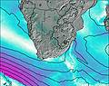 | 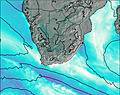 | 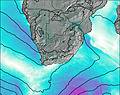 | 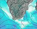 | 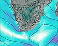 | 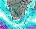 | 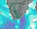 | 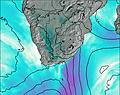 | 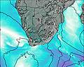 | 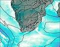 | 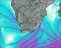 | 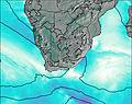 | ||||||||||||||||||||||||
— | — | — | — | — | — | — | 1.0 | — | — | — | — | — | — | — | — | — | — | — | — | — | — | — | — | — | — | — | — | — | — | — | — | — | — | — | — | |
— | 10 | 0.2 | — | 1.0 | — | — | — | — | — | — | — | 0.6 | 8 | — | 10 | 0.3 | — | 0.1 | 10 | 0.5 | 0.6 | 0.5 | — | — | 12 | 4 | — | 4 | 6 | 3 | — | — | 0.2 | 6 | 0.2 | |
max°C | 4 | 7 | 4 | 3 | 4 | 1 | 1 | 1 | 1 | 0 | 2 | 4 | 6 | 8 | 9 | 7 | 2 | 2 | 3 | 7 | 4 | 3 | 5 | 4 | 5 | 8 | 9 | 4 | 10 | 11 | 5 | 3 | 2 | 3 | 7 | 3 |
min°C | 4 | 4 | 3 | 3 | 1 | 1 | 0 | 1 | 1 | 0 | 1 | 3 | 5 | 7 | 8 | 4 | 1 | 1 | 3 | 3 | 4 | 2 | 3 | 4 | 4 | 5 | 6 | 4 | 5 | 10 | 4 | 2 | 2 | 2 | 3 | 2 |
0 | -2 | -5 | -4 | -7 | -6 | -8 | -8 | -7 | -7 | -3 | -4 | -2 | 1 | 2 | -4 | -9 | -9 | -5 | -4 | -4 | -7 | -5 | -1 | -1 | -1 | -1 | -4 | -1 | 4 | -2 | -4 | -4 | -5 | -4 | -6 | |
1500 | 1800 | 1050 | 1050 | 600 | 600 | 550 | 650 | 550 | 550 | 750 | 1750 | 2350 | 2450 | 2750 | 1100 | 700 | 750 | 1250 | 2150 | 950 | 800 | 2900 | 2400 | 2100 | 2650 | 1500 | 1100 | 2000 | 2700 | 1450 | 800 | 750 | 900 | 2200 | 700 | |
Cloud base (m) | 200 | 50 | 150 | 400 | 200 | 200 | 550 | 200 | 300 | 350 | 500 | 2100 | 150 | 150 | 250 | 100 | 100 | 200 | 250 | 50 | 100 | 100 | 200 | 400 | 900 | 200 | 200 | 450 | 1700 | 50 | 250 | 400 | 350 | 400 | 100 | 350 |
— | — | 6:41 | — | — | 6:41 | — | — | 6:43 | — | — | 6:45 | — | — | 6:46 | — | — | 6:47 | — | — | 6:48 | — | — | 6:50 | — | — | 6:50 | — | — | 6:52 | — | — | 6:52 | — | — | 6:54 | |
4:08 | — | — | 4:07 | — | — | 4:07 | — | — | 4:05 | — | — | 4:04 | — | — | 4:02 | — | — | 4:01 | — | — | 4:00 | — | — | 4:00 | — | — | 3:59 | — | — | 3:57 | — | — | 3:56 | — | — | |
Mascarin Peak Weather (Days 0-3):
The weather forecast for Mascarin Peak is: Moderate rain (total 11mm) heaviest on Fri night, then becoming colder with a dusting of snow on Sun night. Freeze-thaw conditions (max 7°C on Fri night, min 0°C on Sun afternoon). Winds increasing (moderate winds from the NNW on Fri afternoon, severe gales from the SSW by Sun night).
Mascarin Peak Weather (Days 3-6):
Moderate rain (total 20mm), heaviest on Wed afternoon. Freeze-thaw conditions (max 9°C on Wed morning, min 0°C on Mon afternoon). Winds increasing (light winds from the SSW on Mon night, stormy winds from the WSW by Wed night).
Mascarin Peak Weather (Days 6-9):
Heavy rain (total 28mm), heaviest during Sat night. Mild temperatures (max 9°C on Sun morning, min 2°C on Fri afternoon). Winds decreasing (severe gales from the WSW on Fri afternoon, light winds from the WSW by Sat morning).
This table gives the weather forecast for Mascarin Peak at the specific elevation of 500 m. Our advanced weather models allow us to provide distinct weather forecasts for several elevations of Mascarin Peak. To see the weather forecasts for the other elevations, use the tab navigation above the table. For a wider overview of the weather, consult the Weather Map of South Africa.
| Weather Station | Temp. | Weather | Wind | Gusts | Cloud / Visibility |
|---|---|---|---|---|---|
Alfred Faure (Iles Crozet) | |||||
East London | |||||
East London Airport |
* NOTE: not all weather observatories update at the same frequency which is the reason why some locations may show data from stations that are further away than known closer ones.
 Like us
 Follow us
