Update:
Still safe to go to Iztaccíhuatl, Mountain police reinstated through a safety recommendation dossier handed to the Mexican government by MEXICO CLIMBING guides, instructors of the Mexican Mountain Police Force four years ago.
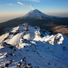
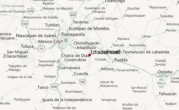
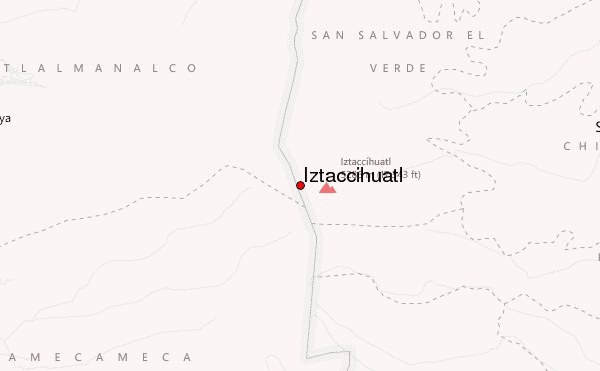
Iztaccíhuatl
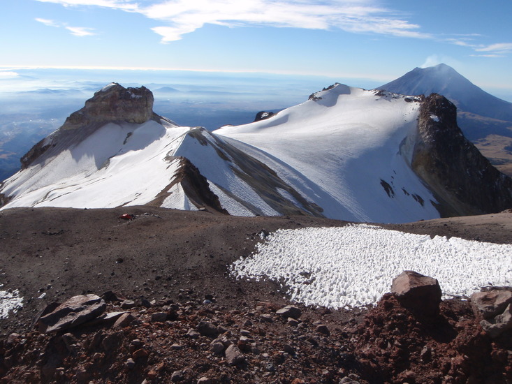
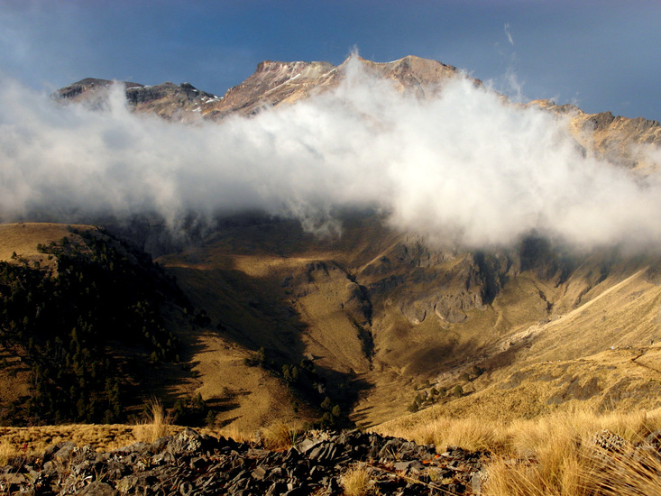
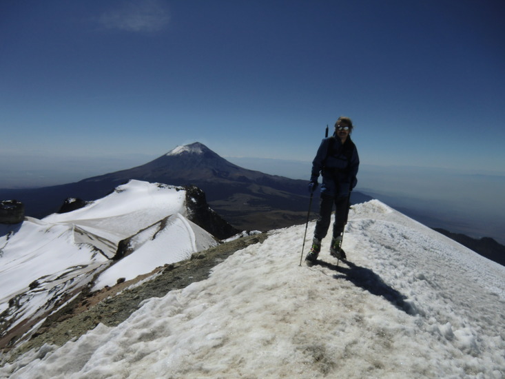
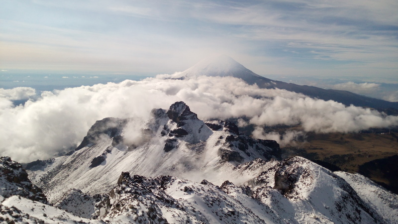
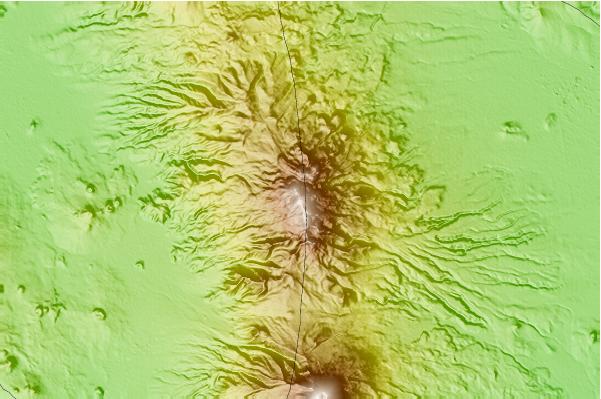
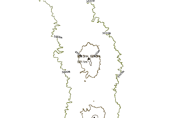
Which roughly translates as white woman, due to the glaciers existing around 15,000 feet (5,215 meters, last measurement) above sea level and that still to this day survive. Izta, for short, is an extinct volcano offering spectacular views of the central Mexico's Sierra Madre and the valleys of Mexico City (Tenochtitlán), Puebla City and Toluca. You can also see on most days, Pico de Orizaba far away in the horizon to the east.
Iztaccíhuatl is also often called the "Sleeping Lady" because of the obvious shape of a laying down woman, face up, as though she was by a spell, asleep through millennia.
The climbing on the classical routes is mostly very moderate "hiking" to slightly technical "scrambling" or glacier (now almost extinct), with some alternative routes which offer some added adventure (beware loose rock and poor ice conditions). Most climbers stick to the two main routes "la normal or the Portillos" route or the "Ayoloco" route which attacks the summit from the State of Mexico side up to the "Belly" glacier of the Sleeping Woman shape of the mountain.
Guide services are provided from different cities but the most reputable ones are either from Mexico City or Puebla, Mex City being only a couple hours away driving or by bus, but since local transports are inconsistent, driving or hiring a guide service is better than taking the bus and missing the last bus down to any city.
A Mexico City based company called "Mexico Climbing" (on Facebook and Instagram) offers premier all included service to the summit on a two day logistic. Mexico Climbing is certified by State Security and authorized by the National Parks Commission CONANP. Climbing Izta is a safe trip from nearby Amecameca town, since an isolated crime incident made Mexico Climbing guides spring into action and perform a series of negotiations with the Mexican government, starting with a televised march/ascent against crime and violence started by yours truly Paco Trad and a few brave volunteers that resulted in the first Mountain Police ever in Mexico. Now a days the mountain is very peaceful, but climbing up from the town of San Rafael as opposed to Amecameca, is still not advised and best be avoided until deemed safe again. Seems illegal timber/logging is a very profitable business and local mobsters from the San Rafael side are reluctant to give free passing to hikers.
All in all, climbing Iztaccíhuatl is very safe from Amecameca for either of the two most popular routes and hopefully some rock climbing and bouldering might find it's way into the local talent's curiosity. There is some potential in adventure rock climbing and possibly some bouldering, ice is receding as in all the rest of the world but some years you will still find good snow covered glaciers and maybe some steep ice for the more experienced mountaineers.
High Altitude Sickness is to be taken seriously since rescues are not very swift and helicopters cannot fly in because of nearby Popocatepetl active volcano. Unless you are a well experienced climber mountaineer, a guide will be most useful to keep you safe and communicated via VHF radio with the local Mountain Police.
Have a safe and fun climb and as we say in Mexico Climbing:
FELICES ESCALADAS!!! Happy Climbing!!!
 Iztaccihuatl – Climbing, Hiking & Mountaineering information


