
– Lat/Long: 38.91° N 106.44° W
 Ice Mountain
Weather Forecast, United StatesIssued: 5 am Thu 02 May Local TimeUpdates in: hr min sUpdate imminent
Ice MountainWeather Forecast, United States
Issued: 5 am Thu 02 May Local Time
Updates in:
Update imminent hr min s

Issued: 5 am Thu 02 May Local Time
Updates in:
Update imminent hr min s
Days 1–3 Weather SummaryLight rain (total 8mm), mostly falling on Sat night. Warm (max 25°C on Sat morning, min 15°C on Sat night). Winds decreasing (strong winds from the WSW on Fri afternoon, calm by Sat afternoon). | Days 4–6 Weather SummaryLight rain (total 6mm), mostly falling on Sun night. Warm (max 25°C on Sun afternoon, min 10°C on Sun night). Mainly strong winds. | Days 7–9 Weather SummaryHeavy rain (total 34mm), heaviest during Thu night. Warm (max 21°C on Fri afternoon, min 9°C on Thu night). Mainly fresh winds. | Days 10–12 Weather SummaryLight rain (total 6mm), mostly falling on Sun afternoon. Warm (max 26°C on Sat afternoon, min 16°C on Sun night). Wind will be generally light. | |||||||||||||||||||||||||||||||||
Thursday 2 | Friday 3 | Saturday 4 | Sunday 5 | Monday 6 | Tuesday 7 | Wednesday 8 | Thursday 9 | Friday 10 | Saturday 11 | Sunday 12 | Monday 13 | |||||||||||||||||||||||||
AM | PM | night | AM | PM | night | AM | PM | night | AM | PM | night | AM | PM | night | AM | PM | night | AM | PM | night | AM | PM | night | AM | PM | night | AM | PM | night | AM | PM | night | AM | PM | night | |
clear | clear | clear | some clouds | some clouds | clear | rain shwrs | rain shwrs | rain shwrs | clear | light rain | rain shwrs | light rain | some clouds | rain shwrs | rain shwrs | clear | rain shwrs | some clouds | some clouds | light rain | light rain | mod. rain | heavy rain | rain shwrs | rain shwrs | rain shwrs | clear | rain shwrs | rain shwrs | rain shwrs | rain shwrs | rain shwrs | rain shwrs | rain shwrs | clear | |
km/h | ||||||||||||||||||||||||||||||||||||
Wave Height Map |  |  |  |  | 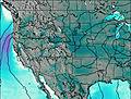 | 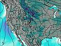 | 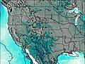 | 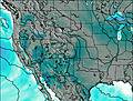 |  |  |  |  | ||||||||||||||||||||||||
— | — | — | — | — | — | — | — | — | — | — | — | — | — | — | — | — | — | — | — | — | — | — | — | — | — | — | — | — | — | — | — | — | — | — | — | |
— | — | — | — | — | — | 0.1 | 4 | 4 | — | 0.1 | 4 | 0.5 | — | 0.6 | 0.4 | — | 0.3 | — | — | 4 | 1.6 | 10 | 14 | 0.6 | 3 | 1.0 | — | 0.8 | 0.3 | 0.5 | 1.5 | 0.5 | 1.4 | 0.8 | — | |
max°C | 19 | 21 | 17 | 23 | 24 | 18 | 25 | 25 | 18 | 24 | 25 | 18 | 13 | 17 | 15 | 17 | 19 | 15 | 18 | 20 | 17 | 18 | 18 | 14 | 19 | 21 | 18 | 24 | 26 | 19 | 22 | 23 | 18 | 22 | 23 | 19 |
min°C | 16 | 20 | 16 | 20 | 24 | 17 | 22 | 21 | 15 | 21 | 23 | 10 | 11 | 17 | 13 | 15 | 19 | 12 | 16 | 19 | 14 | 16 | 18 | 9 | 16 | 21 | 16 | 21 | 21 | 17 | 20 | 21 | 16 | 19 | 23 | 18 |
15 | 20 | 16 | 20 | 24 | 17 | 22 | 21 | 15 | 21 | 23 | 9 | 8 | 16 | 11 | 13 | 18 | 11 | 15 | 18 | 14 | 16 | 18 | 9 | 16 | 21 | 16 | 21 | 21 | 17 | 20 | 21 | 16 | 19 | 23 | 18 | |
2900 | 3550 | 3000 | 3450 | 4000 | 3200 | 3750 | 4050 | 3050 | 3700 | 4150 | 2900 | 2150 | 3000 | 2750 | 2800 | 3350 | 2600 | 2850 | 3400 | 2850 | 2900 | 3250 | 2550 | 2850 | 3650 | 2900 | 3700 | 4100 | 3250 | 3500 | 3800 | 3100 | 3350 | 3850 | 3300 | |
Cloud base (m) | 5050 | 4850 | 5250 | 5050 | 3550 | 8750 | 5000 | 3500 | 3500 | 4050 | 4650 | 3550 | 4500 | 3900 | 5250 | 3550 | 3550 | 3550 | 3550 | 3600 | 3550 | 5100 | 4800 | 4900 | 4700 | 3550 | 3550 | 4150 | 3600 | |||||||
6:05 | — | — | 6:03 | — | — | 6:03 | — | — | 6:01 | — | — | 6:01 | — | — | 6:00 | — | — | 5:58 | — | — | 5:58 | — | — | 5:56 | — | — | 5:56 | — | — | 5:54 | — | — | 5:54 | — | — | |
— | 7:59 | — | — | 8:00 | — | — | 8:00 | — | — | 8:01 | — | — | 8:02 | — | — | 8:04 | — | — | 8:05 | — | — | 8:06 | — | — | 8:07 | — | — | 8:07 | — | — | 8:08 | — | — | 8:09 | — | |
Ice Mountain Weather (Days 0-3):
The weather forecast for Ice Mountain is: Light rain (total 8mm), mostly falling on Sat night. Warm (max 25°C on Sat morning, min 15°C on Sat night). Winds decreasing (strong winds from the WSW on Fri afternoon, calm by Sat afternoon).
Ice Mountain Weather (Days 3-6):
Light rain (total 6mm), mostly falling on Sun night. Warm (max 25°C on Sun afternoon, min 10°C on Sun night). Mainly strong winds.
Ice Mountain Weather (Days 6-9):
Heavy rain (total 34mm), heaviest during Thu night. Warm (max 21°C on Fri afternoon, min 9°C on Thu night). Mainly fresh winds.
This table gives the weather forecast for Ice Mountain at the specific elevation of 460 m. Our advanced weather models allow us to provide distinct weather forecasts for several elevations of Ice Mountain. To see the weather forecasts for the other elevations, use the tab navigation above the table. For a wider overview of the weather, consult the Weather Map of Colorado.
| Weather Station | Temp. | Weather | Wind | Gusts | Cloud / Visibility |
|---|---|---|---|---|---|
Cottonwood Pass (CO) | |||||
Buena Vista Airport | |||||
Leadville Airport |
* NOTE: not all weather observatories update at the same frequency which is the reason why some locations may show data from stations that are further away than known closer ones.
 Like us
 Follow us
