Aadil shah from INDIA writes:
The Haramukh Ascent
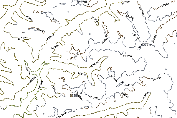
On 20th September 2015, a group of four young Kashmiri climbers summitted what is considered to be the most difficult mountain to climb in the Kashmir province of J&K state. Previously considered to be standing at 5143 mtrs, the new altitude of Mount Haramukh was recorded to be 5255 mtrs above Sea Level. The climb was organized by Jammu & Kashmir Mountaineering and Hiking Club (JKMHC). Starting on 18th September from Kudara Village in the North West district of Bandipora, the team trekked up to the Sarbal meadow where they set up the Base Camp at 3500m. The next day a Summit Team of four members, lead by Aadil Shah, climbed up to the Advanced Base Camp at 4650 mtrs above sea level. The team followed the conventional route mentioned by a veteran climber of the Valley Mr. Nandlal Bakaya in his book “Holidaying and Trekking in Valley”.He had climbed the peak in 1944. During the course of this climb, the climbers were tested by loose scree, precariously poised boulders and near vertical walls. After setting up the Advanced Base Camp, the team advanced further up in order to locate the route for the next day. On 20th September, after thorough deliberations and calculations, the team braved the hostile weather and near vertical walls and climbed further up to the vast expanses of the Ice-Field at around 4900 mtrs above sea level. From here the team roped in and, using advanced gear and techniques, summitted the peak at 4:25 PM. The view is awesome. One can capture the panorama of mighty mountain ranges and the bewitching valleys studded with sparkling water lakes. The team descended to the Advanced Base Camp and stayed there for another night. During the course of the entire climb, the team was in constant touch with the Base Camp. The Summit Team comprised of:
Aadil Shah (Team Leader)
Khurshid Beigh
Taous Baba
Tufail Qureshi
Most climbers regard Mount Haramukh as technically the most challenging mountain to climb in the Kashmir Province. Many attempts have been previously made to scale it. The first ever successful climb was done by the members of the Great Trigonometric Survey, led by Thomas Montegomorie, in 1856. Montgomerie made the first survey of the Karakoram some 210 km (130 miles) to the north, and sketched the two most prominent peaks, labelling them K1 and K2. So, Haramukh is the mountain from which the world's second-highest mountain peak, K2, was discovered and the name given it by the Survey, K2 continues to be used. In the Year 1883 Sir Earnest Neve attempted to climb The Haramukh Peak via Sarbal Route but failed. 3 years later in 1886, he was successful to reach the summit from Erin Valley side which he called the station peak. The summit provided a magnificent view of the ranges beyond, especially of Nanga Parbat. Since then the peak has been successfully scaled first by Kirti Singh and then by Earnest Neve. In 1894 M.A Stein also climbed the peak successfully. General Bruce , Dr Neve & Col Millias also made successful attempts in 1912. In 1944 Master Nandlal Bakaya summitted Mt. Haramukh from the South-Western side and sketched the route to the summit in his book “Holidaying and Trekking in Valley”. In 1983, Rajinder Koul also climbed the peak successfully. Since then, the recent summit is considered to be the first successful one by civilian climbers. Although in June 2015, JKMHC had organized a climb to Mount Haramukh under the leadership of Khursheed Laiguru, but due to constraints in the route the team could make it only to the Station Peak (4830 mtrs).
Members at Basecamp:
Shuja Aalum
Arshed Majeed
Suhail Nazir
Virender Watal
Support/Emergency Team:
Dr. Aamir Ali
Mr. Mahmood Shah
About Haramukh:
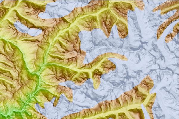
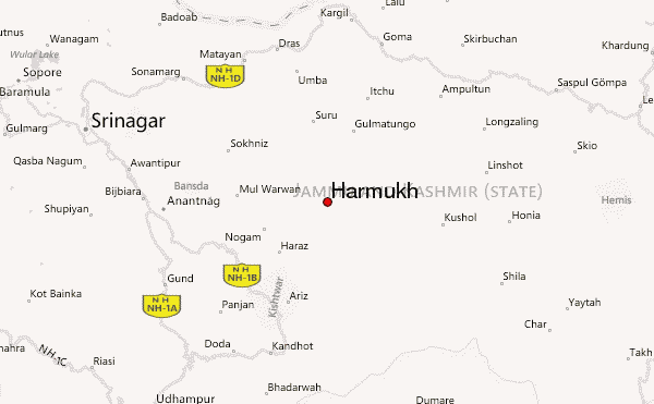
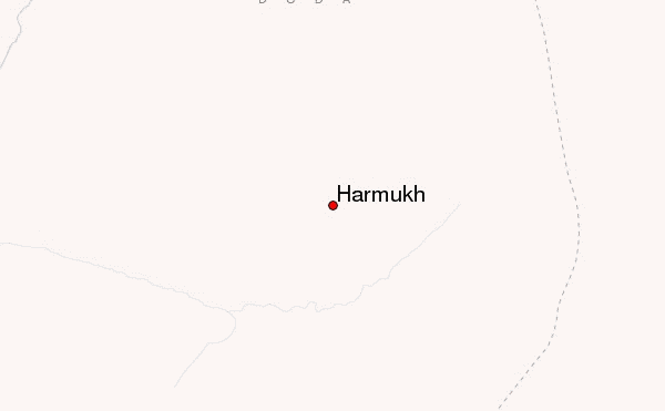
Haramukh (also known as Mount Haramukh or Haramukh Mountain) is a mountain with a peak elevation of 5,225 metres (17033ft), in Ganderbal district of Jammu and Kashmir. Haramukh is part of the Himalaya Range, and is located between Nallah Sindh in the south and Kishanganga Neelum River in the north, rising above Gangabal Lake in the vicinity of Kashmir valley. It is mostly climbed from the northwestern side of Arin Bandipora.
Haramukh lies in the northwestern Himalayan Range. The Karakoram Range borders it on the north and the Kashmir Valley on the south. Melt waters from glaciers form Gangabal Lake which lies at its foot to the north east side and contribute significantly to the regional fresh-water supply, supporting irrigation through Nallah Sindh. This Himalayan Range lies along the southern edge of the Eurasian tectonic plate and is made up of ancient sedimentary rocks (more than 390 million years old). Those strata were folded and thrust-faulted, and granite masses were intruded, when the Indian plate collided with Eurasia, beginning more than 100 million years ago Haramukh means same on all sides. It is notable for its local relief as it is a consistently steep pyramid, dropping sharply to the east and south, with the eastern slope the steepest.
Haramukh was first climbed by members of the Great Trigonometric Survey led by Thomas Montgomerie in 1856. Montgomerie made the first survey of the Karakoram some 210 km (130 miles) to the north, and sketched the two most prominent peaks, labelling them K1 and K2. Haramukh was later climbed by many other climbers. Most Recently the Haramukh peak was climbed by a local group of climbers on September 20th 2015. This was the first successful ascent to the eastern peak since past 35 years. The newly recorded altitude of the eastern hump was 5255m
Aadil Shah ( Alpine adventurers)
Member - Jammu & Kashmir Mountaineering and Hiking Club
2015-10-29 |
 Harmukh – Climbing, Hiking & Mountaineering information

 Like us
 Follow us
