Big Spencer Mountain mountain guide
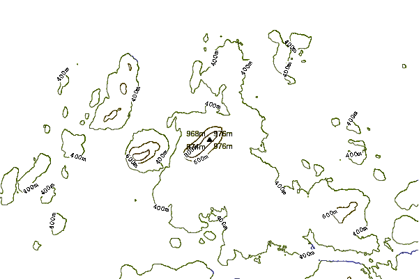
- Elevation: 977 m
- Difficulty:
- Best months to climb:
- Convenient center:
Big Spencer Mountain Climbing Notes
Heidi Moody from UNITED STATES writes:
Parking is available at the base of the mountain. Space is limited. The climb takes you up a cart path that is gradual for about 1 mile and you come to a clearing where the ranger station once was. This is a good place to rest and appreciate the views so far. To the left is a small trail that takes you up the rest of the way to the peak (another mile). In June 2012, the beginning part of the trail was under a beaver pond, so it was tricky navigating around that and back to the trail. There are many ladders and rocks that you have to climb, downed trees that you have to climb under or over. Its a challenging climb, but I did it with my 2 children age 7 & 6, and we passed a family with a dog who made it to the top.
At the top, there is a helicopter landing pad, which makes a great picnic spot. There's also a great rock that you can stand on to look out over and take great pictures. I have a nice one of myself and my Dad on that rock from 1988. Now I have a great one of my husband and children from 2012.
Shortly after we climbed in June, there was a fire that burned several acres at the top of the mountain, so I'm not certain how this affects the trail, if at all.
2012-10-14 |
Click here to read 1 more climbing note for Big Spencer Mountain or submit your own
|
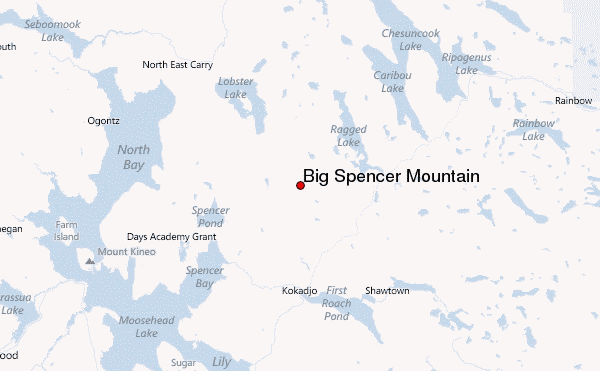
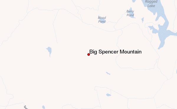
Select Big Spencer Mountain Location Map Detail:
Use this relief map to navigate to mountain peaks in the area of Big Spencer Mountain.
10 other mountain peaks closest to Big Spencer Mountain:
 Big Spencer Mountain – Climbing, Hiking & Mountaineering information

 Like us
 Follow us
