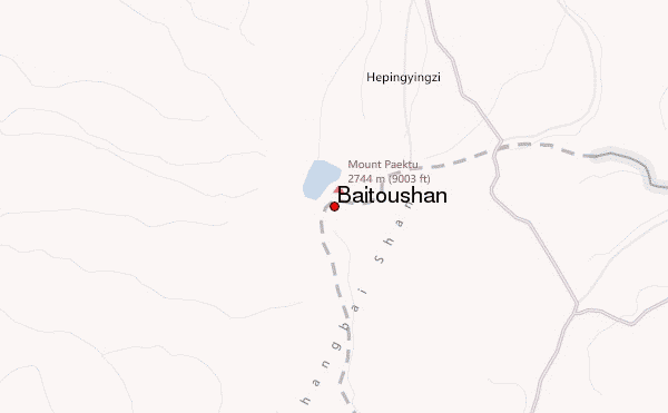
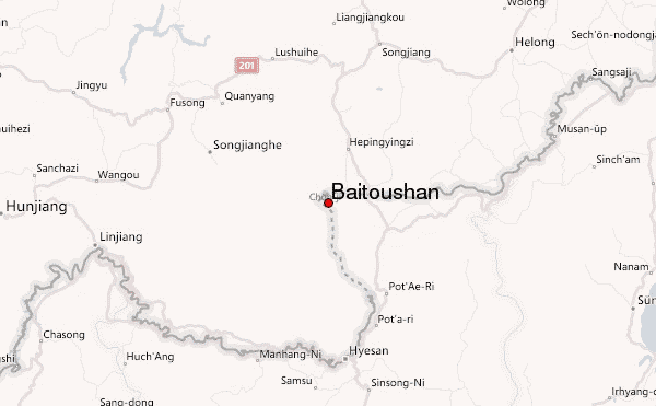
– Lat/Long: 41.98° N 128.08° E
 Baitoushan – Climbing, Hiking & Mountaineering information
Baitoushan – Climbing, Hiking & Mountaineering information
Baitoushan mountain guide
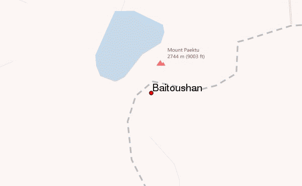
- Elevation: 2744 m
- Difficulty:
- Best months to climb: January, February, March, April, May, June, July, August, September, October, November, December
- Convenient center: Yanji
Baitoushan Climbing NotesBe the first to submit your climbing note! Please submit any useful information about climbing Baitoushan that may be useful to other climbers. Consider things such as access and accommodation at the base of Baitoushan, as well as the logistics of climbing to the summit. |
| Select a
mountain summit from the menu |
||
|
Select a Mountain Summit
|
||
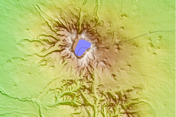
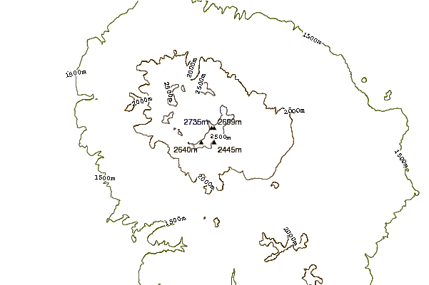
Use this relief map to navigate to mountain peaks in the area of Baitoushan.
10 other mountain peaks closest to Baitoushan:
| 1. | Mt Baekdu-Mt Changbai (2744 m) | 4.8 km |
| 2. | Puksubaek San (2522 m) | 145.1 km |
| 3. | Kangnam Mountains (1046 m) | 165.1 km |
| 4. | Wunü Mountain or Wu Nu Shan (五女山) (821 m) | 233.5 km |
| 5. | Mount Kholodilnik (257 m) | 341.9 km |
| 6. | Kŭmgangsan (1638 m) | 384.4 km |
| 7. | Mount Livadiyskaya (1332 m) | 396.4 km |
| 8. | Seoraksan (1708 m) | 430.9 km |
| 9. | Baegunsan (Gangwon/Gyeonggi) (904 m) | 438.0 km |
| 10. | Myoraksan (818 m) | 440.0 km |
 Like us
 Follow us
