– Lat/Long: 52.45° N 3.80° W
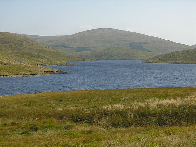
 Y Garn (Plynlimon)
Weather Forecast, United KingdomIssued: 6 am Thu 25 Apr Local TimeUpdates in: hr min sUpdate imminent
Y Garn (Plynlimon)Weather Forecast, United Kingdom
Issued: 6 am Thu 25 Apr Local Time
Updates in:
Update imminent hr min s

Issued: 6 am Thu 25 Apr Local Time
Updates in:
Update imminent hr min s
Days 1–3 Weather SummaryLight rain (total 3mm) at first, then becoming colder with a dusting of snow on Sat night. Freeze-thaw conditions (max 3°C on Thu morning, min 0°C on Thu night). Winds increasing (calm on Thu night, fresh winds from the NE by Sat night). | Days 4–6 Weather SummaryA light covering of new snow mostly falling on Sun morning. Becoming milder with light rain (total 5mm) on Tue night. Very mild (max 10°C on Tue afternoon, min 1°C on Sun morning). Winds increasing (light winds from the NNE on Sun morning, strong winds from the SSE by Tue morning). | Days 7–9 Weather SummaryMostly dry. Very mild (max 12°C on Fri afternoon, min 7°C on Wed morning). Wind will be generally light. | Days 10–12 Weather SummaryLight rain (total 7mm), mostly falling on Mon night. Very mild (max 11°C on Sat morning, min 3°C on Sun night). Winds increasing (light winds from the NNW on Sat night, fresh winds from the WNW by Mon morning). | |||||||||||||||||||||||||||||||||
Thursday 25 | Friday 26 | Saturday 27 | Sunday 28 | Monday 29 | Tuesday 30 | Wednesday 1 | Thursday 2 | Friday 3 | Saturday 4 | Sunday 5 | Monday 6 | |||||||||||||||||||||||||
AM | PM | night | AM | PM | night | AM | PM | night | AM | PM | night | AM | PM | night | AM | PM | night | AM | PM | night | AM | PM | night | AM | PM | night | AM | PM | night | AM | PM | night | AM | PM | night | |
light rain | rain shwrs | cloudy | cloudy | light rain | cloudy | cloudy | light rain | light snow | light snow | rain shwrs | some clouds | light rain | light rain | clear | light rain | rain shwrs | light rain | light rain | cloudy | cloudy | some clouds | light rain | some clouds | some clouds | clear | clear | clear | clear | clear | some clouds | some clouds | rain shwrs | light rain | light rain | light rain | |
km/h | ||||||||||||||||||||||||||||||||||||
Wave Height Map |  |  |  |  |  |  |  |  |  |  |  |  | ||||||||||||||||||||||||
— | — | — | — | — | — | — | — | 1.0 | 5 | — | — | — | — | — | — | — | — | — | — | — | — | — | — | — | — | — | — | — | — | — | — | — | — | — | — | |
0.4 | 0.3 | — | — | 0.1 | — | — | 0.3 | 2.0 | — | 0.1 | — | 0.4 | 0.7 | — | 0.3 | 0.6 | 3 | 0.1 | — | — | — | 0.1 | — | — | — | — | — | — | — | — | — | 0.5 | 0.8 | 1.1 | 4 | |
max°C | 3 | 3 | 1 | 3 | 3 | 2 | 2 | 3 | 3 | 2 | 3 | 3 | 6 | 7 | 6 | 8 | 10 | 7 | 8 | 9 | 9 | 11 | 11 | 10 | 10 | 12 | 8 | 11 | 11 | 7 | 7 | 7 | 4 | 4 | 5 | 4 |
min°C | 3 | 3 | 0 | 2 | 3 | 1 | 1 | 2 | 2 | 1 | 2 | 2 | 5 | 6 | 4 | 7 | 9 | 6 | 7 | 9 | 8 | 11 | 11 | 9 | 9 | 11 | 7 | 10 | 10 | 5 | 7 | 5 | 3 | 4 | 5 | 3 |
-2 | -2 | -2 | -2 | -1 | -4 | -6 | -4 | -4 | -4 | -2 | -3 | 0 | 1 | -1 | 2 | 6 | 3 | 4 | 9 | 8 | 9 | 9 | 6 | 7 | 10 | 5 | 8 | 8 | 3 | 6 | 1 | -2 | -1 | 0 | -2 | |
1050 | 1000 | 800 | 900 | 1050 | 900 | 900 | 1050 | 1250 | 1000 | 1000 | 1050 | 1400 | 1550 | 1650 | 1650 | 1850 | 2000 | 2150 | 2350 | 2900 | 3050 | 3150 | 3000 | 2500 | 2450 | 2450 | 2350 | 2300 | 2100 | 2100 | 1950 | 1250 | 1200 | 1300 | 1200 | |
Cloud base (m) | 300 | 550 | 600 | 2150 | 1700 | 700 | 300 | 200 | 1400 | 200 | 250 | 650 | 400 | 650 | 600 | 1600 | 350 | 250 | 500 | 450 | 450 | 450 | 350 | 1550 | 2400 | 6200 | 8700 | 2300 | 2050 | 350 | 6400 | 450 | 500 | 600 | 250 | |
5:54 | — | — | 5:52 | — | — | 5:50 | — | — | 5:48 | — | — | 5:47 | — | — | 5:45 | — | — | 5:43 | — | — | 5:41 | — | — | 5:39 | — | — | 5:37 | — | — | 5:35 | — | — | 5:33 | — | — | |
— | 8:31 | — | — | 8:32 | — | — | 8:35 | — | — | 8:37 | — | — | 8:37 | — | — | 8:39 | — | — | 8:42 | — | — | 8:44 | — | — | 8:45 | — | — | 8:46 | — | — | 8:49 | — | — | 8:50 | — | |
Y Garn (Plynlimon) Weather (Days 0-3):
The weather forecast for Y Garn (Plynlimon) is: Light rain (total 3mm) at first, then becoming colder with a dusting of snow on Sat night. Freeze-thaw conditions (max 3°C on Thu morning, min 0°C on Thu night). Winds increasing (calm on Thu night, fresh winds from the NE by Sat night).
Y Garn (Plynlimon) Weather (Days 3-6):
A light covering of new snow mostly falling on Sun morning. Becoming milder with light rain (total 5mm) on Tue night. Very mild (max 10°C on Tue afternoon, min 1°C on Sun morning). Winds increasing (light winds from the NNE on Sun morning, strong winds from the SSE by Tue morning).
Y Garn (Plynlimon) Weather (Days 6-9):
Mostly dry. Very mild (max 12°C on Fri afternoon, min 7°C on Wed morning). Wind will be generally light.
This table gives the weather forecast for Y Garn (Plynlimon) at the specific elevation of 684 m. Our advanced weather models allow us to provide distinct weather forecasts for several elevations of Y Garn (Plynlimon). To see the weather forecasts for the other elevations, use the tab navigation above the table. For a wider overview of the weather, consult the Weather Map of United Kingdom.
Y Garn (Plynlimon) Photos
View all
Snowdonia photos (149) |
Cambrian Mountains photos (325) |
photos from mountains in United Kingdom (1741) |
all photos
 Upload new photo
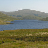
Y Garn (Plynlimon)
 Like us
 Follow us
