– Lat/Long: 58.91° N 137.53° W
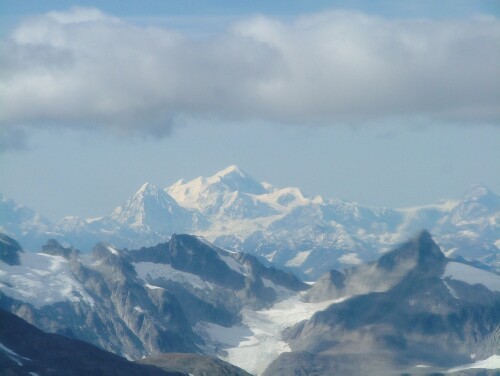
 Mount Fairweather
Weather Forecast, United StatesIssued: 9 pm Wed 24 Apr Local TimeUpdates in: hr min sUpdate imminent
Mount FairweatherWeather Forecast, United States
Issued: 9 pm Wed 24 Apr Local Time
Updates in:
Update imminent hr min s

Issued: 9 pm Wed 24 Apr Local Time
Updates in:
Update imminent hr min s
Days 1–4 Weather SummaryA dusting of new snow. Extremely cold (max -21°C on Thu afternoon, min -23°C on Wed night). Wind will be generally light. | Days 5–7 Weather SummaryA heavy fall of snow, heaviest during Sun morning. Extremely cold (max -23°C on Sat night, min -25°C on Sun morning). Winds decreasing (fresh winds from the ENE on Sun morning, calm by Mon night). | Days 8–10 Weather SummaryA moderate fall of snow, heaviest on Fri morning. Extremely cold (max -20°C on Wed afternoon, min -24°C on Tue night). Winds increasing (light winds from the N on Tue night, near gales from the N by Wed afternoon). | Days 11–13 Weather SummaryA moderate fall of snow, heaviest on Sun night. Extremely cold (max -20°C on Sat night, min -23°C on Sun night). Winds decreasing (strong winds from the ESE on Sun night, light winds from the S by Mon night). | |||||||||||||||||||||||||||||||||
Thursday 25 | Friday 26 | Saturday 27 | Sunday 28 | Monday 29 | Tuesday 30 | Wednesday 1 | Thursday 2 | Friday 3 | Saturday 4 | Sunday 5 | Mon 6 | |||||||||||||||||||||||||
night | AM | PM | night | AM | PM | night | AM | PM | night | AM | PM | night | AM | PM | night | AM | PM | night | AM | PM | night | AM | PM | night | AM | PM | night | AM | PM | night | AM | PM | night | AM | PM | |
clear | clear | clear | clear | some clouds | clear | clear | snow shwrs | snow shwrs | mod. snow | mod. snow | snow shwrs | light snow | some clouds | snow shwrs | clear | some clouds | some clouds | some clouds | clear | snow shwrs | clear | cloudy | cloudy | light snow | light snow | light snow | light snow | light snow | snow shwrs | some clouds | cloudy | cloudy | mod. snow | some clouds | some clouds | |
km/h | ||||||||||||||||||||||||||||||||||||
Wave Height Map |  |  |  |  | 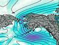 | 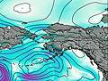 | 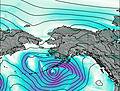 | 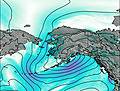 | 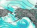 | 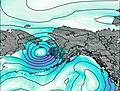 | 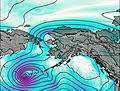 | 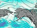 |  | |||||||||||||||||||||||
— | — | — | — | — | — | — | 1.0 | 1.0 | 7 | 9 | 6 | 4 | — | 1.0 | — | — | — | — | — | 1.0 | — | — | — | 3 | 5 | 5 | 1.0 | 1.0 | 1.0 | — | — | — | 8 | — | — | |
— | — | — | — | — | — | — | — | — | — | — | — | — | — | — | — | — | — | — | — | — | — | — | — | — | — | — | — | — | — | — | — | — | — | — | — | |
max°C | -22 | -22 | -21 | -21 | -21 | -21 | -22 | -23 | -23 | -23 | -25 | -24 | -24 | -24 | -23 | -23 | -23 | -23 | -23 | -22 | -20 | -20 | -21 | -20 | -21 | -22 | -21 | -21 | -21 | -21 | -20 | -21 | -22 | -23 | -22 | -21 |
min°C | -23 | -22 | -21 | -21 | -21 | -22 | -23 | -23 | -23 | -24 | -25 | -25 | -24 | -24 | -23 | -23 | -23 | -23 | -24 | -23 | -21 | -20 | -21 | -21 | -22 | -22 | -22 | -22 | -22 | -21 | -21 | -21 | -22 | -23 | -22 | -21 |
-32 | -32 | -29 | -28 | -29 | -29 | -31 | -31 | -33 | -37 | -39 | -39 | -37 | -32 | -28 | -23 | -30 | -32 | -33 | -36 | -37 | -36 | -35 | -34 | -34 | -32 | -32 | -33 | -35 | -34 | -34 | -33 | -35 | -38 | -33 | -30 | |
1100 | 1350 | 1500 | 1200 | 1500 | 1450 | 1050 | 1300 | 1350 | 1100 | 850 | 800 | 700 | 1000 | 1150 | 800 | 1450 | 1550 | 1350 | 1600 | 1600 | 1400 | 1600 | 1550 | 1150 | 950 | 1000 | 700 | 1200 | 1400 | 1400 | 1800 | 1550 | 1200 | 1400 | 1600 | |
Cloud base (m) | 1900 | 2050 | 1950 | 5900 | 2200 | 4600 | 2000 | 1900 | 1900 | 1900 | 1900 | 1900 | 1900 | 1900 | 1900 | 2250 | 2000 | 2000 | 2200 | 2050 | 5600 | 2300 | 2250 | 1900 | 1900 | 1950 | 1950 | 1950 | 3750 | 1900 | 1900 | 1950 | ||||
— | 5:26 | — | — | 5:24 | — | — | 5:20 | — | — | 5:18 | — | — | 5:16 | — | — | 5:13 | — | — | 5:11 | — | — | 5:07 | — | — | 5:05 | — | — | 5:03 | — | — | 5:01 | — | — | 4:58 | — | |
— | — | 8:50 | — | — | 8:52 | — | — | 8:54 | — | — | 8:57 | — | — | 8:59 | — | — | 9:01 | — | — | 9:04 | — | — | 9:06 | — | — | 9:07 | — | — | 9:10 | — | — | 9:13 | — | — | 9:15 | |
Mount Fairweather Weather (Days 0-3):
The weather forecast for Mount Fairweather is: A dusting of new snow. Extremely cold (max -21°C on Thu afternoon, min -23°C on Wed night). Wind will be generally light.
Mount Fairweather Weather (Days 3-6):
A heavy fall of snow, heaviest during Sun morning. Extremely cold (max -23°C on Sat night, min -25°C on Sun morning). Winds decreasing (fresh winds from the ENE on Sun morning, calm by Mon night).
Mount Fairweather Weather (Days 6-9):
A moderate fall of snow, heaviest on Fri morning. Extremely cold (max -20°C on Wed afternoon, min -24°C on Tue night). Winds increasing (light winds from the N on Tue night, near gales from the N by Wed afternoon).
This table gives the weather forecast for Mount Fairweather at the specific elevation of 4663 m. Our advanced weather models allow us to provide distinct weather forecasts for several elevations of Mount Fairweather. To see the weather forecasts for the other elevations, use the tab navigation above the table. For a wider overview of the weather, consult the Weather Map of Alaska United States.
Mount Fairweather Photos
View all
Saint Elias Mountains photos (9) |
Alaska/Yukon Ranges photos (51) |
photos from mountains in United States (2751) |
all photos
 Upload new photo
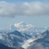
Mount Fairweather
 Like us
 Follow us
