– Lat/Long: 27.70° N 86.87° E
 Mera Peak
Weather Forecast, NepalIssued: 4 pm Fri 19 Apr Local TimeUpdates in: hr min sUpdate imminent
Mera PeakWeather Forecast, Nepal
Issued: 4 pm Fri 19 Apr Local Time
Updates in:
Update imminent hr min s

Issued: 4 pm Fri 19 Apr Local Time
Updates in:
Update imminent hr min s
Days 1–4 Weather SummaryA dusting of new snow. Extremely cold (max -12°C on Fri afternoon, min -14°C on Fri night). Winds increasing (moderate winds from the NW on Fri night, gales from the WNW by Sat night). | Days 5–7 Weather SummaryA light covering of new snow mostly falling on Wed afternoon. Extremely cold (max -14°C on Mon night, min -17°C on Tue night). Mainly gales. | Days 8–10 Weather SummaryA dusting of new snow. Extremely cold (max -13°C on Fri afternoon, min -15°C on Thu afternoon). Winds increasing (moderate winds from the WNW on Thu night, gales from the W by Sat night). | Days 11–13 Weather SummaryA heavy fall of snow, heaviest during Tue afternoon. Extremely cold (max -13°C on Wed afternoon, min -16°C on Sun night). Winds decreasing (gales from the W on Sun night, calm by Mon night). | |||||||||||||||||||||||||||||||||
Fri 19 | Saturday 20 | Sunday 21 | Monday 22 | Tuesday 23 | Wednesday 24 | Thursday 25 | Friday 26 | Saturday 27 | Sunday 28 | Monday 29 | Tuesday 30 | Wed 1 | ||||||||||||||||||||||||
PM | night | AM | PM | night | AM | PM | night | AM | PM | night | AM | PM | night | AM | PM | night | AM | PM | night | AM | PM | night | AM | PM | night | AM | PM | night | AM | PM | night | AM | PM | night | AM | |
snow shwrs | clear | clear | snow shwrs | clear | clear | clear | clear | some clouds | snow shwrs | clear | clear | snow shwrs | clear | some clouds | snow shwrs | clear | clear | some clouds | clear | clear | snow shwrs | clear | clear | snow shwrs | clear | some clouds | snow shwrs | clear | clear | light snow | snow shwrs | snow shwrs | heavy snow | snow shwrs | some clouds | |
km/h | ||||||||||||||||||||||||||||||||||||
Wave Height Map |  |  |  |  |  |  |  |  |  |  |  |  |  | |||||||||||||||||||||||
2.0 | — | — | 2.0 | — | — | — | — | — | 1.0 | — | — | 1.0 | — | — | 3 | — | — | — | — | — | 1.0 | — | — | 2.0 | — | — | 3 | — | — | 2.0 | 1.0 | 1.0 | 15 | 2.0 | — | |
— | — | — | — | — | — | — | — | — | — | — | — | — | — | — | — | — | — | — | — | — | — | — | — | — | — | — | — | — | — | — | — | — | — | — | — | |
max°C | -12 | -13 | -13 | -14 | -14 | -13 | -12 | -12 | -13 | -15 | -14 | -16 | -16 | -16 | -16 | -15 | -14 | -15 | -14 | -14 | -14 | -13 | -13 | -14 | -14 | -14 | -15 | -14 | -15 | -16 | -14 | -14 | -15 | -14 | -14 | -14 |
min°C | -12 | -14 | -13 | -14 | -14 | -13 | -12 | -14 | -14 | -15 | -16 | -16 | -16 | -17 | -17 | -16 | -15 | -15 | -15 | -15 | -14 | -14 | -14 | -14 | -14 | -15 | -15 | -15 | -16 | -16 | -15 | -16 | -15 | -14 | -15 | -14 |
-24 | -29 | -25 | -28 | -29 | -28 | -26 | -28 | -26 | -27 | -30 | -30 | -28 | -31 | -30 | -28 | -29 | -28 | -26 | -27 | -25 | -26 | -28 | -28 | -25 | -30 | -30 | -29 | -30 | -31 | -26 | -20 | -15 | -22 | -15 | -18 | |
4600 | 4250 | 4750 | 4600 | 4250 | 4750 | 4700 | 4400 | 4750 | 4500 | 4150 | 4550 | 4450 | 4050 | 4500 | 4400 | 4050 | 4650 | 4550 | 4250 | 4750 | 4650 | 4300 | 4800 | 4550 | 4300 | 4650 | 4500 | 4100 | 4600 | 4450 | 4100 | 4450 | 4300 | 4100 | 4600 | |
Cloud base (m) | 5600 | 6150 | 6200 | 9400 | 9050 | 9100 | 6650 | 6350 | 6450 | 6550 | 6400 | 5600 | 9600 | 6300 | 6200 | 9450 | 6600 | 6200 | 6900 | 6650 | 7000 | 6400 | 6800 | 5900 | 5600 | 5500 | 4850 | 5250 | 5500 | |||||||
— | — | 5:26 | — | — | 5:26 | — | — | 5:24 | — | — | 5:24 | — | — | 5:22 | — | — | 5:22 | — | — | 5:20 | — | — | 5:20 | — | — | 5:20 | — | — | 5:18 | — | — | 5:18 | — | — | 5:16 | |
6:24 | — | — | 6:24 | — | — | 6:25 | — | — | 6:25 | — | — | 6:27 | — | — | 6:27 | — | — | 6:28 | — | — | 6:29 | — | — | 6:29 | — | — | 6:30 | — | — | 6:30 | — | — | 6:30 | — | — | |
Mera Peak Weather (Days 0-3):
The weather forecast for Mera Peak is: A dusting of new snow. Extremely cold (max -12°C on Fri afternoon, min -14°C on Fri night). Winds increasing (moderate winds from the NW on Fri night, gales from the WNW by Sat night).
Mera Peak Weather (Days 3-6):
A light covering of new snow mostly falling on Wed afternoon. Extremely cold (max -14°C on Mon night, min -17°C on Tue night). Mainly gales.
Mera Peak Weather (Days 6-9):
A dusting of new snow. Extremely cold (max -13°C on Fri afternoon, min -15°C on Thu afternoon). Winds increasing (moderate winds from the WNW on Thu night, gales from the W by Sat night).
This table gives the weather forecast for Mera Peak at the specific elevation of 6476 m. Our advanced weather models allow us to provide distinct weather forecasts for several elevations of Mera Peak. To see the weather forecasts for the other elevations, use the tab navigation above the table. For a wider overview of the weather, consult the Weather Map of Nepal.
| Weather Station | Temp. | Weather | Wind | Gusts | Cloud / Visibility |
|---|---|---|---|---|---|
Tingri | |||||
Paro International Airport | |||||
* NOTE: not all weather observatories update at the same frequency which is the reason why some locations may show data from stations that are further away than known closer ones.
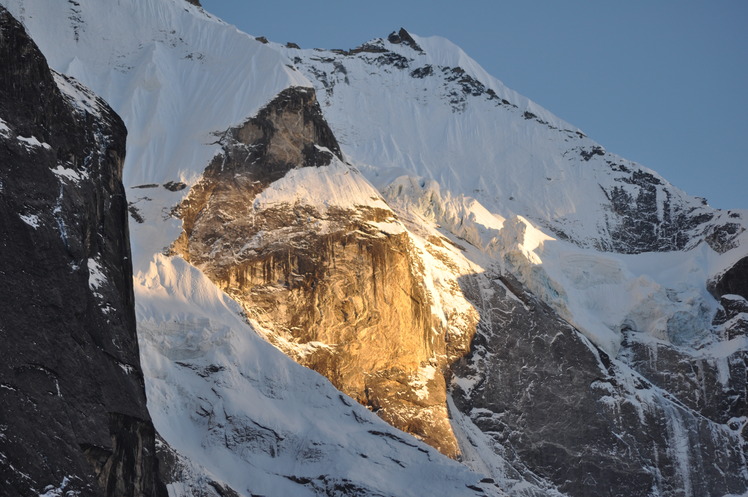
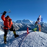
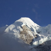
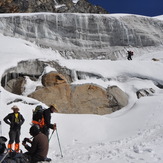
Mera Peak Photos
View all
Central Nepal Himalaya photos (94) |
Greater Himalaya photos (191) |
photos from mountains in Nepal (166) |
all photos
 Upload new photo
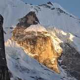

Khare Sunsetet
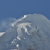
Mera Peak Summit
Mera Peak
Himalayan Trails Trekking & Climbing P. Ltd
Mera Peak (6474 m)
Mera Peak
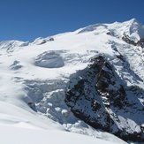
Mera glacier
 Like us
 Follow us
