– Lat/Long: 39.87° S 71.55° W
 Huanquihue Group
Weather Forecast, ArgentinaIssued: 2 am Thu 25 Apr Local TimeUpdates in: hr min sUpdate imminent
Huanquihue GroupWeather Forecast, Argentina
Issued: 2 am Thu 25 Apr Local Time
Updates in:
Update imminent hr min s

Issued: 2 am Thu 25 Apr Local Time
Updates in:
Update imminent hr min s
Days 1–3 Weather SummaryA heavy fall of snow, heaviest during Thu night. Becoming milder with moderate rain (total 16mm) on Thu night. Freeze-thaw conditions (max 2°C on Thu morning, min -2°C on Sat morning). Mainly fresh winds. | Days 4–6 Weather SummaryHeavy rain (total 29mm) on Sun night. Becoming colder with heavy fall of snow, heaviest during Mon afternoon. Freeze-thaw conditions (max 3°C on Sun night, min -3°C on Tue night). Mainly fresh winds. | Days 7–9 Weather SummaryA light covering of new snow mostly falling on Wed morning. Freeze-thaw conditions (max 7°C on Fri night, min -4°C on Wed night). Wind will be generally light. | Days 10–12 Weather SummaryMostly dry. Freeze-thaw conditions (max 8°C on Sat morning, min -2°C on Sun night). Wind will be generally light. | |||||||||||||||||||||||||||||||||
Thursday 25 | Friday 26 | Saturday 27 | Sunday 28 | Monday 29 | Tuesday 30 | Wednesday 1 | Thursday 2 | Friday 3 | Saturday 4 | Sunday 5 | Monday 6 | |||||||||||||||||||||||||
AM | PM | night | AM | PM | night | AM | PM | night | AM | PM | night | AM | PM | night | AM | PM | night | AM | PM | night | AM | PM | night | AM | PM | night | AM | PM | night | AM | PM | night | AM | PM | night | |
light snow | mod. snow | mod. snow | snow shwrs | light snow | heavy snow | light snow | light snow | mod. snow | mod. snow | light snow | heavy rain | heavy snow | heavy snow | heavy snow | light snow | light snow | snow shwrs | light snow | light snow | snow shwrs | cloudy | some clouds | some clouds | clear | rain shwrs | clear | clear | rain shwrs | clear | some clouds | cloudy | some clouds | clear | some clouds | clear | |
km/h | ||||||||||||||||||||||||||||||||||||
Wave Height Map |  |  |  |  |  |  |  |  |  |  |  | 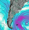 | ||||||||||||||||||||||||
1.0 | 6 | 10 | 4 | 3 | 12 | 1.0 | 1.0 | 9 | 6 | 2.0 | — | 18 | 23 | 33 | 4 | 2.0 | 1.0 | 5 | 2.0 | 1.0 | — | — | — | — | — | — | — | — | — | — | — | — | — | — | — | |
0.6 | — | 16 | — | — | — | — | — | — | — | — | 29 | — | — | — | — | — | — | — | — | — | — | — | — | — | 0.2 | — | — | 0.3 | — | — | — | — | — | — | — | |
max°C | 2 | 1 | 2 | -1 | -1 | 0 | 0 | 1 | 1 | 0 | 2 | 3 | 2 | 2 | 1 | -1 | -1 | -2 | -1 | -1 | -3 | -3 | -2 | -1 | 4 | 4 | 7 | 8 | 8 | 5 | 2 | 1 | 0 | 1 | 1 | 5 |
min°C | 2 | 1 | 0 | -1 | -1 | -1 | -2 | 0 | 1 | 0 | 1 | 2 | 1 | 1 | -1 | -1 | -1 | -3 | -3 | -1 | -4 | -4 | -2 | -4 | 1 | 3 | 3 | 7 | 6 | 3 | 1 | 1 | -2 | 0 | 0 | 3 |
-3 | -3 | -5 | -6 | -7 | -7 | -9 | -6 | -4 | -5 | -4 | -4 | -4 | -3 | -5 | -4 | -5 | -7 | -7 | -4 | -7 | -8 | -6 | -4 | 0 | 0 | 0 | 6 | 5 | 0 | -4 | -4 | -6 | -2 | 0 | 2 | |
1650 | 1550 | 1500 | 1200 | 1200 | 1250 | 1050 | 1300 | 1450 | 1350 | 1400 | 1750 | 1700 | 1550 | 1350 | 1100 | 1200 | 800 | 750 | 1150 | 800 | 650 | 1050 | 0 | 0 | 3450 | 3500 | 3500 | 3500 | 3300 | 2350 | 1400 | 1050 | 0 | 1450 | 3200 | |
Cloud base (m) | 900 | 850 | 850 | 900 | 900 | 900 | 900 | 900 | 850 | 850 | 850 | 850 | 1350 | 1350 | 1400 | 1400 | 850 | 900 | 900 | 900 | 900 | 950 | 900 | 950 | 900 | 900 | 900 | 900 | 8700 | 900 | 900 | 900 | 900 | 900 | ||
8:26 | — | — | 8:26 | — | — | 8:27 | — | — | 8:29 | — | — | 8:29 | — | — | 8:30 | — | — | 8:30 | — | — | 8:32 | — | — | 8:33 | — | — | 8:33 | — | — | 8:34 | — | — | 8:36 | — | — | |
— | 7:00 | — | — | 7:00 | — | — | 6:58 | — | — | 6:57 | — | — | 6:55 | — | — | 6:54 | — | — | 6:52 | — | — | 6:52 | — | — | 6:51 | — | — | 6:50 | — | — | 6:49 | — | — | 6:47 | — | |
Huanquihue Group Weather (Days 0-3):
The weather forecast for Huanquihue Group is: A heavy fall of snow, heaviest during Thu night. Becoming milder with moderate rain (total 16mm) on Thu night. Freeze-thaw conditions (max 2°C on Thu morning, min -2°C on Sat morning). Mainly fresh winds.
Huanquihue Group Weather (Days 3-6):
Heavy rain (total 29mm) on Sun night. Becoming colder with heavy fall of snow, heaviest during Mon afternoon. Freeze-thaw conditions (max 3°C on Sun night, min -3°C on Tue night). Mainly fresh winds.
Huanquihue Group Weather (Days 6-9):
A light covering of new snow mostly falling on Wed morning. Freeze-thaw conditions (max 7°C on Fri night, min -4°C on Wed night). Wind will be generally light.
This table gives the weather forecast for Huanquihue Group at the specific elevation of 1300 m. Our advanced weather models allow us to provide distinct weather forecasts for several elevations of Huanquihue Group. To see the weather forecasts for the other elevations, use the tab navigation above the table. For a wider overview of the weather, consult the Weather Map of Argentina.
| Weather Station | Temp. | Weather | Wind | Gusts | Cloud / Visibility |
|---|---|---|---|---|---|
Chapelco | |||||
Valdivia | |||||
* NOTE: not all weather observatories update at the same frequency which is the reason why some locations may show data from stations that are further away than known closer ones.
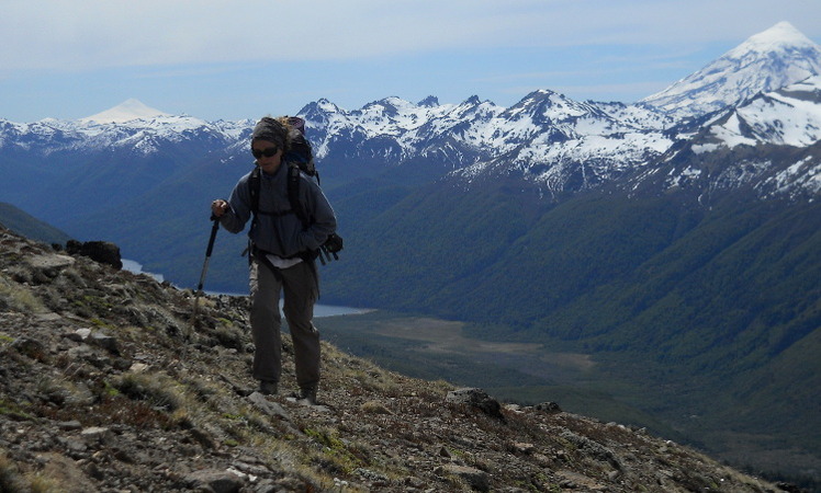
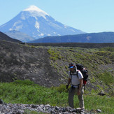
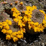
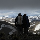
Huanquihue Group Photos
View all
Patagonia photos (146) |
Andes photos (891) |
photos from mountains in Argentina (226) |
all photos
 Upload new photo


 See 10 more Huanquihue Group photos
Trekking en Patagonia
Trekking en Patagonia
Trekking en Patagonia
Trekking en Patagonia
Trekking en Patagonia
Violas en flor
Co Colo Huincul 2133 mts
 Like us
 Follow us
