
– Lat/Long: 42.50° N 73.33° W
 Tower Mountain (Massachusetts)
Weather Forecast, United StatesIssued: 7 pm Mon 08 Jun Local TimeUpdates in: hr min sUpdate imminent
Issued: 7 pm Mon 08 Jun Local Time
Updates in:
Update imminent hr min s

Issued: 7 pm Mon 08 Jun Local Time
Updates in:
Update imminent hr min s
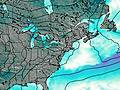
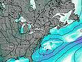
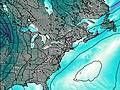
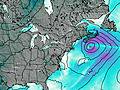
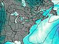
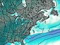
Days 1–4 Weather SummaryLight rain (total 5mm), mostly falling on Wed night. Warm (max 24°C on Thu afternoon, min 12°C on Mon night). Winds increasing (calm on Mon night, fresh winds from the WNW by Thu morning). | Days 5–7 Weather SummaryLight rain (total 8mm), mostly falling on Fri night. Warm (max 25°C on Fri afternoon, min 14°C on Sat night). Winds increasing (calm on Fri morning, strong winds from the WNW by Sun morning). | ||||||||||||||||||
Tuesday 9 | Wednesday 10 | Thursday 11 | Friday 12 | Saturday 13 | Sunday 14 | ||||||||||||||
night | AM | PM | night | AM | PM | night | AM | PM | night | AM | PM | night | AM | PM | night | AM | PM | night | |
clear | clear | clear | clear | some clouds | light rain | risk tstorm | risk tstorm | risk tstorm | some clouds | rain shwrs | risk tstorm | risk tstorm | clear | clear | clear | rain shwrs | some clouds | clear | |
km/h | |||||||||||||||||||
 |  |  |  |  |  |  | |||||||||||||
— | — | — | — | — | — | — | — | — | — | — | — | — | — | — | — | — | — | — | |
— | — | — | — | — | 1.2 | 3 | 0.2 | 0.8 | — | 0.1 | 1.2 | 7 | — | — | — | 0.1 | — | — | |
max °C | 17 | 19 | 23 | 20 | 19 | 19 | 20 | 21 | 24 | 23 | 23 | 25 | 22 | 19 | 20 | 17 | 16 | 18 | 16 |
min °C | 12 | 15 | 21 | 17 | 19 | 19 | 18 | 20 | 23 | 19 | 21 | 23 | 18 | 17 | 20 | 14 | 16 | 18 | 12 |
12 | 15 | 21 | 17 | 19 | 19 | 17 | 20 | 23 | 19 | 21 | 23 | 17 | 16 | 20 | 12 | 14 | 17 | 11 | |
4450 | 4500 | 4650 | 4400 | 4250 | 4450 | 4200 | 4550 | 4600 | 4700 | 4700 | 4700 | 4650 | 4250 | 4050 | 3750 | 3550 | 3400 | 3600 | |
Cloud base (m) | 2050 | 450 | 600 | 400 | 850 | 500 | 650 | 400 | 9400 | 650 | 2200 | 9050 | |||||||
— | 5:16 | — | — | 5:15 | — | — | 5:15 | — | — | 5:15 | — | — | 5:15 | — | — | 5:15 | — | — | |
— | — | — | 8:29 | — | — | 8:29 | — | — | 8:30 | — | — | 8:30 | — | — | 8:30 | — | — | 8:30 | |
Loading...
Tower Mountain (Massachusetts) Weather (Days 0-3):
The weather forecast for Tower Mountain (Massachusetts) is: Light rain (total 5mm), mostly falling on Wed night. Warm (max 24°C on Thu afternoon, min 12°C on Mon night). Winds increasing (calm on Mon night, fresh winds from the WNW by Thu morning).
Tower Mountain (Massachusetts) Weather (Days 3-6):
Light rain (total 8mm), mostly falling on Fri night. Warm (max 25°C on Fri afternoon, min 14°C on Sat night). Winds increasing (calm on Fri morning, strong winds from the WNW by Sun morning).
This table gives the weather forecast for Tower Mountain (Massachusetts) at the specific elevation of 668 m. Our advanced weather models allow us to provide distinct weather forecasts for several elevations of Tower Mountain (Massachusetts). To see the weather forecasts for the other elevations, use the tab navigation above the table. For a wider overview of the weather, consult the Weather Map of Massachusetts.