– Lat/Long: 42.13° N 74.15° W
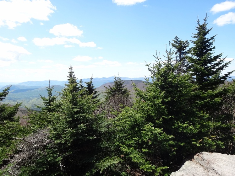
 Sugarloaf Mountain (Greene County, New York)
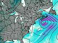
Weather Forecast, United StatesIssued: 7 pm Mon 08 Jun Local TimeUpdates in: hr min sUpdate imminent
Issued: 7 pm Mon 08 Jun Local Time
Updates in:
Update imminent hr min s

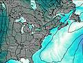
Issued: 7 pm Mon 08 Jun Local Time
Updates in:
Update imminent hr min s
Days 1–4 Weather SummaryLight rain (total 2mm), mostly falling on Wed night. Warm (max 21°C on Tue afternoon, min 13°C on Mon night). Winds increasing (light winds from the W on Tue morning, strong winds from the WNW by Wed night). | Days 5–7 Weather SummaryLight rain (total 8mm), mostly falling on Fri night. Warm (max 23°C on Fri afternoon, min 14°C on Sat night). Winds increasing (calm on Fri morning, strong winds from the W by Sun morning). | ||||||||||||||||||
Tuesday 9 | Wednesday 10 | Thursday 11 | Friday 12 | Saturday 13 | Sunday 14 | ||||||||||||||
night | AM | PM | night | AM | PM | night | AM | PM | night | AM | PM | night | AM | PM | night | AM | PM | night | |
clear | clear | clear | clear | light rain | light rain | rain shwrs | clear | risk tstorm | risk tstorm | clear | risk tstorm | risk tstorm | clear | clear | clear | some clouds | rain shwrs | rain shwrs | |
km/h | |||||||||||||||||||
 |  |  |  |  |  |  | |||||||||||||
— | — | — | — | — | — | — | — | — | — | — | — | — | — | — | — | — | — | — | |
— | — | — | — | 0.1 | 0.8 | 1.2 | — | 0.4 | 0.5 | — | 0.5 | 6 | — | — | — | — | 0.3 | 0.6 | |
max °C | 14 | 16 | 21 | 19 | 17 | 17 | 19 | 20 | 21 | 20 | 19 | 23 | 21 | 16 | 17 | 15 | 15 | 15 | 14 |
min °C | 13 | 15 | 19 | 17 | 17 | 17 | 18 | 20 | 21 | 18 | 19 | 22 | 16 | 16 | 17 | 14 | 14 | 14 | 11 |
12 | 14 | 19 | 17 | 16 | 16 | 17 | 19 | 21 | 18 | 19 | 22 | 15 | 14 | 16 | 12 | 12 | 12 | 9 | |
4450 | 4600 | 4500 | 4400 | 4400 | 4500 | 4400 | 4450 | 4600 | 4750 | 4800 | 4550 | 4600 | 4250 | 4150 | 3700 | 3750 | 3600 | 3500 | |
Cloud base (m) | 550 | 550 | 750 | 600 | 1650 | 500 | 600 | 1600 | 9650 | 800 | 650 | 8900 | |||||||
— | 5:20 | — | — | 5:20 | — | — | 5:20 | — | — | 5:20 | — | — | 5:20 | — | — | 5:18 | — | — | |
— | — | — | 8:30 | — | — | 8:30 | — | — | 8:31 | — | — | 8:31 | — | — | 8:32 | — | — | 8:32 | |
Loading...
Sugarloaf Mountain (Greene County, New York) Weather (Days 0-3):
The weather forecast for Sugarloaf Mountain (Greene County, New York) is: Light rain (total 2mm), mostly falling on Wed night. Warm (max 21°C on Tue afternoon, min 13°C on Mon night). Winds increasing (light winds from the W on Tue morning, strong winds from the WNW by Wed night).
Sugarloaf Mountain (Greene County, New York) Weather (Days 3-6):
Light rain (total 8mm), mostly falling on Fri night. Warm (max 23°C on Fri afternoon, min 14°C on Sat night). Winds increasing (calm on Fri morning, strong winds from the W by Sun morning).
This table gives the weather forecast for Sugarloaf Mountain (Greene County, New York) at the specific elevation of 1161 m. Our advanced weather models allow us to provide distinct weather forecasts for several elevations of Sugarloaf Mountain (Greene County, New York). To see the weather forecasts for the other elevations, use the tab navigation above the table. For a wider overview of the weather, consult the Weather Map of New-York.
Sugarloaf Mountain (Greene County, New York) Photos
View all
Catskill Mountains photos (26) |
Appalachians photos (907) |
photos from mountains in United States (3050) |
all photos
 Upload new photo
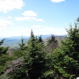
View from Sugarloaf Mountain NY, near summit.