– Lat/Long: 68.17° N 16.59° E
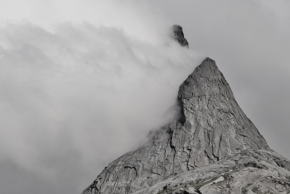
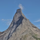
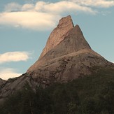
 Stetind
Weather Forecast, NorwayIssued: 7 pm Tue 09 Jun Local TimeUpdates in: hr min sUpdate imminent
Issued: 7 pm Tue 09 Jun Local Time
Updates in:
Update imminent hr min s

Issued: 7 pm Tue 09 Jun Local Time
Updates in:
Update imminent hr min s
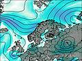
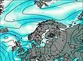
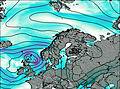
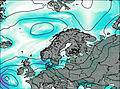
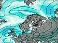
Days 1–4 Weather SummaryMild with light rain (total 7mm) on Wed night Becoming colder with a light covering of snow, mostly falling on Thu morning. Freeze-thaw conditions (max 11°C on Tue night, min 0°C on Thu morning). Mainly fresh winds. | Days 5–7 Weather SummaryMostly dry. Freeze-thaw conditions (max 5°C on Fri night, min 0°C on Fri night). Wind will be generally light. | ||||||||||||||||||
Wednesday 10 | Thursday 11 | Friday 12 | Saturday 13 | Sunday 14 | Monday 15 | ||||||||||||||
night | AM | PM | night | AM | PM | night | AM | PM | night | AM | PM | night | AM | PM | night | AM | PM | night | |
clear | clear | clear | mod. rain | light snow | light snow | clear | some clouds | cloudy | light rain | some clouds | rain shwrs | clear | clear | rain shwrs | rain shwrs | light rain | some clouds | cloudy | |
km/h | |||||||||||||||||||
 |  |  |  |  |  |  | |||||||||||||
— | — | — | — | 4 | 1 | — | — | — | — | — | — | — | — | — | — | — | — | — | |
— | — | — | 7 | — | — | — | — | — | 0.2 | — | 0.2 | — | — | 0.2 | 0.2 | 0.2 | — | — | |
max °C | 11 | 11 | 11 | 10 | 0 | 1 | 4 | 5 | 6 | 5 | 1 | 3 | 4 | 4 | 4 | 4 | 3 | 2 | 2 |
min °C | 10 | 10 | 11 | 3 | 0 | 0 | 2 | 5 | 6 | 0 | 0 | 2 | 3 | 4 | 4 | 3 | 2 | 2 | 0 |
7 | 7 | 8 | 0 | -6 | -4 | -2 | 2 | 3 | -5 | -4 | 2 | 3 | 4 | 3 | 1 | -1 | -1 | 0 | |
2750 | 2850 | 2850 | 2150 | 1400 | 1450 | 1950 | 2100 | 2050 | 1600 | 1600 | 1850 | 1950 | 2000 | 2100 | 2000 | 1800 | 1800 | 1550 | |
Cloud base (m) | 2650 | 2550 | 750 | 250 | 350 | 1600 | 1800 | 2000 | 700 | 400 | 700 | 1450 | 1550 | 750 | 1800 | 1650 | |||
— | 12:00 | — | — | 12:00 | — | — | 12:00 | — | — | 12:00 | — | — | 12:00 | — | — | 12:00 | — | — | |
— | 12:00 | — | — | 12:00 | — | — | 12:00 | — | — | 12:00 | — | — | 12:00 | — | — | 12:00 | — | — | |
Loading...
Stetind Weather (Days 0-3):
The weather forecast for Stetind is: Mild with light rain (total 7mm) on Wed night Becoming colder with a light covering of snow, mostly falling on Thu morning. Freeze-thaw conditions (max 11°C on Tue night, min 0°C on Thu morning). Mainly fresh winds.
Stetind Weather (Days 3-6):
Mostly dry. Freeze-thaw conditions (max 5°C on Fri night, min 0°C on Fri night). Wind will be generally light.
This table gives the weather forecast for Stetind at the specific elevation of 1392 m. Our advanced weather models allow us to provide distinct weather forecasts for several elevations of Stetind. To see the weather forecasts for the other elevations, use the tab navigation above the table. For a wider overview of the weather, consult the Weather Map of Norway.
| Weather Station | Temp. | Weather | Wind | Gusts | Cloud / Visibility |
|---|---|---|---|---|---|
Håfjell.Alpinservice | |||||
Rotvaer | |||||
Evenes AP | |||||
* NOTE: not all weather observatories update at the same frequency which is the reason why some locations may show data from stations that are further away than known closer ones.
Stetind Photos
View all
photos (8) |
Scandinavia/European Arctic Ranges photos (16) |
photos from mountains in Norway (115) |
all photos
 Upload new photo
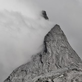
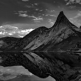

Beauty
Between black and white
The wall of all dreams
Before the rain
Greetings from the top