Saitaris mountain guide
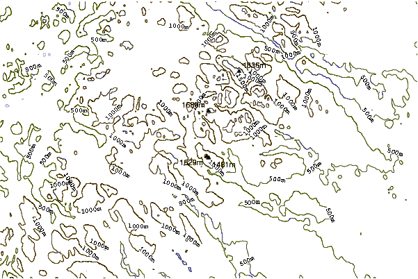
- Elevation: 1905 m
- Difficulty: Major Mountain Expedition
- Best months to climb: July, August, September
- Convenient center: Jokkmokk
Saitaris Climbing Notes
Roger Håkansson from SWEDEN writes:
Saitaris is a beautifully shaped mountain in a very remote area. One needs to be self-sufficient. You must bring everything you need. It's not too difficult to reach the top of the mountain, however I recommend to site your tent some kilometre from the mountain because there are no good places for a base closer to the summit. To reach the rock, you need to cross one of the glaciers surrounding the mountain, look out for crevasses. The "easy" way up is the east ridge. Up on this ridge , the first problem you reach will be some dieders, the very right one is the easiest. Continue until you see an overhanging rock formation. This is actually the way up, It's not that difficult but overhanging and very narrow. After this it will be some scrambling up to a quite flat slab. Here it is difficult to secure. The left side of the slab is more easy. After this you should reach a kind of anchor for belay. Please check this so it's still okay, otherwise replace it. From here you can see the summit and it's an easy but narrow scrambling up to the summit. Look into the summit cairn, in a film box I left a silver necklace. If it's still there it's yours.
Look out for very loose rock on the whole mountain. Be very careful on your way down.
2010-05-25 |
Click here to submit your own climbing note for Saitaris
|
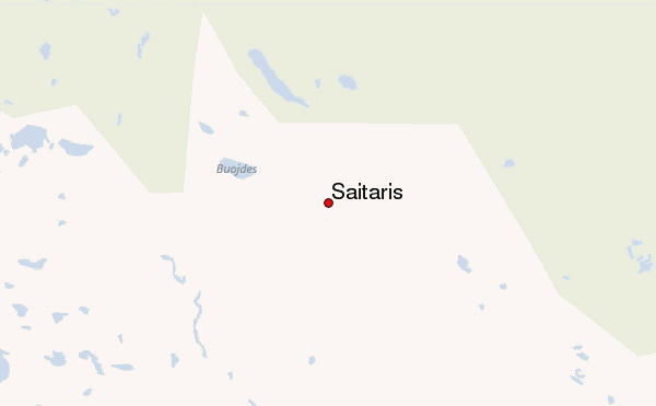
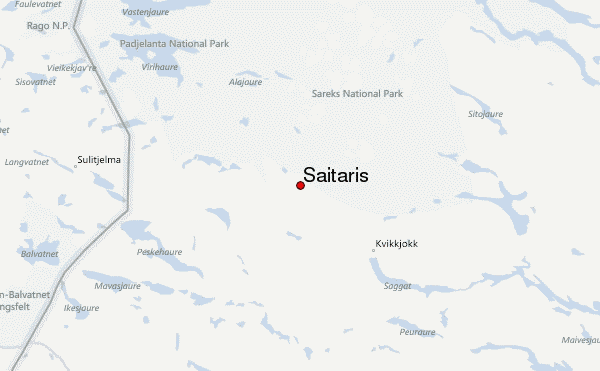
Select Saitaris Location Map Detail:
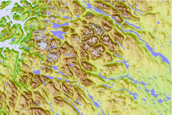
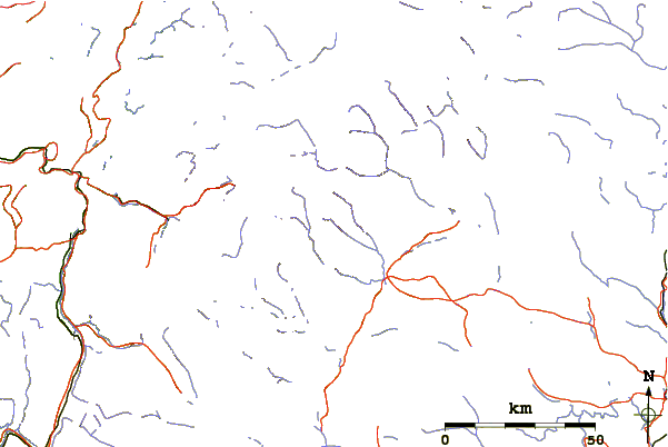
Use this relief map to navigate to mountain peaks in the area of Saitaris.
10 other mountain peaks closest to Saitaris:
 Saitaris – Climbing, Hiking & Mountaineering information
 Like us
 Follow us
